A geographic information system (GIS) is a system designed to capture, store, manipulate, analyze, manage, and present spatial or geographic data. GIS applications are tools that allow users to create interactive queries, analyze spatial information, edit data in maps, and present the results of all these operations. GIS sometimes refers to geographic information science (GIScience), the science underlying geographic concepts, applications, and systems.

A website or Web site is a collection of related network web resources, such as web pages, multimedia content, which are typically identified with a common domain name, and published on at least one web server. Notable examples are wikipedia.org, google.com, and amazon.com.

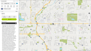
Esri is an international supplier of geographic information system (GIS) software, web GIS and geodatabase management applications. The company is headquartered in Redlands, California.
MapQuest is a free online web mapping service owned by Verizon Media. It was launched in 1996 as the first commercial web mapping service. MapQuest vies for market share with competitors such as Google Maps and Here.
Google Toolbar is a web browser toolbar for Internet Explorer, developed by Google. It was first released in 2000 for Internet Explorer 5. Google Toolbar was also supported on Firefox from September 2005 to June 2011.
In computing, geolocation software is software that is capable of deducing the geolocation of a device connected to the Internet. The identification of a device's IP address can be used to determine the country, city, or post/ZIP code, determining an object's geographical location. Other methods include examination of a MAC address, image metadata, or credit card information.
Animated mapping is the application of animation, either computer or video, to add a temporal component to a map displaying change in some dimension. Most commonly the change is shown over time, generally at a greatly changed scale. An example would be the animation produced after the 2004 tsunami showing how the waves spread across the Indian Ocean.
Personalization consists of tailoring a service or a product to accommodate specific individuals, sometimes tied to groups or segments of individuals. A wide variety of organizations use personalization to improve customer satisfaction, digital sales conversion, marketing results, branding, and improved website metrics as well as for advertising. Personalization is a key element in social media and recommender systems.
A file hosting service, cloud storage service, online file storage provider, or cyberlocker is an internet hosting service specifically designed to host user files. It allows users to upload files that could be accessed over the internet after a user name and password or other authentication is provided. Typically, the services allow HTTP access, and sometimes FTP access. Related services are content-displaying hosting services, virtual storage, and remote backup.
Yahoo! Maps was a free online mapping portal provided by Yahoo! Functionality included local weather powered by The Weather Channel, printing maps, and local reviews powered by Yelp. It shut down in 2015.
Geovisualization or geovisualisation, refers to a set of tools and techniques supporting the analysis of geospatial data through the use of interactive visualization.
MapInfo Pro is a desktop geographic information system (GIS) software product produced by Pitney Bowes Software and used for mapping and location analysis. MapInfo Pro allows users to visualize, analyze, edit, interpret, understand and output data to reveal relationships, patterns, and trends. MapInfo Pro allows users to explore spatial data within a dataset, symbolize features, and create maps.
Geobytes is a global company specializing in geolocation and anti-spam software. Geobytes was incorporated in the State of Delaware, USA in 1999 making it one of the oldest companies in the online geolocation industry.

The British Cartographic Society (BCS) is an association of individuals and organisations dedicated to exploring and developing the world of maps. It is a registered charity. Membership includes mapping companies, publishers, designers, academics, researchers, map curators, individual cartographers, GIS specialists and ordinary members of the public with an interest in maps.

Ordnance Survey (OS) is the national mapping agency of the United Kingdom which covers the island of Great Britain. Since 1 April 2015 part of Ordnance Survey has operated as Ordnance Survey Ltd, a government-owned company, 100% in public ownership. The Ordnance Survey Board remains accountable to the Secretary of State for Business, Energy and Industrial Strategy. It is also a member of the Public Data Group.
Digital mapping is the process by which a collection of data is compiled and formatted into a virtual image. The primary function of this technology is to produce maps that give accurate representations of a particular area, detailing major road arteries and other points of interest. The technology also allows the calculation of distances from one place to another.
Circumarctic Environmental Observatories Network (CEON) is a network of terrestrial and freshwater observation platforms, science experts and network partners promoting the collection and dissemination of environmental data from the Arctic.
CEON observation platforms include land and freshwater observatories, research infrastructures, former research sites where retrospective analyses are being or can be undertaken, data and image archive centers and community monitoring programs.
Discoverability is the degree to which of something, especially a piece of content or information, can be found in a search of a file, database, or other information system. Discoverability is a concern in library and information science, many aspects of digital media, software and web development, and in marketing, since something cannot be used if people cannot find it or do not understand what it can be used for. Metadata, or "information about information," such as a book's title, a product's description, or a website's keywords, affects how discoverable something is on a database or online. In the 2010s, adding metadata to a product that is available online can make it easier for end users to find the product. For example, if a song file is made available online, making the title, name of the band, genre, year of release, and other pertinent information available in connection with this song file will make it easier for users to find this song file. Organizing information by putting it into alphabetical order or including it in a search engine is an example of how to improve discoverability. Discoverability is related to, but different from, accessibility and usability, other qualities that affect the usefulness of a piece of information.

WorldMap is a web platform for creating, displaying, analyzing, and searching spatial data and other data forms across multiple disciplines.
