
Geography of the United States Virgin Islands

The Virgin Islands are geologically and biogeographically the easternmost part of the Greater Antilles, the northern islands belonging to the Puerto Rican Bank and St. Croix being a displaced part of the same geologic structure. Politically, the British Virgin Islands have been governed as the western island group of the Leeward Islands, which are the northern part of the Lesser Antilles, and form the border between the Caribbean Sea and the Atlantic Ocean. The archipelago is separated from the true Lesser Antilles by the Anegada Passage and from the main island of Puerto Rico by the Virgin Passage.

The Little Sisters is an informal name for a group of some of the smaller islands of the British Virgin Islands, south of Tortola and southwest of Virgin Gorda. These islands are also called the Southern Islands.

Cruz Bay, U.S. Virgin Islands is the main town on the island of Saint John in the United States Virgin Islands. According to the 2000 census, Cruz Bay had a population of 2,743.
The area code (340) is the local telephone area code of U.S. Virgin Islands. The (340) area code was created during a split from the original (809) area code, which began permissive dialing on 1 June 1997 and ended 30 June 1998.
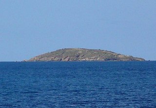
Flanagan Island is an island located within the Virgin Islands archipelago in the Caribbean and forms part of the U.S. Virgin Islands.

Mingo Cay is an island part of Central sub-district, in Saint John, United States Virgin Islands. It is located between Saint Thomas and Saint John.
Adrian is a neighborhood on the island of Saint John in the United States Virgin Islands. Much of this area is part of Virgin Islands National Park. The Catherineburg Sugar Mill Ruins are in Adrian. The only grove of bamboo on St. John can be found here, to the east of John Head Road.

Annaberg is a former sugar factory and plantation on the island of Saint John in the United States Virgin Islands. It is uninhabited and part of the Annaberg Historic District within the Virgin Islands National Park.
Bordeaux is a neighborhood on the island of Saint John in the United States Virgin Islands. It is named for Mount Bordeaux, the highest point on the island. Most of this area is part of Virgin Islands National Park.
Concordia is an area on the island of Saint John in the United States Virgin Islands. It is located on the south east corner of the island, near Salt Pond Bay. Much of the area is part of Virgin Islands National Park. Concordia Eco-Resort is located here.
Fish Bay is a bay and neighborhood on the island of Saint John in the United States Virgin Islands. Most of this area is part of Virgin Islands National Park.
Fredriksdal is an area of Virgin Islands National Park on the island of Saint John in the United States Virgin Islands.
Hermitage is an area of Virgin Islands National Park on the island of Saint John in the United States Virgin Islands. It is located along the north side of Coral Bay, between the town of Coral Bay and the island's inhabited East End. The mangroves of Princess Bay, inside the National Park, are a popular kayaking and snorkeling spot.
Johns Folly is a neighborhood on the island of Saint John in the United States Virgin Islands. It is located on the east side of the island, south of Coral Bay and north of Salt Pond Bay.
L'Esperance is a former plantation on the island of Saint John in the United States Virgin Islands. It is uninhabited and part of Virgin Islands National Park. The L'Esperance trail is maintained by the National Park Service.
Lameshur is a former plantation on the island of Saint John in the United States Virgin Islands. It is inside Virgin Islands National Park and home to the Virgin Islands Environmental Resource Station (VIERS). The Tektite program placed two underwater habitats in Great Lameshur Bay and the Tektite Underwater Habitat Museum is located in the VIERS camp. The road to Lameshur is unmaintained and 4 wheel drive vehicles are often required. The University of the Virgin Islands has a research station and dock in Lameshur on Yawzi Point.
Mount Pleasant is an area of Virgin Islands National Park on the island of Saint John in the United States Virgin Islands. It is located between Maho Bay and Centerline Road. This area is uninhabited and its name has fallen out of use.
Sieben is a former plantation on the island of Saint John in the United States Virgin Islands. Homes in this area are considered by the local government to be located in Remainder Fish Bay. The Sieben plantation ruins are accessible via the L'Esperance Trail. Most of this area is part of Virgin Islands National Park. The only baobab tree on St. John is near the Sieben ruins.
Susannaberg is a neighborhood on the island of Saint John in the United States Virgin Islands. Part of this area is inside Virgin Islands National Park. The island's medical clinic, lumberyard, and several other businesses are located in Susannaberg.

