Limona, Florida

Last updated

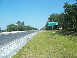
Limona was an unincorporated community in Hillsborough County, Florida. It existed by that name from about 1876 to about the 1963, when it became part of the unincorporated town of Brandon, Florida.

Unincorporated area Region of land not governed by own local government

In law, an unincorporated area is a region of land that is not governed by a local municipal corporation; similarly an unincorporated community is a settlement that is not governed by its own local municipal corporation, but rather is administered as part of larger administrative divisions, such as a township, parish, borough, county, city, canton, state, province or country. Occasionally, municipalities dissolve or disincorporate, which may happen if they become fiscally insolvent, and services become the responsibility of a higher administration. Widespread unincorporated communities and areas are a distinguishing feature of the United States and Canada. In most other countries of the world, there are either no unincorporated areas at all, or these are very rare; typically remote, outlying, sparsely populated or uninhabited areas.

Hillsborough County, Florida County in Florida, United States

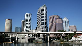
Hillsborough County is a county in the U.S. state of Florida. In the 2010 census, the population was 1,229,226, making it the fourth-most populous county in Florida and the most populous county outside the Miami Metropolitan Area. A 2017 estimate has the population of Hillsborough County at 1,408,566 people, which itself is greater than the populations of 10 states according to their 2017 population estimates. Its county seat and largest city is Tampa.

Brandon, Florida Census-designated place in Florida, United States

Brandon is an unincorporated community and census-designated place (CDP) in Hillsborough County, Florida, United States. It is part of the Tampa–St. Petersburg–Clearwater Metropolitan Statistical Area. As of the 2010 census, the CDP had a population of 103,483, up from 77,895 at the 2000 census.

Coordinates: 27°56′44″N82°18′14″W / 27.94556°N 82.30389°W / 27.94556; -82.30389

Geographic coordinate system Coordinate system

A geographic coordinate system is a coordinate system that enables every location on Earth to be specified by a set of numbers, letters or symbols. The coordinates are often chosen such that one of the numbers represents a vertical position and two or three of the numbers represent a horizontal position; alternatively, a geographic position may be expressed in a combined three-dimensional Cartesian vector. A common choice of coordinates is latitude, longitude and elevation. To specify a location on a plane requires a map projection.


Related Research Articles

Berlin Township, St. Clair County, Michigan Civil township in Michigan, United States

Berlin Township is a civil township of St. Clair County in the U.S. state of Michigan. At the 2000 census, the township population was 3,162.

Dawson, Alabama Unincorporated community in Alabama, United States

Dawson is a small unincorporated community located in DeKalb County, Alabama, United States. It is located atop Sand Mountain, approximately 4 miles (6 km) northeast of the town of Crossville.

Piney Flats is an unincorporated community in Sullivan County in the U.S. state of Tennessee. It is part of the Kingsport–Bristol (TN)–Bristol (VA) Metropolitan Statistical Area, which is a component of the Johnson City–Kingsport–Bristol, TN-VA Combined Statistical Area – commonly known as the "Tri-Cities" region. Some areas of Piney Flats along U.S. Route 11E have been annexed by Johnson City and Bluff City north of the intersection and areas along Allison Road & Piney Flats Road.

Claxton is an unincorporated community in McMinn County, Tennessee, United States.

Fellowship, Florida human settlement in Florida, United States of America

Fellowship is an unincorporated community in Marion County, Florida, United States. It is located near the intersection of U.S. 27 and County Road 464. The community is part of the Ocala Metropolitan Statistical Area.

Tallevast is an unincorporated community in Manatee County, Florida, United States. It is part of the Bradenton–Sarasota–Venice Metropolitan Statistical Area.

Olloki is a village in Navarre (Spain). Until December 1, 2005 it was called a "concejo" —a sort of unincorporated area — when it joined Esteribar.

Billeaud is an unincorporated community in Lafayette Parish, Louisiana, United States.

Withams is an unincorporated community in Accomack County, Virginia.

Myakka City is an unincorporated community in southeastern Manatee County, Florida, United States. It lies along State Road 70 near the city of Bradenton, the county seat of Manatee County. Its elevation is 43 feet (13 m), and it is located at 27°20′59″N 82°9′41″W. Although Myakka is unincorporated, it has a post office, with the ZIP code of 34251; the ZCTA for ZIP code 34251 had a population of 6,351 at the 2010 census. up from 4,239 in 2000.

Memphis Heights is an unincorporated area in Manatee County, Florida, United States.

Gillette is an unincorporated area and small community in Manatee County, Florida, United States.

Waterbury is an unincorporated area in Manatee County, Florida, United States.

Elwood Park is an unincorporated area in Manatee County, Florida, United States.

Bethesda is an unincorporated community in Lancaster County, in the U.S. state of Pennsylvania.

Marrs Center, Indiana Unincorporated community in Indiana, United States

Marrs Center is an unincorporated community in Marrs Township, Posey County, in the U.S. state of Indiana.

Bloom Center, Logan County, Ohio human settlement in United States of America

Bloom Center is an unincorporated community in Logan County, in the U.S. state of Ohio.

Dalzell is an unincorporated community in Washington County, in the U.S. state of Ohio.

Sandy is an unincorporated area in Manatee County, Florida, United States.

Maggie is an unincorporated community in Mason County, in the U.S. state of West Virginia.