
Geography of the United States Virgin Islands

The Virgin Islands are geologically and biogeographically the easternmost part of the Greater Antilles, the northern islands belonging to the Puerto Rican Bank and St. Croix being a displaced part of the same geologic structure. Politically, the British Virgin Islands have been governed as the western island group of the Leeward Islands, which are the northern part of the Lesser Antilles, and form the border between the Caribbean Sea and the Atlantic Ocean. The archipelago is separated from the true Lesser Antilles by the Anegada Passage and from the main island of Puerto Rico by the Virgin Passage.
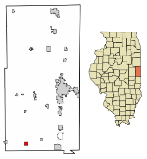
Sidell is a village in Sidell Township, Vermilion County, Illinois, United States. It is part of the Danville, Illinois Metropolitan Statistical Area. The population was 626 at the 2000 census.

Cruz Bay, U.S. Virgin Islands is the main town on the island of Saint John in the United States Virgin Islands. According to the 2000 census, Cruz Bay had a population of 2,743.
Thatch Cay is a small, uninhabited 230 acre island one-half mile off the northeastern coast of Saint Thomas. Its highest peak is 482 feet. It is one of the last privately held, undeveloped islands in the U.S. Virgin Islands.
The area code (340) is the local telephone area code of U.S. Virgin Islands. The (340) area code was created during a split from the original (809) area code, which began permissive dialing on 1 June 1997 and ended 30 June 1998.
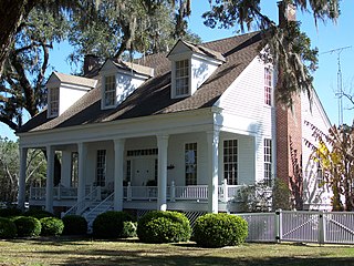
Capps is an unincorporated community in Jefferson County, Florida, United States. It is located at the intersection of U.S. Routes 19 and 27. During the 1940s and 1950s, Capps was the headquarters of an agribusiness known as Tungston Plantation, owned by Everett P. Larsh, an industrialist from Dayton, Ohio, and managed by L. H. Crampton. Tungston plantation comprised a total of approximately 16,000 acres, of which about 8,000 acres was planted in tung trees. Each year, the tung nut was harvested and brought to the mill at Capps, and its contents processed into tung oil for use in paints, varnishes and other products. During those years, Tungston Plantation constituted the largest tung operation in the U.S. under single ownership.
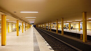
Leopoldplatz is a Berlin U-Bahn station in the Wedding district which serves as an interchange between the lines U 6 and U 9. It is operated by the BVG.
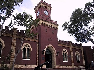
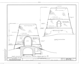
Fort Christian is a Dano-Norwegian-built fort in Charlotte Amalie, Saint Thomas, U.S. Virgin Islands. Built 1672-1680, early in the first successful colonial establishment on the island, the fort served as a critical point of defense and government during the entire period of Dano-Norwegian, and later Danish, administration, which ended in 1917 with the sale of the islands to the United States. It currently holds the St. Thomas Museum, which holds artifacts and art of the Dano-Norwegian period. It was designated a U.S. National Historic Landmark in 1977.
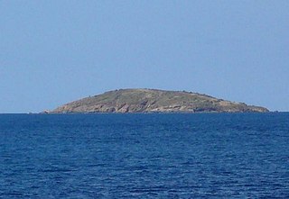
Flanagan Island is an island located within the Virgin Islands archipelago in the Caribbean and forms part of the U.S. Virgin Islands.
The U.S. Virgin Islands Paradise Jam is a college basketball tournament that takes place in late November of each year, with the men usually playing the week before Thanksgiving and the women playing Thanksgiving week. It normally takes place in St. Thomas at the Sports and Fitness Center on the campus of the University of the Virgin Islands.

The Settlement is the main and only town on Anegada in the British Virgin Islands in the Caribbean.
Estate Thomas is a settlement adjacent to Charlotte Amalie on the island of Saint Thomas in the United States Virgin Islands.
Mafolie is a settlement on the island of Saint Thomas in the United States Virgin Islands.
Solberg is a settlement on the Northside of the island of Saint Thomas in the United States Virgin Islands.
Mary Point is an uninhabited peninsula on the island of Saint John in the United States Virgin Islands. There are no roads or trails and steep cliffs prevent access from the water. Although Mary Point once housed a small sugar cane plantation, the area is now overgrown with thick forest. The foundation and crumbling walls of Mary Point Estate can be seen from the Francis Bay trail. It is part of Virgin Islands National Park. Mary Creek, the shallow bay on the east side, is a popular spot for fly fishing and kitesurfing.
Sion Farm is a settlement on the island of Saint Croix in the United States Virgin Islands.
Sunny Isle is a shopping center at Sion Farm on the island of Saint Croix in the United States Virgin Islands.
Emancipation Garden is a park in Saint Thomas, U.S. Virgin Islands

