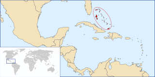
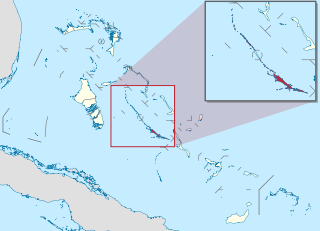
This article talks about transportation in the Bahamas, a North American archipelagic state in the Atlantic Ocean.

Ragged Island is a small island and district in the southern Bahamas. Ragged Island is part of the Jumentos Cays and Ragged Island Chain. The crescent-shaped chain measures over 110 miles (180 km) in length and includes cays known as Raccoon Cay, Hog Cay and Double-Breasted Cay. On 8 September 2017, Duncan Town took a direct hit from Hurricane Irma.

Musha Cay is a 150-acre, privately owned island in the Exuma Chain, in the southern Bahamas. It is located 85 miles (137 km) southeast of Nassau. It is owned by illusionist David Copperfield.

The Allen Cays rock iguana or Allen Cays iguana is an endangered subspecies of the northern Bahamian rock iguana that is found on Allen's Cay in the Bahamas. Its status is Endangered, with a wild population of 1,000 animals, and it can be found on the IUCN Red List.

The Exuma Island iguana is a critically endangered subspecies of northern Bahamian rock iguana that is found on the Exuma island chain in the Bahamas with a wild population of 1,300 animals, it is listed on the IUCN Red List.

The following outline is provided as an overview of and topical guide to the Bahamas:
The Bahamas National Trust is a non-profit organisation in the Bahamas that manages the country's twenty-seven national parks. Its headquarters is located in New Providence at The Retreat Gardens on Village Road. The Bahamas National Trust was created by an Act of Parliament in 1959, through the efforts of two groups of conservationists.

The following is an alphabetical list of topics related to the Commonwealth of the Bahamas.

The Exuma Cays Land and Sea Park is a protected area in the Exuma Cays of the Bahamas. The protected area extends from Shroud Cay in the north to Bell Cay in the south. The vegetation consists of mangrove communities, with the east sides being clad in low scrub and the western sides with taller scrub. There are many epiphytic orchids and bromeliads.

Stocking Island is a small, long, narrow island off the port of Georgetown, Great Exuma Island, Bahamas. The island features beaches and several resorts.

Pig Beach is an uninhabited island located in Exuma, the Bahamas. The island takes its unofficial name from the fact that it is populated by a colony of feral pigs that live on the island and in the surrounding shallows.

Long Island is an island in the Bahamas that is split by the Tropic of Cancer. It is one of the Districts of the Bahamas and is known as the most scenic island in the Bahamas. Its capital is Clarence Town. The population of Long Island is 3,094 inhabitants.

Staniel Cay is an island located in The Exuma Cays, a district of The Bahamas.

The Conception Island National Park is a protected area in the Bahamas. The island lies between Cat Cays to the north and Rum Cay to the south. The vegetation consists of mangrove communities, with typical strand vegetation, and the island is visited by green turtles, sea birds and migrating birds.

Jewfish Cay, also known as Hummingbird Cay, is an island of the Bahamas, located in the Exuma district near Culmer's Cay and Bowe Cay. The island is host to an anchorage. The island is privately owned, and is also home to a marine biology research station connected to Tufts University.

Compass Cay is an island in The Bahamas, located in the Exuma district. The island, notable for its naturally-protected harbor, has been outfitted with a beach lodge and a marina. The island also has a famed population of docile nurse sharks. The nurse sharks in the marina have become a popular tourist attraction, bringing in visitors from as far as the island of Nassau. The marina has a small shop with trinkets and snacks. It is also developing a restaurant. There is a large maze of mangroves that lead out from the marina. Walking throughout the island, you can find a beach and a "landing strip," a long patch of sand only visible at low tide.


