
Aragua State is located in the north-central region of Venezuela. It has plains and jungles and Caribbean beaches. The most popular are Cata and Choroni. It has Venezuela's first national park which is called Henri Pittier.

The St. Croix River is a river in northeastern North America, 71 miles (114 km) in length, that forms part of the Canada–United States border between Maine (U.S.) and New Brunswick (Canada). The river rises in the Chiputneticook Lakes and flows south and southeast, between Calais and St. Stephen. It discharges into Passamaquoddy Bay, in the Bay of Fundy.

Notre-Dame-de-Grâce—Lachine was a federal electoral district in Quebec, Canada, that was represented in the House of Commons of Canada from 1997 to 2015. Its population in 2006 was 104,715.
Villa de Todos los Santos de Calabozo is an inland town of Venezuela, once capital of the Province of Caracas in the colonial period, formerly in the State of Miranda and former capital of the state of Guárico.

Guárico River is a river in Venezuela.
The Back River is a 6.5-mile-long (10.5 km) river located in New Hampshire and Massachusetts in the United States. It is a tributary to the Powwow River, part of the Merrimack River watershed. Approximately 3.0 miles (4.8 km) of the river are in New Hampshire, with the remaining 3.5 miles (5.6 km) in Massachusetts.
Castro Marim and Vila Real de Santo António Marsh Natural Reserve is a natural reserve in Portugal.

San Fernando de Atabapo was the capital city of Venezuela's Amazonas state until the early 1900s. The population in 1997 was approximately 5,000.

Capanaparo River is a river of Colombia and Venezuela. It is part of the Orinoco River basin. In Venezuela together with the Cinaruco River, other smaller rivers and the area around them they form the Santos Luzardo National Park since 1988.

Cinaruco River is a river of Colombia and Venezuela. It is part of the Orinoco River basin. It has partially clear tanic waters. In Venezuela this river is part of the Santos Luzardo National Park since the year 1988. The Cinaruco River together with the Capanaparo River, other smaller rivers and the area around them form this national park. It houses a big biodiversity and many fisherman go each year looking for peacock bass. Three different species of peacock bass are found in this river: Cichla intermedia, Cichla orinocensis and Cichla temensis from smallest to biggest.

The Inírida is a river in the north-west of South America, in the territory of Colombia, the largest tributary of the Guaviare.

Portuguesa River is a river of Venezuela. It is part of the Orinoco River basin, and is a tributary of the Apure River.
The Caño Central is a river of Venezuela. It drains into Lake Valencia.
Suapure River is a river of Venezuela. It is part of the Orinoco River basin.
Sipapo River is a river of Venezuela. It is part of the Orinoco River basin.
Cuao River is a river of Venezuela. It is part of the Orinoco River basin.
The Autana River is a blackwater river of Venezuela, a tributary of the Sipapo River in the middle Orinoco River basin.
The Oyster River is a tributary of the Saint George River in Knox County, Maine. From its source in Rockport, the river runs 12.5 miles (20.1 km) south and southwest to its confluence with the Saint George. Its lower third forms the border between Warren and Thomaston.

Crane Park Island is a Local Nature Reserve in Twickenham in the London Borough of Richmond upon Thames. It is also part of The Crane Corridor Site of Metropolitan Importance for Nature Conservation. The site is an island in the River Crane, which is owned by Richmond upon Thames London Borough Council and managed by the London Wildlife Trust. The (only) entrance is next to the Shot Tower in Crane Park.

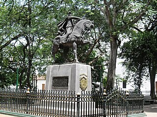
The Third Republic of Venezuela is the name commonly used to refer to the reestablished Republic of Venezuela declared by Simón Bolívar in the year 1817, during the Venezuelan War of Independence. The beginning of the Third Republic of Venezuela is attributed to the period after the Guyana Campaign, during which the republicans restored democratic institutions in Angostura. The Republic ended after the Congress of Angostura of 1819 decreed the union of Venezuela with New Granada, to form the republic of Gran Colombia.

