The Penguin Atlas of World History

Last updated
The Penguin Atlas of World History
PenguinAtlasCovers.png
2004 English Editions
AuthorHerman Kinder
Original titleAtlas zur Weltgeschichte
IllustratorWerner Hilgemann
CountryUnited States
LanguageEnglish
Genre Historical atlas
Publisher Penguin Books
Publication date
1964 (German), 1974, 2004
Media type Paperback
ISBN 978-0-14-101263-6

The Penguin Atlas of World History is a two-volume, paperback-sized historical atlas first published by Penguin Books in 1974, with the latest edition published in 2004. It was translated from a German atlas, Atlas zur Weltgeschichte by Hermann Kinder and Werner Hilgemann, originally published by Deutsche Taschenbuch Verlag ten years prior to the first English edition, in 1964.

Historical atlas

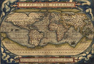
A historical atlas is an atlas that includes historical maps and charts depicting the evolving geopolitical landscape. They are helpful in understanding historical context, the scope and scale of historical events and historical subjects, and macro-history. Some historical atlases try to present the entire history of the world, such as the Historical Atlas of the World, while others are more specialised, for only one time period or location, such as the Historical Atlas of the American West or The Historical Atlas of China. They may also include historical photographs and explanatory text or essays.

Penguin Books British publishing house

Penguin Books is a British publishing house. It was co-founded in 1935 by Sir Allen Lane, his brothers Richard and John, as a line of the publishers The Bodley Head, only becoming a separate company the following year. Penguin revolutionised publishing in the 1930s through its inexpensive paperbacks, sold through Woolworths and other high street stores for sixpence, bringing high-quality paperback fiction and non-fiction to the mass market. Penguin's success demonstrated that large audiences existed for serious books. Penguin also had a significant impact on public debate in Britain, through its books on British culture, politics, the arts, and science.

German language West Germanic language

German is a West Germanic language that is mainly spoken in Central Europe. It is the most widely spoken and official or co-official language in Germany, Austria, Switzerland, South Tyrol (Italy), the German-speaking Community of Belgium, and Liechtenstein. It is also one of the three official languages of Luxembourg and a co-official language in the Opole Voivodeship in Poland. The languages which are most similar to German are the other members of the West Germanic language branch: Afrikaans, Dutch, English, the Frisian languages, Low German/Low Saxon, Luxembourgish, and Yiddish. There are also strong similarities in vocabulary with Danish, Norwegian and Swedish, although those belong to the North Germanic group. German is the second most widely spoken Germanic language, after English.

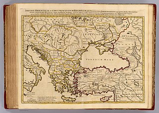
Volume 1 encompasses pre-history to the eve of the French Revolution, and Volume 2 includes the Revolution itself and extends to the Iraq War. The book is formatted such that maps appear on the left-hand page with accompanying textual notations on the right, as opposed to most larger-format atlases that feature irregular and mixed formatting of text and maps. However, time lines, such as one tracing the development of life, and organizational charts, such as a graphic depicting the workings of the United Nations according to its charter, are occasionally featured as well.

French Revolution social and political revolution in France and its colonies occurring from 1789 to 1798

The French Revolution was a period of far-reaching social and political upheaval in France and its colonies beginning in 1789. The Revolution overthrew the monarchy, established a republic, catalyzed violent periods of political turmoil, and finally culminated in a dictatorship under Napoleon who brought many of its principles to areas he conquered in Western Europe and beyond. Inspired by liberal and radical ideas, the Revolution profoundly altered the course of modern history, triggering the global decline of absolute monarchies while replacing them with republics and liberal democracies. Through the Revolutionary Wars, it unleashed a wave of global conflicts that extended from the Caribbean to the Middle East. Historians widely regard the Revolution as one of the most important events in human history.

Iraq War war which started on 20 March 2003

The Iraq War was a protracted armed conflict that began in 2003 with the invasion of Iraq by a United States-led coalition that overthrew the government of Saddam Hussein, in breach of international law. The conflict continued for much of the next decade as an insurgency emerged to oppose the occupying forces and the post-invasion Iraqi government. An estimated 151,000 to 600,000 or more Iraqis were killed in the first three to four years of conflict. The U.S. became re-involved in 2014 at the head of a new coalition; the insurgency and many dimensions of the civil armed conflict continue. The invasion occurred as part of a declared war against international terrorism and its sponsors under the administration of U.S. President George W. Bush following the September 11 terrorist attacks.

Evolutionary history of life The processes by which organisms evolved on Earth

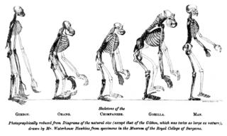
The evolutionary history of life on Earth traces the processes by which living and fossil organisms evolved, from the earliest emergence of life to the present. Earth formed about 4.5 billion years (Ga) ago and evidence suggests life emerged prior to 3.7 Ga. The similarities among all known present-day species indicate that they have diverged through the process of evolution from a common ancestor. Approximately 1 trillion species currently live on Earth of which only 1.75–1.8 million have been named and 1.6 million documented in a central database. These represent less than one percent of the species that have ever lived on earth.

The Atlas is also notable for Werner Hilgemann's unique cartographical style, which treats city and state names on maps as political/governing entities, allowing them to be graphically linked with other labels to show alliances and treaties, thereby adding an extra informational dimension.

See also

Related Research Articles

Cartography The study and practice of making maps

Cartography is the study and practice of making maps. Combining science, aesthetics, and technique, cartography builds on the premise that reality can be modeled in ways that communicate spatial information effectively.

Atlas A collection of maps

An atlas is a collection of maps; it is typically a bundle of maps of Earth or a region of Earth.

<i>Theatrum Orbis Terrarum</i> 1571 atlas by Abraham Ortelius

Theatrum Orbis Terrarum is considered to be the first true modern atlas. Written by Abraham Ortelius, strongly encouraged by Gillis Hooftman and originally printed on May 20, 1570, in Antwerp, it consisted of a collection of uniform map sheets and sustaining text bound to form a book for which copper printing plates were specifically engraved. The Ortelius atlas is sometimes referred to as the summary of sixteenth-century cartography. The publication of the Theatrum Orbis Terrarum (1570) is often considered as the official beginning of the Golden Age of Netherlandish cartography.

Jan Janssonius Dutch cartographer and publisher

Johannes Janssonius was a Dutch cartographer and publisher who lived and worked in Amsterdam in the 17th century.

<i>The Atlas of Middle-earth</i> book

The Atlas of Middle-earth by Karen Wynn Fonstad is an atlas of J. R. R. Tolkien's fictional realm of Middle-earth. It was published in 1981, following Tolkien's major works The Hobbit, The Lord of the Rings, and The Silmarillion.

East Germanic languages Group of extinct Indo-European languages in the Germanic family

The East Germanic languages, also called the Oder–Vistula Germanic languages, are a group of extinct Germanic languages family spoken by East Germanic peoples.

Willem Blaeu Dutch cartographer, atlas maker and publisher (1571-1638)

Willem Janszoon Blaeu, also abbreviated to Willem Jansz. Blaeu, was a Dutch cartographer, atlas maker and publisher. Along with his son Johannes Blaeu, Willem is considered one of the notable figures of the Netherlandish/Dutch school of cartography in its golden age.

<i>Atlas Mira</i> book

The World Atlas is the Soviet and later Russian atlas of the world.

<i>Times Atlas of the World</i>

The Times Atlas of the World, rebranded The Times Atlas of the World: Comprehensive Edition in its 11th edition and The Times Comprehensive Atlas of the World from its 12th edition, is a world atlas currently published by HarperCollins Publisher L.L.C. Its most recent edition, the fourteenth, was published on 25 September 2014.

Jodocus Hondius Flemish/Dutch artist, cartographer, engraver

Jodocus Hondius was a Flemish engraver and cartographer. He is sometimes called Jodocus Hondius the Elder to distinguish him from his son Jodocus Hondius II. Hondius is best known for his early maps of the New World and Europe, for re-establishing the reputation of the work of Gerard Mercator, and for his portraits of Francis Drake. One of the notable figures in the Golden Age of Dutch/Netherlandish cartography, he helped establish Amsterdam as the center of cartography in Europe in the 17th century.

Alexander Keith Johnston (1804–1871) Scottish geographer

Alexander Keith Johnston FRSE FRGS FGS FEGS LLD was a Scottish geographer and cartographer.

<i>Atlas Maior</i> book

The Atlas Maior is the final version of Joan Blaeu's atlas, published in Amsterdam between 1662 and 1672, in Latin, French, Dutch, German and Spanish, containing 594 maps and around 3,000 pages of text. It was the largest and most expensive book published in the seventeenth century. Earlier, much smaller versions, titled Theatrum Orbis Terrarum, sive, Atlas Novus, were published from 1634 onwards. Like Abraham Ortelius's Theatrum Orbis Terrarum (1570), the Atlas Maior is widely considered a masterpiece of the Golden Age of Dutch/Netherlandish cartography.

<i>Barrington Atlas of the Greek and Roman World</i> large-format English language atlas of ancient Europe, Asia, and North Africa, edited by Richard J. A. Talbert

The Barrington Atlas of the Greek and Roman World is a large-format English language atlas of ancient Europe, Asia, and North Africa, edited by Richard J. A. Talbert. The time period depicted is roughly from archaic Greek civilization through Late Antiquity. The atlas was published by Princeton University Press in 2000. The book was the winner of the 2000 Association of American Publishers Award for Best Professional/Scholarly Multivolume Reference Work in the Humanities.

Joan Blaeu Dutch cartographer (1596-1673)

Joan Blaeu was a Dutch cartographer born in Alkmaar, the son of cartographer Willem Blaeu.

Mark Ovenden British writer and journalist, specialising in cartography

Mark Ovenden F.R.G.S. is a broadcaster and author who specialises in the subjects of graphic design, cartography and architecture in public transport, with an emphasis on underground rapid transit.

Robert Morden English cartographer

Robert Morden was an English bookseller, publisher, and maker of maps and globes. He was among the first successful commercial map makers.

<i>The Atlas of Pern</i> book by Karen Wynn Fonstad

The Atlas of Pern by Karen Wynn Fonstad is an authorized companion book to the science fiction Dragonriders of Pern series by Anne McCaffrey. It was completed in 1984 based on the first seven Pern novels and collaboration with McCaffrey.

<i>The World Atlas of Wine</i> book by Hugh Johnson

The World Atlas of Wine by Hugh Johnson and Jancis Robinson, MW, is an atlas and reference work on the world of wine, published by Mitchell Beazley. It pioneered the use of wine-specific cartography to give wine a sense of place, and has since the first edition published in 1971 sold 4 million copies in 14 languages. Considered among the most significant wine publications to date, and it remains one of the most popular books on wine, with the most recent seventh edition published in October 2013.

<i>Harmonia Macrocosmica</i> book by Andreas Cellarius

The Harmonia Macrocosmica is a star atlas written by Andreas Cellarius and published in 1660 by Johannes Janssonius. The first part of the atlas contains copper plate prints depicting the world systems of Claudius Ptolemy, Nicolaus Copernicus, and Tycho Brahe. At the end are star maps of the classical and further constellations, the latter ones as introduced by Julius Schiller in his Coelum stellatum christianum of 1627.

<i>Atlas van Loon</i> book

The Atlas van Loon was commissioned by Frederik Willem van Loon of Amsterdam. It consists of a large number of maps published between 1649 and 1676:

References