An emergency position-indicating radiobeacon station is a distress radiobeacon, a tracking transmitter that is triggered during an accident. These are detected by satellites. The system is monitored by an international consortium of rescue services, COSPAS-SARSAT. The basic purpose of this system is to help rescuers find survivors within the so-called "golden day" during which the majority of survivors can usually be saved.
A distress signal, also known as a distress call, is an internationally recognized means for obtaining help. Distress signals are communicated by transmitting radio signals, displaying a visually observable item or illumination, or making a sound audible from a distance.
The Ontario provincial highway network consists of all public highways maintained by the Canadian province of Ontario. The Ministry of Transportation of Ontario (MTO) maintains over 16,600 kilometres (10,300 mi) of roadways organized into various classifications which crisscross the province and provide access to major population centres.
400 is the natural number following 399 and preceding 401.
King's Highway 58, commonly referred to as Highway 58, is a provincially maintained highway in the Canadian province of Ontario. The route is divided into two segments with a combined length of 15.5 km (9.6 mi). The southern segment travels from Niagara Regional Road 3, formerly Highway 3, in Port Colborne, to the Highway 58A junction in the southern end of Welland, a distance of 7.2 km (4.5 mi). The northern segment begins at Highway 20 near Allanburg and travels north and west to a large junction with Highway 406 at the St. Catharines – Thorold boundary, a distance of 8.3 km (5.2 mi). An 18.1 km (11.2 mi) gap separates the two segments within Welland and Pelham. The entire route is located within the Regional Municipality of Niagara.

The state highway system of the U.S. state of California is a network of highways that are owned and maintained by the Highway Division of the California Department of Transportation (Caltrans).

King's Highway 406, commonly referred to as Highway 406, is a 400-series highway in the Canadian province of Ontario. The primary north-south route though the central portion of the Niagara Peninsula, Highway 406 connects Welland, Thorold and downtown St. Catharines to the Queen Elizabeth Way (QEW).
The aircraft emergency frequency is a frequency used on the aircraft band reserved for emergency communications for aircraft in distress. The frequencies are 121.5 MHz for civilian, also known as International Air Distress (IAD) or VHF Guard, and 243.0 MHz for military use, also known as Military Air Distress (MAD) or UHF Guard. Earlier emergency locator transmitters used the guard frequencies to transmit, but an additional frequency of 406 MHz is used by more modern ELTs.
King's Highway 140, commonly referred to as Highway 140, is a provincially maintained highway in the Canadian province of Ontario. The highway connects Port Colborne near Lake Erie with Highway 406 in Welland, via the Main Street Tunnel. It was constructed in the early 1970s as part of the Welland Bypass project of the Welland Canal, which resulted in the severance of several highways and rail lines. Opened to traffic in late 1972, several months following the tunnel, Highway 140 has remained unchanged since, despite growing calls to resign it as an extension of Highway 406.

The International Cospas-Sarsat Programme is a satellite-aided search and rescue initiative. It is organized as a treaty-based, nonprofit, intergovernmental, humanitarian cooperative of 45 nations and agencies. It is dedicated to detecting and locating radio beacons activated by persons, aircraft or vessels in distress, and forwarding this alert information to authorities that can take action for rescue.
King's Highway 58A, commonly referred to as Highway 58A, is a provincially maintained highway in the Canadian province of Ontario. The short route serves to connect Highway 58 with Highway 140 and passes beneath the Welland Canal through the Townline Tunnel. The entire route is located within the city of Welland in the Regional Municipality of Niagara.

Area codes 234 and 330 are North American telephone area codes for part of northeast Ohio, United States. Area code 330 was established on March 9, 1996, and was Ohio's first new area code since the North American Numbering Plan started in 1947.

An airway beacon was a rotating light assembly mounted atop a tower. These were once used extensively in the United States for visual navigation by airplane pilots along a specified airway corridor. Approximately 1,500 airway beacons were constructed to guide pilots from city to city, covering 18,000 miles (29,000 km). Most of the beacons are gone, but the State of Montana continues to maintain several as navigation aids in mountainous terrain. One beacon is preserved for historical purposes in Saint Paul, Minnesota at the Indian Mounds Park on a bluff overlooking the Mississippi River. Recently, the beacon at Grants, New Mexico was restored for historic preservation, using original items found at other nearby sites.

In navigation, an electric beacon is a kind of beacon, a device which marks a fixed location and allows direction finding equipment to find relative bearing, the direction to the beacon. The most common are radio beacons, which broadcast a radio signal which is picked up by radio direction finding systems on ships, aircraft and vehicles to determine the bearing to the beacon, but the term also covers infrared and sonar beacons.

The State Highways of Washington in the U.S. state of Washington comprise a network of over 7,000 miles (11,270 km) of state highways, including all Interstate and U.S. Highways that pass through the state, maintained by the Washington State Department of Transportation (WSDOT). The system spans 8.5% of the state's public road mileage, but carries over half of the traffic. All other public roads in the state are either inside incorporated places or are maintained by the county.
Survival radios are carried by ships and aircraft to facilitate rescue in an emergency. They are generally designed to transmit on international distress frequencies. Maritime systems have been standardized under the Global Maritime Distress Safety System.

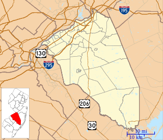
Evesboro is an unincorporated community located within Evesham Township in Burlington County, New Jersey, United States. Major highways around Evesboro are Route 70 and Route 73.
An emergency locator beacon is a radio beacon, a battery powered radio transmitter, used to locate airplanes, vessels, and persons in distress and in need of immediate rescue. Various types of emergency locator beacons are carried by aircraft, ships, vehicles, hikers and cross-country skiers. In case of an emergency, such as the aircraft crashing, the ship sinking, or a hiker becoming lost, the transmitter is deployed and begins to transmit a continuous radio signal, which is used by search and rescue teams to quickly find the emergency and render aid.


