
Hamamatsu is a city located in western Shizuoka Prefecture, Japan. In September 2023, the city had an estimated population of 780,128 in 340,591 households, making it the prefecture's largest city, with a population density of 500/km2 (1,300/sq mi) over the total urban area of 1,558.06 km2 (601.57 sq mi).

Numazu is a city located in eastern Shizuoka Prefecture, Japan. As of 1 December 2019, the city had an estimated population of 189,486 in 91,986 households, and a population density of 1,014 persons per km2. The total area of the city is 186.96 square kilometres (72.19 sq mi).

Fujieda is a city located in Shizuoka Prefecture, Japan. As of 30 April 2019, the city has an estimated population of 145,032 in 59,480 households, and a population density of 750 persons per km2. The total area of the city was 194.06 square kilometres (74.93 sq mi). Fujieda is a member of the World Health Organization’s Alliance for Healthy Cities (AFHC).

The Abukuma River, with a length of 234 km (145 mi), is the second longest river in the Tōhoku region of Japan and the 6th longest river in the country. It is designated as a Class A river.
Suruga Province was an old province in the area that is today the central part of Shizuoka Prefecture. Suruga bordered on Izu, Kai, Sagami, Shinano, and Tōtōmi provinces; and was bordered by the Pacific Ocean through Suruga Bay to the south. Its abbreviated form name was Sunshū (駿州).
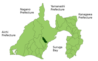
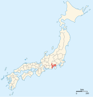
Shida District was a rural district located in central Shizuoka Prefecture, Japan.
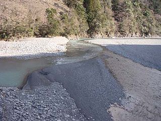
The Ōi River is a river in Shizuoka Prefecture, Japan.

The Fuji River is a river in Yamanashi and Shizuoka Prefectures of central Japan. It is 128 kilometres (80 mi) long and has a watershed of 3,990 square kilometres (1,540 sq mi). With the Mogami River and the Kuma River, it is regarded as one of the three most rapid flows of Japan.

The Shinano River, known as the Chikuma River in its upper reaches, is the longest and widest river in Japan and the third largest by basin area. It is located in northeastern Honshu, rising in the Japanese Alps and flowing generally northeast through Nagano and Niigata Prefectures before emptying into the Sea of Japan. It is designated as a Class A river.
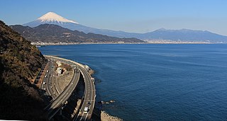
Suruga Bay is a bay on the Pacific coast of Honshū in Shizuoka Prefecture, Japan. It is situated north of a straight line from Omaezaki Point to Irōzaki Point at the tip of the Izu Peninsula and surrounded by Honshū to the southwest and west and the Izu Peninsula to the east.

The Kano River is an A class river in Shizuoka Prefecture of central Japan. It is 46 kilometres (29 mi) long and has a watershed of 853 square kilometres (329 sq mi).

Minami Alps National Park is a national park in the Akaishi Mountains, Chūbu region, Honshū, Japan.

The Nagara River has its source in the city of Gujō, Gifu Prefecture, and its mouth in the city of Kuwana, Mie Prefecture, Japan. Along with the Kiso River and Ibi River, the Nagara River is one of the Kiso Three Rivers of the Nōbi Plain. Previously, the river was named Sunomata River. With a length of 166 km (103 mi), it drains an area of 1,985 square kilometres (766 sq mi) in the Chūbu region and empties into Ise Bay. The government of Japan classifies it as a Class 1 river.

Shizuoka is the capital city of Shizuoka Prefecture, Japan, and the prefecture's second-largest city in both population and area. It has been populated since prehistoric times. As of 1 September 2023, the city had an estimated population of 677,867 in 106,087 households, and a population density of 480 inhabitants per square kilometre (1,200/sq mi).

The Tenryū River is a river in central Honshū, Japan. With a length of 213 km (132 mi), it is Japan's ninth longest river.
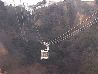
The Nihondaira Ropeway is Japanese aerial lift line in the city of Shizuoka in Shizuoka Prefecture, operated by Shizuoka Railway (Shizutetsu). Opened in 1967, the line climbs Nihondaira, a hill with views of the city, Suruga Bay, and Mount Fuji. The line does not accept LuLuCa, a smart card ticketing system by Shizutetsu.
The Agatsuma River is a major river in the northern Kantō region of Japan. It is 76.22 kilometres (47.36 mi) in length and has a basin area of 1,366 square kilometres (527 sq mi). Located entirely within Gunma Prefecture, it is one of the prefecture's major rivers. It is also a major tributary of the Tone River. The river is an important source of hydroelectric power, and 17 power plants are located on its banks.

The Watarase River is a major river in the northern Kantō region of Japan. A tributary of the Tone River, it is 106.7 kilometres (66.3 mi) in length and drains an area of 2,621 square kilometres (1,012 sq mi). Its source is at Mount Sukai on the boundary of the city of Nikkō in Tochigi Prefecture and it empties into the Tone River at the boundary of the city of Koga in Ibaraki Prefecture and the city of Kazo in Saitama Prefecture. It is classed as a First-class river by the Japanese government.
Abe District was formerly a rural district located in Shizuoka Prefecture, Japan. The entire area of the district is now within modern Shizuoka City, with the original core area corresponding to the extension of Aoi Ward.

Typhoon Gilda, known in the Philippines as Typhoon Deling was a destructive, deadly, costly and long-lived tropical cyclone that left over 145 confirmed deaths over Japan and South Korea, mostly due to torrential rainfall that induced landslides, all generated by the typhoon and its associated meiyu front. The eighth named storm and third typhoon of the 1974 Pacific typhoon season, the system was first noted by the China Meteorological Agency as an area of convection embedded on a trough, to the north of Enewetak Atoll on June 25. It was named Gilda on June 30 as it strengthened to a tropical storm. Under a favorable environment, it strengthened to a typhoon two days later as it moved northwestward. Another trough pulled Gilda poleward while changing less in intensity, until it intensified to a Category 2 typhoon as it battered the Ryukyu Islands at its peak. Increasing wind shear gradually weakened the system; however, it remained as a minimal typhoon until it passed through the southern tip of South Korea on July 6, where it weakened to a tropical storm. Colder waters in the Sea of Japan and high shear further degraded Gilda, until it transitioned to an extratropical low as it made landfall near Hokkaido on July 9. The remnants of the system briefly intensified near the Kuril Islands before weakening and dissipating on July 17 over the Sea of Okhotsk.


