Aderklaa

Last updated
Aderklaa
Kirche auf dem Dorfanger in Aderklaa.jpg
Church in the center of the village
AUT Aderklaa Noe CoA.svg
Coat of arms
Austria adm location map.svg
Red pog.svg
Aderklaa
Location within Austria
Coordinates: 48°17′N16°32′E / 48.283°N 16.533°E / 48.283; 16.533 Coordinates: 48°17′N16°32′E / 48.283°N 16.533°E / 48.283; 16.533
Country Austria
State Lower Austria
District Gänserndorf
Government
   Mayor Bernhard Wolfram (ÖVP)
Area
  Total8.62 km2 (3.33 sq mi)
Elevation
157 m (515 ft)
Population
(1 January 2016) [1]
  Total210
  Density24/km2 (63/sq mi)
Time zone UTC+1 (CET)
  Summer (DST) UTC+2 (CEST)
Postal code
2232
Area code 02247

Aderklaa is a town in the district of Gänserndorf in Lower Austria in Austria.

Lower Austria State of Austria

Lower Austria is the northeasternmost of the nine states of Austria. Since 1986, the capital of Lower Austria has been St. Polten, the most recently designated capital in Austria. Previously, Lower Austria's capital was Vienna, even though Vienna has not officially been part of Lower Austria since 1921. With a land area of 19,186 km2 (7,408 sq mi) and a population of 1.612 million people, Lower Austria is the country's largest state; it is the second most populous after the federal state of Vienna.
Austria Federal republic in Central Europe

Austria, officially the Republic of Austria, is a country of nearly 9 million people in Central Europe. It is bordered by the Czech Republic and Germany to the north, Hungary and Slovakia to the east, Slovenia and Italy to the south, and Switzerland and Liechtenstein to the west. The territory of Austria covers 83,879 km2 (32,386 sq mi). The terrain is highly mountainous, lying within the Alps; only 32% of the country is below 500 m (1,640 ft), and its highest point is 3,798 m (12,461 ft). The majority of the population speaks local Bavarian dialects as their native language, and German in its standard form is the country's official language. Other local official languages are Hungarian, Burgenland Croatian, and Slovene.

Geography

Aderklaa lies in the Marchfeld in Lower Austria between Vienna and Deutsch Wagram. About 1.22 percent of the municipality is forested.

The Marchfeld is a sedimentary basin between the Eastern Alps and the Carpathian Mountains. It is located in the southeast of the Weinviertel and is a river basin formed by the river Morava.

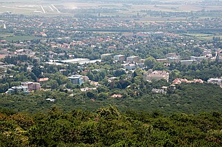
Vienna Capital city and state in Austria

Vienna is the federal capital and largest city of Austria, and one of the nine states of Austria. Vienna is Austria's primate city, with a population of about 1.9 million, and its cultural, economic, and political centre. It is the 7th-largest city by population within city limits in the European Union. Until the beginning of the 20th century, it was the largest German-speaking city in the world, and before the splitting of the Austro-Hungarian Empire in World War I, the city had 2 million inhabitants. Today, it has the second largest number of German speakers after Berlin. Vienna is host to many major international organizations, including the United Nations and OPEC. The city is located in the eastern part of Austria and is close to the borders of the Czech Republic, Slovakia, and Hungary. These regions work together in a European Centrope border region. Along with nearby Bratislava, Vienna forms a metropolitan region with 3 million inhabitants. In 2001, the city centre was designated a UNESCO World Heritage Site. In July 2017 it was moved to the list of World Heritage in Danger.

Related Research Articles

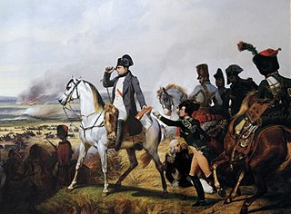
Battle of Wagram battle

The Battle of Wagram was a military engagement of the Napoleonic Wars that ended in a costly but decisive victory for Emperor Napoleon I's French and allied army against the Austrian army under the command of Archduke Charles of Austria-Teschen. The battle led to the breakup of the Fifth Coalition, the Austrian and British-led alliance against France.

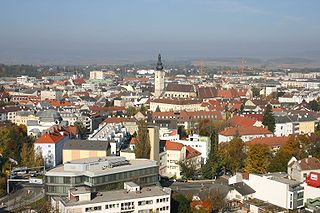
Sankt Pölten Place in Lower Austria, Austria

Sankt Pölten, mostly abbreviated to the official name St. Pölten, is the capital and largest city of the State of Lower Austria in northeast Austria, with 52,716 inhabitants as of 1 January 2015. St Pölten is a city with its own statute and therefore it is both a municipality and a district in the Mostviertel.

Horn, Austria Place in Lower Austria, Austria

Horn is a small town in the Waldviertel in Lower Austria, Austria and the capital of the district of the same name.

Bad Vöslau Place in Lower Austria, Austria

Bad Vöslau is a spa town in the Lower Austria federal state of Austria. It is also known as the cradle of the Austrian red wine cultivation. Population (2008): 11,190.

Schwaz Place in Tyrol, Austria

Schwaz is a city in the Austrian state of Tyrol. It is the administrative center of the Schwaz district. Schwaz is located in the lower Inn valley.

Seibersdorf Place in Lower Austria, Austria

Seibersdorf is an Austrian market town with 1,283 residents in the District of Baden in Lower Austria.

Altenmarkt an der Triesting Place in Lower Austria, Austria

Altenmarkt an der Triesting is a town in the district of Baden in Lower Austria in Austria.

Ebenthal, Lower Austria Place in Lower Austria, Austria

Ebenthal is a town in the district of Gänserndorf in the Austrian state of Lower Austria.

Großhofen Place in Lower Austria, Austria

Großhofen is a town in the district of Gänserndorf in the Austrian state of Lower Austria.

Hohenau an der March Place in Lower Austria, Austria

Hohenau an der March is a town in the district of Gänserndorf in the Austrian state of Lower Austria, close to Vienna and the borders with the Czech Republic and Slovakia.

Jedenspeigen Place in Lower Austria, Austria

Jedenspeigen is a town in the district of Gänserndorf in the Austrian state of Lower Austria.

Schönkirchen-Reyersdorf Place in Lower Austria, Austria

Schönkirchen-Reyersdorf is a town in the district of Gänserndorf in the Austrian state of Lower Austria.

Spannberg Place in Lower Austria, Austria

Spannberg is a town in the district of Gänserndorf in the Austrian state of Lower Austria.

Sulz im Weinviertel Place in Lower Austria, Austria

Sulz im Weinviertel is a town in the district of Gänserndorf in the Austrian state of Lower Austria. It is known for its open air museum in Niedersulz, the largest in Lower Austria.

Neunkirchen, Austria Place in Lower Austria, Austria

Neunkirchen is the capital of the district of Neunkirchen in the Austrian state of Lower Austria. As of 2006 it has a population of 11,564.

Semmering, Austria Place in Lower Austria, Austria

Semmering is a town in the district of Neunkirchen in the Austrian state of Lower Austria. It is famous for its skiing, and has hosted the Alpine skiing World Cup several times. When the famous Semmering Railway was completed in 1854, it brought many tourists from Vienna to here. Today, tourists are fewer, but more than 100,000 overnight stays are still recorded each year. In 2011, the town had a permanent population of 571.

Fischamend Place in Lower Austria, Austria

Fischamend is a city in the district of Bruck an der Leitha in the Austrian state of Lower Austria. It belonged to Wien-Umgebung District which was dissolved in 2016.

Konstantin Ghilian Karl dAspré austrian general

Konstantin Ghilian Karl d'Aspré von Hoobreuk, served in the army of Habsburg Austria during the French Revolutionary Wars. In the Napoleonic Wars, he made a mark in two major campaigns. In 1809, he was briefly Proprietor (Inhaber) of an infantry regiment and rose to command a division. His son Konstantin d'Aspré (1789–1850) also became an Austrian general.

References