
Cyrenaica is the eastern coastal region of Libya. Also known as Pentapolis in antiquity, it formed part of the Roman province of Crete and Cyrenaica, later divided into Libya Pentapolis and Libya Sicca. During the Islamic period, the area came to be known as Barqa, after the city of Barca.
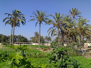
Awjila is an oasis town in the Al Wahat District in the Cyrenaica region of northeastern Libya. Since classical times it has been known as a place where high quality dates are farmed. From the Arab conquest in the 7th century, Islam has played an important role in the community. The oasis is located on the east-west caravan route between Egypt and Tripoli, and on the north-south route between Benghazi and the Sahel between Lake Chad and Darfur, and in the past was an important trading center. It is the place after which the Awjila language, an Eastern Berber language, is named. The people cultivate small gardens using water from deep wells. Recently, the oil industry has become an increasingly important source of employment.

Ajdabiya was one of the districts of Libya. It lay in the northeastern part of the country. Its capital was Ajdabiya. As of 2007 it was subsumed within the enlarged Al Wahat District.

Kufra or Kofra, also spelled Cufra, is the largest district of Libya. Its capital is Al Jawf, one of the oases in Kufra basin. There is a very large oil refinery near the capital. In the late 15th century, Leo Africanus reported an oasis in the land of the Berdoa, visited by a caravan coming from Awjila. It is possible that this oasis was identical with either the Al Jawf or the Taiserbo oasis, and on early modern maps, the Al Kufra region was often labelled as Berdoa based on this report.

Jalo Oasis is an oasis in Cyrenaica, Libya, located west of the Great Sand Sea and about 250 km south-east of the Gulf of Sidra. Quite large, 19 kilometres (12 mi) long and up to 11 kilometres (7 mi) wide, it supports a number of settlements, the largest of which is the town of Jalu. Jalu was the administrative capital of the Jalu District from 1983 to 1988, at which time the area became part of the Ajdabiya District and as of 2007 is now part of the Al Wahat District.

Al Wahat, occasionally spelt Al Wahad or Al Wahah is one of the districts of Libya. Its capital and largest city is Ajdabiya. The district is home to much of Libya's petroleum extraction economic activity.

Al Hiri is a town in the Al Wahat District in the Cyrenaica region of northeastern Libya. From 2001 to 2007 it was part of Ajdabiya District. Formerly (1983-1987) it was part of the Jalu District (baladiyah).
Labba is a desert town in the Al Wahat District in the Cyrenaica region of northeastern Libya.
Jalu, Jaloo, or Gialo is a town in the Al Wahat District in northeastern Libya in the Jalo oasis. From 2001 to 2007 it was part of Ajdabiya District. Formerly (1983-1987) it was the administrative seat of Jalu District (baladiyah).

The Libyan Coastal Highway, formerly the Litoranea Balbo, is a highway that is the only major road that runs along the entire east-west length of the Libyan Mediterranean coastline. It is a section in the Cairo–Dakar Highway #1 in the Trans-African Highway system of the African Union, Arab Maghreb Union and others.
Jalu Municipality was one of the municipalities (baladiyah) of Libya from 1983 to 1987. It lay in the northeastern part of the country. Its capital was Jalu. From 2001 to 2007 the area was part of Ajdabiya District. As of 2007 it was subsumed within the enlarged Al Wahat District.
Tobruk–Ajdabiya Road is an asphalt road linking Tobruk and Ajdabiya, in the Cyrenaica region of northeastern Libya. It is used primarily by travelers between Tripoli and Toburk, or to Egypt.
Mizda–Brak Road is an asphalt road in west-central Libya running south from Mizda near the coast to Brak through Shuwairif.
The Zuwayya are an independent Murabtin tribe, one of the major Arab Bedouin tribes of Cyrenaica and Fezzan, Libya.
Rebiana, in Tedaga called Muzui or Mouzi which is the original name of this place, is an oasis in the Libyan Desert in the Kufra District of Libya, about 120 km west of El Tag.
The Battle of Brega–Ajdabiya road was a battle during the Libyan Civil War between forces loyal to Libyan leader Muammar Gaddafi and anti-Gaddafi forces for control of the towns of Brega and Ajdabiya respectively and the Libyan Coastal Highway between them.
The Cyrenaican desert campaign was a military campaign conducted by the Libyan military in the form of hit-and-run attacks against rebel-held towns and oil facilities in the eastern Libyan Desert that began in April 2011, during the Libyan Civil War. The campaign failed in denying anti-Gaddafi forces control of southern Cyrenaica.

The Atiq Mosque is a mosque in the oasis village of Awjila, in the Sahara desert of the Cyrenaica region of eastern Libya. The community dates back to classical times. Since being taken by the Arabs in the seventh century, Islam has always played a central role in the life of Awjila. The 12th-century mosque, the oldest in the region, has unusual conical domes made of mudbrick and limestone that provide light and ventilation.

