Aksu City

Last updated

Aksu
阿克苏市 (Chinese)
ئاقسۇ شەھىرى (Uyghur)
A Ke Su Bu Xing Jie .jpg
Aksu pedestrian street
Location of Aksu within Xinjiang (China).png
Location of Aksu City (pink) in Aksu Prefecture and Xinjiang
China Xinjiang rel location map.svg
Red pog.svg
Aksu
Location of the city centre in Xinjiang
China edcp relief location map.jpg
Red pog.svg
Aksu
Location of Aksu in China
Coordinates(Aksu City government): 41°11′06″N80°17′25″E / 41.1850°N 80.2904°E / 41.1850; 80.2904
CountryChina
Autonomous region Xinjiang
Prefecture Aksu
Municipal seat Lengger Subdistrict
Township-level divisions 7 subdistricts, 2 towns, 4 townships, 5 other areas
Area
  Total14,668 km2 (5,663 sq mi)
Population
 (2020) [1]
  Total695,000
  Density47/km2 (120/sq mi)
Ethnic groups
  Major ethnic groups Uyghurs, Han Chinese
Time zone UTC+8 (China Standard [lower-alpha 1] )
Postal code
843000
Area code 0997
GDP (2020) [2] CNY¥25.125 billion
US $3.64 billion
GDP per capita CNY¥36,151
US $5,239
 - GrowthIncrease2.svg 5.8%
Website akss.gov.cn (in Chinese)
  1. Locals in Xinjiang frequently observe UTC+6 (Xinjiang Time), 2 hours behind Beijing.
  2. From map: "THE DELINEATION OF INTERNATIONAL BOUNDARIES ON THIS MAP MUST NOT BE CONSIDERED AUTHORITATIVE"
  3. From map: "The representation of international boundaries is not necessarily authoritative."

Related Research Articles

<span class="mw-page-title-main">Hotan</span> County-level city in Xinjiang, China

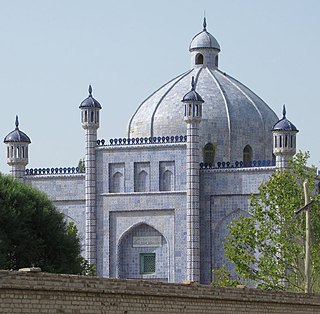
Hotan is a major oasis town in southwestern Xinjiang, an autonomous region in Northwestern China. The city proper of Hotan broke off from the larger Hotan County to become an administrative area in its own right in August 1984. It is the seat of Hotan Prefecture.

<span class="mw-page-title-main">Yarkant County</span> County in Xinjiang, China

Yarkant County, also Shache County, also transliterated from Uyghur as Yakan County, is a county in the Xinjiang Uyghur Autonomous Region, China, located on the southern rim of the Taklamakan Desert in the Tarim Basin. It is one of 11 counties administered under Kashgar Prefecture. The county, usually referred to as Yarkand in English, was the seat of an ancient Buddhist kingdom on the southern branch of the Silk Road and the Yarkand Khanate. The county sits at an altitude of 1,189 metres (3,901 ft) and as of 2003 had a population of 373,492.

<span class="mw-page-title-main">Taxkorgan Tajik Autonomous County</span> Autonomous county in western Xinjiang, China

Taxkorgan Tajik Autonomous County is an autonomous county of Kashgar Prefecture, in western Xinjiang, China. The county seat is Tashkurgan. The county is the only Tajik autonomous county in China.

<span class="mw-page-title-main">Aral, Xinjiang</span> County-level & Sub-prefectural city in Xinjiang, China

Aral is a sub-prefecture-level city surrounded by Aksu Prefecture in Xinjiang Uyghur Autonomous Region, China. Aral means "island" in Uyghur. The city's name is often written as Alar.

<span class="mw-page-title-main">Aksu Prefecture</span> Prefecture in Xinjiang, China

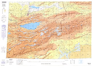
Aksu Prefecture is located in mid-Western Xinjiang, China. It has an area of 131,161 km2 (50,642 sq mi) and 2.714 million inhabitants at the 2020 census whom 715,319 lived in the built-up area made up of Aksu urban district. The name Aksu is Turkic for 'white water'. Aksu Prefecture has a 263.8 km (163.9 mi) long international boundary with Kyrgyzstan and Kazakhstan.

<span class="mw-page-title-main">Artux</span> County-level city in Xinjiang, China

Artux, Artush or Atush is a county-level city and the capital of Kizilsu Kyrgyz Autonomous Prefecture in Xinjiang, China. The government seat is in Guangming Road Subdistrict. As of 2018, it has a population of 285,507 people, 81.4 per cent of whom are Uyghurs.

<span class="mw-page-title-main">Uqturpan County</span> County in Xinjiang, China

Uqturpan County or Uchturpan County, also Wushi County, is a county in the Xinjiang Uyghur Autonomous Region under the administration of Aksu Prefecture and shares an approximately 150 km (93 mi) long border with Kyrgyzstan's Issyk-Kul Region. The county is bordered to the northeast by Onsu County (Wensu), to the southeast by Aksu city, to the west by Akqi County in Kizilsu Kyrgyz Autonomous Prefecture and to the south by Kalpin County (Keping). It has an area of 9,012 square kilometres (3,480 sq mi) and as of the 2002 census a population of 180,000.

<span class="mw-page-title-main">Xinhe County, Xinjiang</span> County in Xinjiang, China

Xinhe County as the official romanized name, also formerly known as its Uyghur name Toksu County, is a county in Aksu Prefecture, Xinjiang Uyghur Autonomous Region, China.

<span class="mw-page-title-main">Kuqa, Xinjiang</span> County-level city in Xinjiang, China

Kuqa is a county-level city in Aksu Prefecture, Xinjiang Uyghur Autonomous Region, China. Other names and variants of spelling of Kuqa are Kocha, Kuchu, Kuchar, Kuchi, Kuchel, K'u-ch'e-chen, K'u-ch'e-hsien, Kuga, Kucha and K'u-ch'e. It was once the homeland of the ancient Buddhist Kingdom of Kucha.

<span class="mw-page-title-main">Awat County</span> County in Xinjiang, China

Awat County is a county in Aksu Prefecture, Xinjiang Uyghur Autonomous Region, China. Awat County is located on the southern foot of the Tian Shan mountain range and on the northern edge of the Taklamakan Desert.

<span class="mw-page-title-main">Onsu County</span> County in Xinjiang, China

Onsu County and from Mandarin Chinese Wensu County, is a county in the Xinjiang Uyghur Autonomous Region and is under the administration of the Aksu Prefecture, bordering Kyrgyzstan's Issyk-Kul Region to the northwest. It contains an area of 14,309 km2 (5,525 sq mi).

<span class="mw-page-title-main">Shufu County</span> County in Xinjiang, China

Shufu County, also transliterated from Uyghur as Konaxahar County or Konasheher County/Kona Sheher County, is a county in Kashgar Prefecture, Xinjiang Uyghur Autonomous Region, China. It contains an area of 3,513 km2 (1,356 sq mi). According to the 2002 census, it has a population of 360,000.

<span class="mw-page-title-main">Akto County</span> County in Xinjiang, China

Akto County is a county in Kizilsu Kyrgyz Autonomous Prefecture, Xinjiang Uygur Autonomous Region, China. The county borders Tajikistan and Kyrgyzstan and has two towns, 11 townships, four state-owned farms and a plant nursery under its jurisdiction with the county seat being Akto Town. The county contains an area of 24,555 km2 (9,481 sq mi) and has a population of 221,526 as of 2015, of 231,756 as of 2017.

<span class="mw-page-title-main">Qiemo County</span> County in Xinjiang, China

Qiemo County as the official romanized name, also transliterated from Uyghur as Qarqan County, is a county under the administration of the Bayin'gholin Mongol Autonomous Prefecture in the Xinjiang Uyghur Autonomous Region of the People's Republic of China, bordering the Tibet Autonomous Region to the south. Its area is 138,645 square kilometers (53,531 sq mi) and, according to the 2002 census, it has a population of 60,000. The county seat is at Qiemo Town.

<span class="mw-page-title-main">Karakax County</span> County in Xinjiang, China

Karakax County, alternatively Moyu County, also transliterated from Uyghur as Qaraqash County, alternately Qaraqash, is a county in the Xinjiang Uyghur Autonomous Region and is located in the southern edge of the Tarim Basin, it is under the administration of the Hotan Prefecture. It contains an area of 25,667 km2 (9,910 sq mi). According to the 2011 census it has a population of 577,000 and 98,1% are Uyghurs. The county is bordered to the north by Awat County in Aksu Prefecture, to the northeast by Lop County, to the southeast by Hotan County, to the northwest by Maralbexi County in Kashgar Prefecture, and to the southwest by Pishan County and Kunyu. Exclaves of Kunyu are located within the county.

<span class="mw-page-title-main">Yutian County, Xinjiang</span> County in Xinjiang, China

Yutian County, also transliterated from Uyghur as Keriya County, is a county in Hotan Prefecture, Xinjiang Uyghur Autonomous Region, China. It is based at the Keriya Town, and is separate from Hotan County, which is another county in the same prefecture. The Yutian County has an area of 39,023 km2 (15,067 sq mi). According to the 2002 census, it has a population of 220,000. The county is bounded on the north by Aksu Prefecture, on the east by Minfeng/Niya County, on the west by Qira County and on the south by the Rutog and Gertse counties of the Tibet Autonomous Region.

<span class="mw-page-title-main">Lop County</span> County in Xinjiang, China

Lop County, also Luopu, is a county in Hotan Prefecture, in the southwest of the Xinjiang Uyghur Autonomous Region, China. Almost all the residents of the county are Uyghur and live around oases situated between the desolate Taklamakan Desert and Kunlun Mountains. The county is bordered to the north by Aksu and Awat County in Aksu Prefecture, to the east by Qira/Chira County, to the northwest by Karakax County, to the west by Hotan (Khotan) and to the south and west by Hotan County.

<span class="mw-page-title-main">Kashgar</span> County-level city in Xinjiang, China

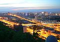
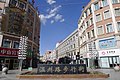
Kashgar or Kashi is a city in the Tarim Basin region of southern Xinjiang, China. It is one of the westernmost cities of China, located near the country's border with Kyrgyzstan and Tajikistan. For over 2,000 years, Kashgar was a strategically important oasis on the Silk Road between China, the Middle East, and Europe. It is one of the oldest continuously inhabited cities in the world and has a population of 711,300 people. Kashgar's urban area covers 15 km2 (5.8 sq mi), although its administrative area extends over 555 km2 (214 sq mi).

Jiya is a township in the northeastern part of Hotan City in Hotan Prefecture, Xinjiang, China in an oasis area on the eastern bank of the White Jade River in the southwestern part of the Taklamakan Desert. To the north and east, Jiya borders Lop County, the county which Jiya was a part of until 2006, and to the south and west, Jiya borders the rest of Hotan city.

References

  1. "阿克苏市概况" (in Chinese). 29 January 2021. Archived from the original on 20 May 2020. Retrieved 12 March 2021.
  2. "阿克苏市2020年1-12月经济运行综合分析报告" (in Chinese). 29 January 2021. Retrieved 12 March 2021.
  3. "Aksu Private Jet Charter Cost and Permit Lead Time | FlyLibrajet.com" . Retrieved 25 November 2021.
  4. 1 2 3 4 夏征农; 陈至立, eds. (September 2009). 辞海:第六版彩图本[ Cihai (Sixth Edition in Color)] (in Chinese). 上海. Shanghai: Shanghai Lexicographical Publishing House. Shanghai Lexicographical Publishing House. p. 8. ISBN   9787532628599.
  5. 1 2 阿克苏市概况. ئاقسۇ阿克苏市人民政府 (in Simplified Chinese). Retrieved 18 May 2020. 阿克苏市,维吾尔语意为"白水城",{...}市辖4乡2镇、5个街道和8个片区管委会,
  6. Hill (2009), p. 408, n. 20.13. "In Buddhist Sanskrit, it was known as Bharuka."
  7. Bailey, H. W. (1985): Indo-Scythian Studies being Khotanese Texts Volume VII. Cambridge University Press. 1985.
  8. Hulsewé, A. F. P. and Loewe, M. A. N. 1979. China in Central Asia: The Early Stage 125 BC AD 23: an annotated translation of chapters 61 and 96 of the History of the Former Han Dynasty, p. 162. E. J. Brill, Leiden.
  9. "阿克苏地区 - 新疆哲学社会科学". Archived from the original on 3 March 2016. Retrieved 31 August 2013.
  10. Bernard Samuel Myers (1959). Encyclopedia of World Art . McGraw-Hill. p.  445. The city bearing the Turkish name of Aksu was perhaps earlier called Bharuka and may overlie the ancient site, of which nothing has yet been found.
  11. John E. Hill (July 2003). "Section 20 – The Kingdom of Suoche 莎車 (Yarkand).". Notes to The Western Regions according to the Hou Hanshu (2nd ed.). Washington University. Retrieved 3 February 2020. Neolithic artefacts from 5000 BC have been discovered in the Aksu area. By the first century BC news had reached the Chinese imperial court of the Kingdom of Baluka, one of the 36 kingdoms of the Western Regions.
  12. Xuanzang. "跋禄迦國"  [Kingdom of Baluka]. Great Tang Records on the Western Regions (in Chinese). Vol. 1 via Wikisource.
  13. Li, Rongxi. Translator. 1996. The Great Tang Dynasty Record of the Western Regions. Numata Center for Buddhist Translation and Research. Berkeley, California.
  14. Insight Guides (1 April 2017). Insight Guides Silk Road. APA. ISBN   978-1-78671-699-6.
  15. René Grousset (1970). The Empire of the Steppes: A History of Central Asia . Rutgers University Press. pp.  114–. ISBN   978-0-8135-1304-1. aksu 717.
  16. Jonathan Karam Skaff (6 August 2012). Sui-Tang China and Its Turko-Mongol Neighbors: Culture, Power, and Connections, 580-800. Oxford University Press. pp. 311–. ISBN   978-0-19-999627-8.
  17. Christopher I. Beckwith (28 March 1993). The Tibetan Empire in Central Asia: A History of the Struggle for Great Power Among Tibetans, Turks, Arabs, and Chinese During the Early Middle Ages. Princeton University Press. pp. 88–89. ISBN   0-691-02469-3.
  18. Marvin C. Whiting (2002). Imperial Chinese Military History: 8000 BC-1912 AD. iUniverse. pp. 277–. ISBN   978-0-595-22134-9.
  19. Wright, George Frederick (2009), Asiatic Russia, Volume 1, BiblioBazaar, LLC, pp. 47–48, ISBN   978-1-110-26901-3 (Reprint of a 19th-century edition)
  20. 烏什庫車阿克蘇等處回人
  21. 1 2 3 Jeong, Su-il (2016). The Silk Road Encyclopedia. Seoul Selection. p. 40. ISBN   9781624120763.
  22. Great Britain. Parliament. House of Commons (1871). Accounts and papers of the House of Commons. Ordered to be printed. p. 34. Retrieved 28 December 2010.
  23. Kim, Ho-dong (2004). Holy war in China: the Muslim rebellion and state in Chinese Central Asia, 1864–1877. Stanford University Press. p. xvi. ISBN   0-8047-4884-5.
  24. Younghusband, Francis E. (1896). The Heart of a Continent. London: John Murray. p. 154.
  25. Andrew D. W. Forbes (1986). Warlords and Muslims in Chinese Central Asia: a political history of Republican Sinkiang 1911–1949. Cambridge, England: CUP Archive. p. 89. ISBN   0-521-25514-7 . Retrieved 28 June 2010.
  26. Andrew D. W. Forbes (1986). Warlords and Muslims in Chinese Central Asia: a political history of Republican Sinkiang 1911–1949. Cambridge, England: CUP Archive. p. 241. ISBN   0-521-25514-7 . Retrieved 28 June 2010.
  27. 1 2 3 4 5 阿克苏市历史沿革 [Aksu City Historical Development] (in Simplified Chinese). XZQH.org. 30 January 2015. Retrieved 18 May 2019.
  28. 阿克苏市概况. ئاقسۇ阿克苏市人民政府 (in Simplified Chinese). Retrieved 20 May 2020. 阿克苏市位于东经79°43′26″~82°00′38″,北纬39°28′57″~41°30′10″,
  29. 政府概况. 洛浦县政府网 Luopu County Government Network (in Simplified Chinese). Retrieved 18 December 2019. 地处东经79°59′-81°83′,北纬36°30′-39°29′东邻策勒县,{...}北伸延入塔克拉玛干大沙漠与阿克苏市、阿瓦提县为邻,
  30. 中国气象数据网 – WeatherBk Data (in Simplified Chinese). China Meteorological Administration . Retrieved 10 October 2023.
  31. 中国气象数据网 (in Simplified Chinese). China Meteorological Administration . Retrieved 10 October 2023.
  32. 阿克苏 - 气象数据 -中国天气网 (in Chinese). Weather China. Retrieved 29 November 2022.
  33. 2019年统计用区划代码和城乡划分代码:阿克苏市 [2019 Statistical Area Numbers and Rural-Urban Area Numbers: Aksu City] (in Simplified Chinese). National Bureau of Statistics of the People's Republic of China. 2019. Retrieved 18 May 2019. 统计用区划代码 名称 652901001000 栏杆街道 652901002000 英巴扎街道 652901003000 红桥街道 652901004000 新城街道 652901005000 南城街道 652901006000 柯柯牙街道 652901007000 多浪街道 652901100000 喀勒塔勒镇 652901101000 阿依库勒镇 652901200000 依干其乡 652901201000 拜什吐格曼乡 652901202000 托普鲁克乡 652901203000 库木巴希乡 652901401000 红旗坡农场 652901404000 实验林场 652901407000 纺织工业城 652901408000 经济技术开发区 652901409000 特色产业园区
  34. "Meshrep". UNESCO . Retrieved 20 May 2020. Folk Art Group of Culture Center of Kara Tal Town in Aksu City
  35. قۇربانجان قېيۇم, ed. (25 March 2019). ئاقسۇ ۋىلايەتلىك پارتكوم ئىشخانىسىنىڭ كادىرلىرى ئۆيمۇ ئۆي كىرىپ پارتىيەنىڭ خەلققە نەپ يەتكۈزۈش سىياسەتلىرىنى تەشۋىق قىلدى. Tianshannet (in Uyghur). Retrieved 19 May 2020. ئاقسۇ شەھىرى قاراتال بازىرى
  36. Office, Government Publishing (October 2011). "Congressional-Executive Commission on China". p.  165 via Google Books. Aykol township, Aksu city, Aksu prefecture
  37. huaxia, ed. (17 September 2020). "Full Text: Employment and Labor Rights in Xinjiang". Xinhua News Agency . Retrieved 20 September 2020. A poor villager named Habibulla Mamut from Aykol Town of Aksu City
  38. "China: List of Political Prisoners Detained or Imprisoned as of October 10, 2012" (PDF). Congressional-Executive Commission on China . 10 October 2012. p. 77. Retrieved 21 May 2020. Yiganchi (Igerchi)
  39. دۇ ۋەنگۈي ئاقسۇ شەھىرىدە تەكشۈرۈپ تەتقىق قىلغاندا، مۇنداق تەكىتلىدى: دىققەتنى باش نىشانغا مەركەزلەشتۈرۈپ، تۈرلۈك خىزمەتلەرنى چوڭقۇر، ئىنچىكە، ئەمەلىي ئىشلەش كېرەك. 5 July 2019. Retrieved 19 May 2020. ئاقسۇ شەھىرىنىڭ ئېگەرچى يېزىسى
  40. Xie Yuzhong 解玉忠 (2003). 地名中的新疆 (in Simplified Chinese). Ürümqi: 新疆人民出版社. pp. 161–163. ISBN   7-228-08004-1. 依干其 Igarchi {...}
    拜什吐格曼 Bextügman {...}
    托普鲁克 Topluk {...
    }
  41. 古丽米娜, ed. (7 November 2018). ئاقسۇ شەھىرىدە خىزمەت ئەترىتىدىكىلەر كەنت ئاھالىسىگە ياردەملىشىپ ئۈندىداردا غاز سېتىشىپ بەردى. ﺷﯩﻨﺠﺎﯓ ﻛﯘﺋﯧﻨﻠﯘﻥ ﺗﻮﺭﻯ & Tianshannet (in Uyghur). Retrieved 19 May 2020. ئاقسۇ شەھىرى بەشتۈگمەن يېزىسى
  42. Shohret Hoshur; Joshua Lipes (23 August 2010). "More Arrests in Aksu Blast". Radio Free Asia . Translated by Shohret Tursun, Luisetta Mudie. Retrieved 20 May 2020. According to a staff member from the Topluq police station, officers have been searching all area hospitals, walk-in clinics, and public spaces in the vicinity of the village.
  43. ئامانگۈل ئابدۇراخمان, ed. (19 March 2020). ئېتىز – ئېرىق باشلىرىدا ئالدىراشچىلىق باشلاندى. Xinjiang Daily (in Uyghur). Retrieved 19 May 2020. ئاقسۇ شەھىرىنىڭ توپلۇق يېزىسى
  44. ئالىم راخمان, ed. (21 March 2016). خىزمەت گۇرۇپپىسى دېھقانلارغا بازار ئېچىپ بەردى. People's Daily (in Uyghur). Retrieved 19 May 2020. ئاقسۇ شەھىرى قۇمباش يېزىسى
  45. Stanley W. Toops (15 March 2004). "The Demography of Xinjiang". In S. Frederick Starr (ed.). Xinjiang: China's Muslim Borderland. Routledge. p. 254. ISBN   978-0765613189.
  46. Stanley W. Toops (15 March 2004). "The Demography of Xinjiang". In S. Frederick Starr (ed.). Xinjiang: China's Muslim Borderland. Routledge. pp. 256–257. ISBN   978-0765613189.
  47. 3-7 各地、州、市、县(市)分民族人口数 (in Simplified Chinese). شىنجاڭ ئۇيغۇر ئاپتونوم رايونى新疆维吾尔自治区统计局 Statistic Bureau of Xinjiang Uygur Autonomous Region. 15 March 2017. Archived from the original on 11 October 2017. Retrieved 3 September 2017.
  48. "Largest Cities in China 2016". Country Digest.
  49. "ĀKÈSŪ SHÌ (County-level City)". City Population.
  50. Morris Rossabi, ed. (2004). Governing China's Multiethnic Frontiers (PDF). University of Washington Press. p. 179. ISBN   0-295-98390-6.

Further reading

Aksu City
Uyghur name
Uyghur ئاقسۇ