Alto Hospicio

Last updated
Alto Hospicio
Desde el aire, Alto Hospicio. Iquique. I region..jpg
Panoramic view of Alto Hospicio
Bandera de Alto Hospicio.svg
Escudo de Alto Hospicio.svg
Comuna de Alto Hospicio.svg
Chile location map.svg
Red pog.svg
Alto Hospicio
Location in Chile
Coordinates: 20°15′S70°07′W / 20.250°S 70.117°W / -20.250; -70.117
Country Flag of Chile.svg  Chile
Region Flag of Tarapaca, Chile.svg  Tarapacá
Province Iquique Province
Government
[1]
  Type Municipal council
   Alcalde Patricio Ferreira (PDC)
Area
[2]
  Total593.2 km2 (229.0 sq mi)
Elevation
600 m (2,000 ft)
Population
 (2012 Census)
  Total94,441
  Density160/km2 (410/sq mi)
Demonym Hospiciano
Time zone UTC−4 (CLT)
  Summer (DST) UTC−3 (CLST)
Postal code
1130000
Area code (+56) 5
Website Official website (in Spanish)

Alto Hospicio is a Chilean municipality and commune located next to Iquique, in the Iquique Province, I Region. It is a fast-growing popular area in the heights of Iquique and has a population of 94,254 according to the preliminary result of the 2012 census. It is the second largest commune of the Greater Iquique urbanization with a total population of 275,000 in 2012.

Contents

History

The first inhabitants of Alto Hospicio were the Chango indigenous group, that arrived from the coast. They climbed 550 meters from the cove of Ique Ique during the so-called Festival of the Mule (Bajo Molle), and stopped to rest on the pampa. During Inca times of Tupac Inca Yupanqui (1380 - 1410 CE), Spanish began to exploit the silver deposits of Huantajaya located about three miles northeast of Alto Hospicio Central Prison. Exploitation of silver continued until the end of the eighteenth century when Basilio de la Fuente, a prominent resident of the town of San Lorenzo of Tarapacá, made a fortune with the mineral and funded major irrigation works. After the War of the Pacific, Alto Hospicio was little more than a desolate train station (specifically the area of High Molle), where no more than 100 people lived. By the 1950s, groups of Aymara farmers settled in the area, bringing agricultural products from the inland altiplano. They constructed modest plots for small-scale horticulture and agriculture (both crops and livestock). The economic boom experienced by Iquique in the mid-1990s brought about a population explosion in Alto Hospicio. It was transformed from a small town of about 2,000 inhabitants in the early nineties to a huge city with over 100,000 inhabitants. Alto Hospicio is 10 km away and 600 m above Lower Iquique. In August 2007 the Alto Hospicio Basic Emergency Hospital opened in La Pampa area of the city. Though originally part of Iquique, Alto Hospicio was incorporated as its own municipality on 12 April 2004, when Law No. 19943 was approved under President Ricardo Lagos Escobar.

Demographics

Preliminary results of the 2012 census indicate a population of 94,254 inhabitants of Alto Hospicio. According to the 2002 census of the National Statistics Institute, Alto Hospicio had 50,215 inhabitants. Of these, the vasy majority lived in urban areas outside Iquique, and only a tiny minority in rural areas due to its desert like surrounding. The population grew by nearly 900% (44,627 persons) between the 1992 and 2002 censuses [2] and similar (90.7%) between 2002 and 2012 by about 44,000 inhabitants.

The commune of Alto Hospicio is composed of 4 census districts.

Census district2002 Census1992 Census
#DistrictArea (km2)TotalUrbanRuralTotalUrbanRural
1Autódromo435.01,8441,84315055014
2Alto Hospicio4.131,68731,68708,9158,9150
3Santa Rosa118.67,3527,328242,5642,55311
4Pampa del Molle35.59,3329,33203,0683,0680
Total593.250,21550,1902515,05215,03715

Source: INE 2007 report, "Territorial division of Chile" [2]

Climate

The climate of the area is coastal desert, similar to La Pampa, which is influenced by the dry climate and the Humboldt Current. It is characterized by abundant cloudiness, and low oscillation amplitude from autumn throughout the winter to the early part of spring. But this changes in summer when temperatures double and the oscillation increases, and temperature can vary considerably throughout the day. In the morning it may be sunny, but be very cloudy or rainy in the afternoon. The community receives some rainfall in summer, especially between January and February due to high air pressure fronts commonly called "Bolivia," negatively referring to cold Bolivian or Altiplano winters. Alto Hospicio also receives some rainfall in winter but not every year. Chile's climate is changing due to global warming. Alto Hospicio is a place where temperatures are not incredibly high, but sun rays can be very damaging. Average high in summer is 24 °C (75.2 °F) and 9.4 °C (48.92 °F) to 15 °C (59 °F) in winter.

Climate data for Alto Hospicio
MonthJanFebMarAprMayJunJulAugSepOctNovDecYear
Record high °C (°F)34.4
(93.9)
30.2
(86.4)
26
(79)
27.2
(81.0)
28.4
(83.1)
25
(77)
22.9
(73.2)
21.7
(71.1)
25
(77)
28
(82)
29.9
(85.8)
31.2
(88.2)
34.4
(93.9)
Average high °C (°F)21.3
(70.3)
23.1
(73.6)
20.7
(69.3)
19.6
(67.3)
16
(61)
15.2
(59.4)
12.3
(54.1)
14.4
(57.9)
15.7
(60.3)
16.2
(61.2)
17.5
(63.5)
20.3
(68.5)
17.6
(63.7)
Average low °C (°F)18.6
(65.5)
15.3
(59.5)
13.8
(56.8)
13
(55)
12
(54)
10.6
(51.1)
8.7
(47.7)
7.4
(45.3)
12.1
(53.8)
14
(57)
15.7
(60.3)
16
(61)
13.1
(55.6)
Record low °C (°F)11
(52)
14
(57)
12
(54)
8
(46)
3
(37)
0
(32)
−1
(30)
3
(37)
6
(43)
3
(37)
7
(45)
9
(48)
−1
(30)
Average precipitation mm (inches)0.6
(0.02)
0.6
(0.02)
0
(0)
0.2
(0.01)
0.2
(0.01)
0.1
(0.00)
2.6
(0.10)
1.3
(0.05)
0.3
(0.01)
0
(0)
0
(0)
0.1
(0.00)
6
(0.2)
Source: Weather Underground [3]

Administration

As a commune, Alto Hospicio is a third-level administrative division of Chile administered by a municipal council, headed by an alcalde who is directly elected every four years. The 2008-2012 alcalde is Ramón Galleguillos Castillo. [1]

Within the electoral divisions of Chile, Alto Hospicio is represented in the Chamber of Deputies by Marta Isasi (Ind.) and Hugo Gutiérrez (PC) as part of the 2nd electoral district, which includes the entire Tarapacá Region. The commune is represented in the Senate by José Miguel Insulza (PS, 2018–2026) and José Durana (UDI, 2018–2026) as part of the 1st senatorial constituency (Arica and Parinacota Region and Tarapacá Region).

Related Research Articles

<span class="mw-page-title-main">Iquique Province</span> Province in Tarapacá, Chile

Iquique Province is one of two provinces in the northern Chilean region of Tarapacá. Its capital is the port city of Iquique.

<span class="mw-page-title-main">Los Ángeles, Chile</span> City and Commune in Bío Bío, Chile

Los Ángeles is the capital of the province of Bío Bío, in the commune of the same name, in Bío Bío, in the center-south of Chile. It is located between the Laja and Biobío rivers. The population is 186,671 inhabitants. The municipality ("comuna") of Los Ángeles has the highest absolute rural population of any Chilean municipality.

<span class="mw-page-title-main">Arica</span> City in Arica y Parinacota, Chile

Arica is a commune and a port city with a population of 222,619 in the Arica Province of northern Chile's Arica y Parinacota Region. It is Chile's northernmost city, being located only 18 km (11 mi) south of the border with Peru. The city is the capital of both the Arica Province and the Arica and Parinacota Region. Arica is located at the bend of South America's western coast known as the Arica Bend or Arica Elbow. At the location of the city are two valleys that dissect the Atacama Desert converge: Azapa and Lluta. These valleys provide citrus and olives for export.

<span class="mw-page-title-main">Calama, Chile</span> City and Commune in Antofagasta, Chile

Calama is a city and commune in the Atacama Desert in northern Chile. It is the capital of El Loa Province, part of the Antofagasta Region. Calama is one of the driest cities in the world with average annual precipitation of just 5 mm (0.20 in). The River Loa, Chile's longest, flows through the city. Calama has a population of 147,886.

<span class="mw-page-title-main">Iquique</span> City and Commune in Tarapacá, Chile

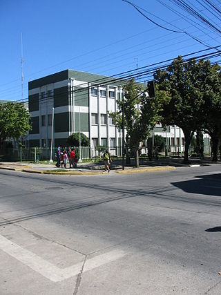
Iquique is a port city and commune in northern Chile, capital of both the Iquique Province and Tarapacá Region. It lies on the Pacific coast, west of the Pampa del Tamarugal, which is part of the Atacama Desert. It has a population of 191,468 according to the 2017 census. It is also the main commune of Greater Iquique. The city developed during the heyday of the saltpetre mining in the Atacama Desert in the 19th century. Once a Peruvian city with a large Chilean population, it was conquered by Chile in the War of the Pacific (1879–1883). Today it is one of only two free ports of Chile, the other one being Punta Arenas, in the country's far south.

<span class="mw-page-title-main">Tarapacá Region</span> Region of Chile

The Tarapacá Region is one of Chile's 16 first-order administrative divisions. It comprises two provinces, Iquique and Tamarugal. It borders the Chilean Arica y Parinacota Region to the north, Bolivia's Oruro Department and Potosí Department on the east, Chile's Antofagasta Region to the south and the Pacific Ocean to the west. The port city of Iquique is the region's capital.

Huara is a Chilean town and commune in Tamarugal Province, Tarapacá Region. It is located 45 km (28 mi) or northeast of Iquique. The village is crossed by the Pan-American Highway and is the crossing point for the road that goes to Oruro in Bolivia. This road also serves as access to the Atacama Giant site and the Volcán Isluga National Park.

<span class="mw-page-title-main">Combarbalá</span> City and commune in Coquimbo, Chile

Combarbalá is the capital city of the commune of Combarbala. It is located in the Limarí Province, Region of Coquimbo, at an elevation of 900 m (2,952 ft). It is known for the tourist astronomic observatory Cruz del Sur; the petroglyphs of Rincon las Chilcas; its typical handcraft made of the unique combarbalita stone; the classical basketball match at the end February; the Virgen de la Piedra catholic-pagan festivity, among other tourist attractions.

<span class="mw-page-title-main">Pica, Chile</span> Chilean oasis and town in Atacama Desert

Pica is a Chilean town and commune in Tamarugal Province, Tarapacá Region. Situated in the inland of the Atacama Desert on an oasis, Pica is famous for its small and unusually acidic limes known as Limón de Pica. The town has a communal hot spring with a surface temperature of 40 °C, which makes it a popular bath place in the middle of the desert. It has hotels and all basic services. The town lies four kilometers to the northeast of the oasis village of Matilla.

<span class="mw-page-title-main">Pozo Almonte</span> City and Commune in Tarapacá, Chile

Pozo Almonte is a city and commune of Chile located in the interior of Atacama Desert. It has been the capital of Tamarugal Province since this province was established in 2007. The city is located at 52 km (32 mi) from Tacapacá Region's capital, Iquique. It has over 15,000 inhabitants. The commune has an area of 13,766 km (8,554 mi) and borders the following communes: Iquique, Alto Hospicio, Huara, Pica, María Elena and Tocopilla.

<span class="mw-page-title-main">Colchane</span> Commune in Tarapacá, Chile

Colchane is a Chilean village and commune in Tamarugal Province, Tarapacá Region.

<span class="mw-page-title-main">Ollagüe, Chile</span> Commune in Antofagasta, Chile

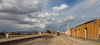
Ollagüe is a Chilean frontier village and commune in El Loa Province, Antofagasta Region. The village is 215 kilometres (134 mi) northeast of the city of Calama, and has a station and marshalling yard on the FCAB rail line.

<span class="mw-page-title-main">Camarones, Chile</span> City and Commune in Arica y Parinacota, Chile

Camarones is a city and commune in the Arica y Parinacota Region in Chile. It forms part of the administrative Arica Province and has a population of 1,220. Its municipality seat is in the town of Cuyo, located next to the Chile Highway 5. Cuyo is the administrative center of the commune and a place of rest for travellers. The main towns are Codpa and Caleta Camarones. The latter is a fishing inlet of only 44 inhabitants. Codpa is the largest town in the commune, located 114 kilometres (71 mi) from the city of Arica. It is an entirely rural commune with almost no tourist activity, and is well known for its uncharted areas. The only Afro-Chilean community in Chile is located in Camarones.

Sierra Gorda is a Chilean commune in Antofagasta Province, Antofagasta Region. The total population was 1,516 as of the 2012 census. The two main settlements are the villages of Sierra Gorda and Baquedano.

<span class="mw-page-title-main">Greater Iquique</span>

Greater Iquique is a Chilean conurbation that includes Iquique and Alto Hospicio communes in the Iquique Province in Tarapacá Region. It has a population of 299,843 in the 2017 census, becoming the second largest city in Norte Grande after Antofagasta. Its designation as a metropolitan area is recent.

Camiña is a Chilean commune and village in El Tamarugal Province, Tarapacá Region. According to the 2002 census, the commune population was 1,275 and has an area of 2,200.2 km2 (850 sq mi).

<span class="mw-page-title-main">Abra Pampa</span> Municipality and town in Jujuy Province, Argentina

Abra Pampa is a town and municipality in Jujuy Province in Argentina, and is the capital of the Department of Cochinoca. The city is the economic center and communication of the Puna, it is the second town in importance in the region, after La Quiaca which is 73 km to the north by the Ruta Nacional 9, paved road, which also connects with the provincial capital, 224 km away.

<span class="mw-page-title-main">Curacaví</span> City and Commune in Santiago Metropolitan Region, Chile

Curacaví is a city and commune in the Melipilla Province of central Chile's Santiago Metropolitan Region. Its climate is temperate Mediterranean with a long dry season, experiencing high temperatures in summer and low temperatures in winter. Curacaví is located on the Ruta 68 between the coastal conurbation of Viña del Mar and Valparaíso and Santiago which has proved a popular home for expats working in Santiago.

Julio Segundo Pérez Silva is a Chilean taxi driver and serial killer who raped and killed at least 14 women and girls between 1998 and 2001. Popularly known as "The Psychopath of Alto Hospicio", his crimes took place in the Tarapacá Region, specifically in the city of Iquique and in the town of Alto Hospicio, hence his nickname.

<span class="mw-page-title-main">Luz Ebensperger</span> Chilean lawyer and politician

Luz Eliana Ebensperger Orrego is a Chilean lawyer and politician of the Independent Democratic Union (UDI). Since 11 March 2018, she has served as a senator for Constituency 2, corresponding to Tarapacá Region. From 2010 to 2014, she was the region's intendant, during the first administration of President Sebastián Piñera.

References

  1. 1 2 "Municipality of Alto Hospicio" (in Spanish). Archived from the original on December 29, 2007. Retrieved 7 September 2010.
  2. 1 2 3 "Territorial division of Chile" (PDF). Archived from the original (PDF) on 14 November 2010. Retrieved 4 November 2010.
  3. "Promedios meteorólogicos en Alto Hospicio". MSN. 2010. Archived from the original on 2016-12-01. Retrieved 2011-12-31.