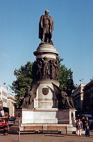
O'Connell Street is a street in the centre of Dublin, Ireland, running north from the River Liffey. It connects the O'Connell Bridge to the south with Parnell Street to the north and is roughly split into two sections bisected by Henry Street. The Luas tram system runs along the street.

Merrion Square is a Georgian garden square on the southside of Dublin city centre.

Drumcondra is a residential area and inner suburb on the Northside of Dublin, Ireland. It is administered by Dublin City Council. The River Tolka and the Royal Canal flow through the area.
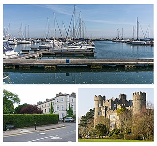
Malahide is an affluent coastal settlement in Fingal, County Dublin, Ireland, situated 14 kilometres (9 mi) north of Dublin city. It has a village centre surrounded by suburban housing estates, with a population of over 17,000.

Connolly station or Dublin Connolly is one of the busiest railway stations in Dublin and Ireland, and is a focal point in the Irish route network. On the North side of the River Liffey, it provides InterCity, Enterprise and commuter services to the north, north-west, south-east and south-west. The north–south Dublin Area Rapid Transit (DART) and Luas red line light rail services also pass through the station. The station offices are the headquarters of Irish Rail, Iarnród Éireann. Opened in 1844 as Dublin Station, the ornate facade has a distinctive Italianate tower at its centre.

Pearse railway station or Dublin Pearse is a railway station on Westland Row on the Southside of Dublin, Ireland. It is Ireland's busiest commuter station and second busiest station overall with 9 million passenger journeys through the station in 2016.

Cabra is an inner suburb on the northside of Dublin city in Ireland. It is approximately 2 kilometres (1.2 mi) northwest of the city centre, in the administrative area of Dublin City Council. It was commonly known as Cabragh until the early 20th century. Largely located between the Royal Canal and the Phoenix Park, it is primarily a residential suburb, with a range of institutions and some light industry. Cabra is served by bus, tram and mainline rail; it lies across Navan Road, one of the main roads from central Dublin to the orbital motorway.

Fairview is an inner coastal suburb of Dublin in Ireland, in the jurisdiction of Dublin City Council and in the city's D03 postal district. Part of the area forms Fairview Park, a recreational amenity laid out on land reclaimed from the sea.

Busáras is the central bus station in Dublin, Ireland for Intercity and regional bus services operated by Bus Éireann. Designed in the International Modern style, Busáras is also a stop on the Red Line of the Luas system, in Store Street just before the terminus at Dublin Connolly railway station. Áras Mhic Dhiarmada is the official name of the building, which also includes the headquarters of the Department of Social Protection. CIÉ, parent of Bus Éireann, leases the lower floors from the department. Áras Mhic Dhiarmada is named after Seán Mac Diarmada, a leader of the Easter Rising in 1916.

Broadstone is one of the three neighbourhoods that make up present-day Phibsboro in Dublin, Ireland. The most southerly of these, it begins just two kilometres north of Father Mathew Bridge at Ormond Quay. The area is triangular, bounded by Phibsborough Road and Constitution Hill to the West, North Circular Road to the north, and Dorset Street and Bolton Street to the south-east. The postal district for the area is Dublin 7.

Parnell Street is a street in Dublin, Ireland, which runs from Capel Street in the west to Gardiner Street and Mountjoy Square in the east. It is at the north end of O'Connell Street, where it forms the south side of Parnell Square.

Talbot Street is a city-centre street located on Dublin's Northside, near to Dublin Connolly railway station. It was laid out in the 1840s and a number of 19th-century buildings still survive. The Irish Life Mall is on the street.

North Strand Road is a street in the Northside of Dublin, Ireland. It links the city centre from Connolly Station to Fairview by road.
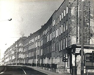
Summerhill is a primarily residential area of inner city Dublin, Ireland, on the Northside of the city. It is located about 500 m to 1,5 km to the east of the O'Connell Street area, roughly in the area bordered by Gardiner Street in the West, Mountjoy Square, Ballybough in the North, Northeast and East, and Talbot Street and Amiens Street in the South and South East. It also encompasses the historical "Five Lamps" landmark and is located in the East of the Dublin 1 postal district. It is one of the most densely populated and economically deprived areas of the city.

The House of Stratford is a British aristocratic family, originating in Stratford-on-Avon between the eleventh and thirteenth centuries. The family has produced multiple titles, including Earl of Aldborough, Viscount Amiens, Baron Baltinglass, Viscount Stratford de Redcliffe and the Dugdale Baronets. The Viscount Powerscourt and Baron Wrottesley both claim descent from this House. Historic seats have included Farmcote Manor and Stratford Park in Gloucester, Merevale Hall in Warwickshire, Baltinglass Castle, Belan and Aldborough House in Ireland, and Stratford House in London, amongst many others. The house was at its most powerful in the fourteenth, sixteenth, and eighteenth centuries.

Aldborough House is a landmark Georgian building in Dublin, Ireland. Built as a private residence by 1795, the original structure included a chapel and a theatre wing. The house was used for periods as a school, barracks and post office depot, before becoming vacant in the early 21st century. While vacant, the building was subject to vandalism and a fire, was listed by An Taisce - The National Trust for Ireland as in poor condition, and included in its 2021 list of 'Top 10 Most-at-Risk' buildings nationally.
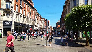
North Earl Street is a short stretch of city-centre street located on Dublin's Northside and formerly a major shopping area. It runs from Marlborough Street in the west to O'Connell Street beside the Spire.

Beresford Place is a street in Dublin, Ireland originally laid out as a crescent surrounding The Custom House in 1792.

Buckingham Street is a street in Dublin running from Summerhill to Amiens Street. It is divided into Buckingham Street Lower and Buckingham Street Upper.


