Anakiwa, New Zealand

Last updated

Anakiwa

Anakiwa, New Zealand.jpg

Anakiwa from the south-west, looking toward Outward Bound
NZ-Marlborough plain map.png
Disc Plain red.svg
Anakiwa
Coordinates: 41°15′52″S173°54′46″E / 41.26444°S 173.91278°E / -41.26444; 173.91278
Country New Zealand
Region Marlborough

Anakiwa is a coastal residential village in the Marlborough region of New Zealand. It sits at the head of Queen Charlotte Sound/Tōtaranui, one of the Marlborough Sounds. 2013 census data suggests a population of 177, [1] however a high proportion of dwellings are only seasonally occupied.

Marlborough Region Place in Marlborough, New Zealand

The Marlborough Region, commonly known simply as Marlborough, is one of the regions of New Zealand, located in the northeast of the South Island. Marlborough is a unitary authority, both a region and a district, and its council is located at Blenheim. It has a population of 46,600.

Queen Charlotte Sound (New Zealand) part of Marlborough Sounds, in New Zealands South Island

Queen Charlotte Sound / Tōtaranui is the easternmost of the main sounds of the Marlborough Sounds, in New Zealand's South Island.

Marlborough Sounds network of sea-drowned valleys

The Marlborough Sounds are an extensive network of sea-drowned valleys at the northern end of the South Island of New Zealand. The Marlborough Sounds were created by a combination of land subsidence and rising sea levels. According to Māori mythology, the sounds are the prows of the sunken wakas of Aoraki.

Contents

Anakiwa is also the terminus of the Queen Charlotte Track, with most hikers choosing to complete their walk here, before catching a water taxi back to Picton. [2]

Queen Charlotte Track New Zealand cycling and tramping trail

The Queen Charlotte Track is a 70 km long New Zealand walking track between Queen Charlotte Sound and Kenepuru Sound in the Marlborough Sounds. It extends from Ship Cove in the north to Anakiwa in the south. For most parts, the track leads through native bush along the ridgeline of hills between the sounds, offering good views either side.

Services

Anakiwa has two public wharves, each with a public boat ramp. There are a total of 5 publicly accessible boat ramps along the Anakiwa foreshore. There are numerous lodges, backpacker, and bed & breakfast accommodation within the village, as well as a seasonal store which caters to Queen Charlotte track hikers, as well as other visitors. Public toilets are located metres from the entrance to the Queen Charlotte track, along with a payphone in a small kiosk shelter.

Other nearby services, within a 7 km radius, in the Linkwater valley include a Challenge Petrol station & store; camping ground with cabins; motel; primary school; community hall; and a rural fire station. Havelock is the nearest town, being 20 kilometres west with a 25-minute drive. Picton is 22 kilometres east, accessible by road for 35 minutes. The major centre of Blenheim is 59 kilometres south, a 56-minute drive, and is where the main airport is which serves the region.

Linkwater Place in Marlborough, New Zealand

Linkwater is a locality in the Marlborough region of New Zealand. Queen Charlotte Drive, the direct route between Havelock, to the west and Picton to the east, passes through it. Kenepuru Sound lies to the north and northeast.

Havelock, New Zealand Place in Marlborough, New Zealand

Havelock is a coastal township in the Marlborough region of New Zealand. It sits at the head of Pelorus Sound, one of the Marlborough Sounds, and at the mouth of the Pelorus and Kaituna Rivers. The 2013 census recorded its population as 486, a decrease of 3 since 2006.

Picton, New Zealand Place in Marlborough, New Zealand

Picton is a town in the Marlborough Region of New Zealand's South Island. The town is located near the head of the Queen Charlotte Sound, 25 km (16 mi) north of Blenheim and 65 km (40 mi) west of Wellington. Waikawa lies just north-east of Picton, and is often considered to be contiguous part of Picton.

History

Anakiwa had long been a Māori settlement, most recently occupied by members of the Ngāti Rāhiri hapū of Te Ātiawa iwi [3] until 1859 when they returned to Taranaki, at least in part to fight in the First Taranaki War. [4] In earlier centuries, the Ngai Tara iwi had influence over the area. It was included in the New Zealand Company's deed of purchase in 1839, though there is doubt that the chiefs of the region understood the document or that it was correctly translated. [5]

Māori people indigenous Polynesian people of New Zealand

The Māori are the indigenous Polynesian people of New Zealand. Māori originated with settlers from eastern Polynesia, who arrived in New Zealand in several waves of canoe voyages some time between 1250 and 1300. Over several centuries in isolation, the Polynesian settlers developed a unique culture, with their own language, a rich mythology, and distinctive crafts and performing arts. Early Māori formed tribal groups based on eastern Polynesian social customs and organisation. Horticulture flourished using plants they introduced; later, a prominent warrior culture emerged.

In Māoridom and New Zealand, a hapū functions as "the basic political unit within Māori society".

Iwi are the largest social units in Aotearoa Māori society. The Māori-language word iwi means "people" or "nation", and is often translated as "tribe", or "a confederation of tribes". The word is both singular and plural in Māori.

In 1864, the New Zealand Government granted land to the Beauchamp family for farming in Anakiwa. In 1928 the family built a guesthouse on the site, which was purchased with donated funds by Hamish Thomas as the site for Outward Bound New Zealand. [6] It was opened as "The Cobham Outward Bound School" in 1962 by Governor-General Lord Cobham. [7]

Outward Bound New Zealand

Outward Bound New Zealand (OBNZ) is a non-profit organisation providing experiential education in New Zealand. Its stated goal is to help participants reach their potential "through challenge in the outdoors". In total, more than fifty thousand students have attended the school.

Charles Lyttelton, 10th Viscount Cobham Governor-General, military leader, athlete, cricketer

Charles John Lyttelton, 10th Viscount Cobham, was the ninth Governor-General of New Zealand and an English cricketer from the Lyttelton family.

Tirimoana is a settlement within Anakiwa which was originally known as the Tirimoana Subdivision of the farm lands that once occupied the area to the south and west of Outward Bound School.

Boundary Gate Corner which is 3.25 kilometres from the Queen Charlotte Drive intersection, marked the boundary between the two farms in the early 1900s, and a gate once stood here across the access road. Today, there is a sign and bench seat which marks this location.

Related Research Articles

Ngāti Toa

Ngāti Toa, Ngāti Toarangatira or Ngāti Toa Rangatira, is a Māori iwi (tribe) in the lower North Island and upper South Island of New Zealand. Its rohe extends from Whanganui in the north, Palmerston North in the east, and Kaikoura and Hokitika in the south. Ngāti Toa remains a small iwi with a population of only about 4500. It has four marae: Takapūwāhia and Hongoeka in Porirua, and Whakatū and Wairau in the north of the South Island. Ngāti Toa's governing body has the name Te Rūnanga o Toa Rangatira.

Pōtatau Te Wherowhero The first Māori king

Pōtatau Te Wherowhero was a Māori warrior, leader of the Waikato iwi (tribes), the first Māori King and founder of the Te Wherowhero royal dynasty. He was first known just as Te Wherowhero and took the name Pōtatau after he became king in 1858. As disputes over land grew more severe Te Wherowhero found himself increasingly at odds with the Government and its policies.

Te Pīhopatanga o Te Waipounamu is an episcopal polity of the Anglican Church in Aotearoa, New Zealand and Polynesia. Te Pīhopatanga encompasses the South Island of New Zealand in its entirety and also Stewart Island/Rakiura and the Chatham Islands. According to the 2001 census there are approximately 15,000 Māori Anglicans within this area. Te Waipounamu is one of five pīhopatanga that comprise Te Pīhopatanga o Aotearoa, the Māori Anglican Church in Aotearoa/New Zealand.

Ngāti Koata

Ngāti Koata or Ngāti Kōata is a Māori iwi of New Zealand, originating on the west coast of Waikato, but now mainly at the northern tip of South Island.

Ngāti Kuia is a Māori iwi of the Northern South Island in New Zealand. They first settled in the Pelorus Sound, and later spread to the Marlborough Sounds, Nelson and Tasman districts to Taitapu on the West Coast, and as far south as the Nelson Lakes National Park. Ngāti Kuia tradition states that their founding tupuna Matua Hautere, a descendant of Kupe, came to Te Waipounamu in his waka Te Hoiere, guided by the kaitiaki Kaikaiawaro.

Ngāti Rārua are descendants of the Polynesian explorers who arrived in Aotearoa aboard the waka (canoe) Tainui.

Rangitāne

For the ship see RMS Rangitane

In Māori tradition, Te Kōhatuwhenua was one of the great ocean-going, voyaging canoes that was used in the migrations that settled New Zealand. Taranaki iwi Ngāti Ruanui and Ngā Rauru trace their ancestry back to Taikehu, the captain of Te Kōhatuwhenua.

In Māori tradition, Te Rangiuamutu was one of the great ocean-going, voyaging canoes that was used in the migrations that settled New Zealand. Taranaki iwi Ngāti Ruanui and Ngā Rauru link their ancestry to Tamatearokai the captain of Te Rangiuamutu.

Te Matatini

Te Matatini is a national Māori performing arts festival in which kapa haka performers from all around Aotearoa compete in the Te Matatini festival. The name was given by Professor Wharehuia Milroy, a composite of Te Mata meaning the face and tini denoting many — hence the meaning of Te Matatini is many faces.

Ngāti Maru (Taranaki)

Ngāti Maru is a Māori iwi of inland Taranaki in New Zealand. They are descended from Maruwharanui, the eldest son of Pito Haranui and his wife, Manauea. Pito Haranui belonged to an ancient Taranaki people known as the Kahui-Maru, whose genealogy predates the arrival of Toi.

Atawhai is one of the suburbs of Nelson, New Zealand. It lies north of Nelson and is the location of Wakapuaka Cemetery, a burial place since 1861. It also has a coastline on Nelson Haven and access to Boulder Bank from State Highway 6.

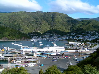
The history of the Nelson Region of New Zealand dates back to settlement by the Māori people in about the 12th century. The Nelson and Marlborough Region were known to the Māori as Te Tau Ihu o Te Waka a Maui which means "The Prow of the Canoe of Maui".

Te Raukura

Te Raukura, otherwise known as Te Wharewaka o Poneke is a building located on Taranaki Street Wharf, Wellington waterfront, New Zealand. It houses a conference venue, Karaka Cafe, and waka house.

Te Atiawa o Te Waka-a-Māui is a Māori iwi (tribe) in the upper South Island of New Zealand. Its rohe extends from Golden Bay and Marlborough Sounds at the top of the South Island to Cape Campbell, St Arnaud and Westport.

Te Tau Ihu Māori

Te Tau Ihu Māori are a group of Māori iwi in the upper South Island of New Zealand. It includes Ngāti Kuia, Rangitāne and Ngāti Apa, Ngāti Koata, Ngāti Rārua and Ngāti Toa, and Ngāti Tama and Te Āti Awa.

Waipounamu Māori are a group of Māori iwi at or around the South Island of New Zealand. It includes the iwi (tribe) of Ngāi Tahu and the historical iwi of Kāti Māmoe, who occupy the island except for its most northern districts. It also includes Te Tau Ihu Māori iwi, such as Ngāti Toa, Te Atiawa o Te Waka-a-Māui, Ngāti Apa ki te Rā Tō, Rangitāne, Ngāti Kuia, Ngāti Rārua, Ngāti Kōata and Ngāti Tama.

The Māori people and Moriori people have hundreds of marae around New Zealand.

References

  1. "2013 Census map" . Retrieved 30 May 2018.
  2. "Anakiwa". Cruise Guide to the Marlborough Sounds. Retrieved 30 May 2018.
  3. "Palisades and kumara". Department of Conservation. New Zealand Government. Retrieved 30 May 2018.
  4. Mitchell, Hilary; Mitchell, John (2007). Te Tau Ihu o te Waka: History of Māori of Nelson and Marlborough. 2. Wellington: Huia Publishers. pp. 392–3. ISBN   9781869692940.
  5. Mitchell, Hilary; Mitchell, John (2004). Te Tau Ihu o te Waka: History of Māori of Nelson and Marlborough. 1. Wellington: Huia Publishers. pp. 76–7,274–81. ISBN   9781869690878.
  6. "Adventures for body and soul". The Press. 24 November 2012. Retrieved 28 May 2018.
  7. Inside Outward Bound, The New Zealand Journey (Motion picture). Outward Bound Trust New Zealand. 2014. Retrieved 27 May 2018.

Coordinates: 41°15′52″S173°54′46″E / 41.26444°S 173.91278°E / -41.26444; 173.91278

Geographic coordinate system Coordinate system

A geographic coordinate system is a coordinate system that enables every location on Earth to be specified by a set of numbers, letters or symbols. The coordinates are often chosen such that one of the numbers represents a vertical position and two or three of the numbers represent a horizontal position; alternatively, a geographic position may be expressed in a combined three-dimensional Cartesian vector. A common choice of coordinates is latitude, longitude and elevation. To specify a location on a plane requires a map projection.