Annex Peak

Last updated
Annex Peak
Relief map of USA Alaska.png
Red triangle with thick white border.svg
Annex Peak
Highest point
Elevation 4,094 ft (1,248 m) [1]
Listing Mountains of the United States
Coordinates 58°21′41″N134°08′13″W / 58.36139°N 134.13694°W / 58.36139; -134.13694 Coordinates: 58°21′41″N134°08′13″W / 58.36139°N 134.13694°W / 58.36139; -134.13694 [1]
Geography
Location Juneau, Alaska, U.S.
Parent range Boundary Ranges
Topo map USGS Juneau B-1

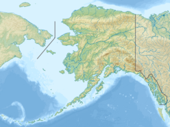
Annex Peak is a mountain in the city and borough of Juneau, Alaska, United States. It is a part of the Boundary Ranges of the Coast Mountains in western North America. It is 3 miles (4.8 km) west of Scow Cove and 11 miles (18 km) northeast of the city of Juneau.

Mountain A large landform that rises fairly steeply above the surrounding land over a limited area

A mountain is a large landform that rises above the surrounding land in a limited area, usually in the form of a peak. A mountain is generally steeper than a hill. Mountains are formed through tectonic forces or volcanism. These forces can locally raise the surface of the earth. Mountains erode slowly through the action of rivers, weather conditions, and glaciers. A few mountains are isolated summits, but most occur in huge mountain ranges.

Juneau, Alaska State capital city and borough in Alaska, United States

The City and Borough of Juneau, commonly known as Juneau, is the capital city of Alaska. It is a unified municipality on Gastineau Channel in the Alaskan panhandle, and it is the second largest city in the United States by area. Juneau has been the capital of Alaska since 1906, when the government of what was the District of Alaska was moved from Sitka as dictated by the U.S. Congress in 1900. The municipality unified on July 1, 1970, when the city of Juneau merged with the city of Douglas and the surrounding Greater Juneau Borough to form the current municipality, which is larger by area than both Rhode Island and Delaware.

Alaska State of the United States of America

Alaska is a U.S. state in the northwest extremity of North America, just across the Bering Strait from Asia. The Canadian province of British Columbia and territory of Yukon border the state to the east, its most extreme western part is Attu Island, and it has a maritime border with Russia to the west across the Bering Strait. To the north are the Chukchi and Beaufort seas—southern parts of the Arctic Ocean. The Pacific Ocean lies to the south and southwest. It is the largest state in the United States by area and the seventh largest subnational division in the world. In addition, it is the 3rd least populous and the most sparsely populated of the 50 United States; nevertheless, it is by far the most populous territory located mostly north of the 60th parallel in North America: its population—estimated at 738,432 by the United States Census Bureau in 2015— is more than quadruple the combined populations of Northern Canada and Greenland. Approximately half of Alaska's residents live within the Anchorage metropolitan area. Alaska's economy is dominated by the fishing, natural gas, and oil industries, resources which it has in abundance. Military bases and tourism are also a significant part of the economy.

The mountain's name was published locally by D. A. Brew and A. B. Ford of the United States Geological Survey (USGS) in 1965; it was collected by the USGS between 1976 and 1981, and entered into the Survey's Geographic Names Information System on March 31, 1981. [1]

United States Geological Survey scientific agency of the United States government

The United States Geological Survey is a scientific agency of the United States government. The scientists of the USGS study the landscape of the United States, its natural resources, and the natural hazards that threaten it. The organization has four major science disciplines, concerning biology, geography, geology, and hydrology. The USGS is a fact-finding research organization with no regulatory responsibility.

Geographic Names Information System geographical database

The Geographic Names Information System (GNIS) is a database that contains name and locative information about more than two million physical and cultural features located throughout the United States of America and its territories. It is a type of gazetteer. GNIS was developed by the United States Geological Survey in cooperation with the United States Board on Geographic Names (BGN) to promote the standardization of feature names.
See also

Related Research Articles

Wisconsin Range

The Wisconsin Range is a major mountain range of the Horlick Mountains in Antarctica, comprising the Wisconsin Plateau and numerous glaciers, ridges and peaks bounded by the Reedy Glacier, Shimizu Ice Stream, Horlick Ice Stream and the interior ice plateau.

Neptune Range

The Neptune Range is a mountain range, 112 km (70 mi) long, lying WSW of Forrestal Range in the central part of the Pensacola Mountains in Antarctica. The range is composed of Washington Escarpment with its associated ridges, valleys and peaks, the Iroquois Plateau, and the Schmidt and Williams Hills. It was discovered and photographed on January 13, 1956 on a US Navy transcontinental plane flight from McMurdo Sound to Weddell Sea and return.

Dipyramid is a pair of mountain peaks in borough of Juneau, Alaska, United States. It is a part of the Boundary Ranges of the Coast Mountains in western North America. The summit is 34 miles (55 km) north-northeast of the city of Juneau and 1 mile southeast of The Citadel. The peaks are 0.2 miles (322 m) apart.

Explorers Range

Explorers Range is a large mountain range in the Bowers Mountains of Victoria Land, Antarctica, extending from Mount Bruce in the north to Carryer Glacier and McLin Glacier in the south. Named by the New Zealand Antarctic Place-Names Committee (NZ-APC) for the northern party of New Zealand Geological Survey Antarctic Expedition (NZGSAE), 1963–64, whose members carried out a topographical and geological survey of the area. The names of several party members are assigned to features in and about this range. All of the geographical features listed below lie situated on the Pennell Coast, a portion of Antarctica lying between Cape Williams and Cape Adare.

Mendenhaven is a populated place in Juneau, Alaska, United States. It is 2 miles (3 km) north of the Juneau International Airport and 8 miles (13 km) northwest of the city of Juneau. The name was published in 1962 by the United States Geological Survey, and entered into the Geographic Names Information System on March 31, 1981.

Saint Terese is a populated place in Juneau, Alaska, United States. It is named for Thérèse of Lisieux and home to a shrine dedicated to her, a Juneau-area visitor attraction which long predates the current cruise ship era.

Aaron Island is an island in the City and Borough of Juneau, Alaska, United States. It was named by Lester A. Beardslee in 1880. Located in Lynn Canal, it is 1.2 miles (1.9 km) northwest of Point Stephens and 17 miles (27 km) northwest of the city of Juneau. The name was collected by the United States Geological Survey between 1976 and 1981, and entered into the Geographic Names Information System on March 31, 1981.

The Brassiere Hills are a pair of summits in the City and Borough of Juneau, Alaska, United States. It is located at the northern end of Taku Inlet, 4.5 miles (7.2 km) north of Taku Point and 18 miles (29 km) northeast of the city of Juneau. The peaks are 2,405 feet (733 m) and 2,360 feet (719 m) high and a stream named Zipper Creek runs between them.

Tee Harbor, Juneau human settlement in United States of America

Tee Harbor refers to two adjacent populated places in the City and Borough of Juneau, Alaska. The area had a population of 32 in 1950. It is located 3 miles (4.8 km) northwest of Fairhaven and 17 miles (27 km) northwest of the main city of Juneau.

Boundary Peak 79 is a mountain in the city and borough of Juneau, Alaska, United States. It is a part of the Boundary Ranges of the Coast Mountains in western North America.

Amherst Peak is a mountain in the city and borough of Juneau, Alaska, United States. It is a part of the Boundary Ranges of the Coast Mountains in western North America. It is near the Taku Glacier, 0.2 miles (0.32 km) northwest of Echo Pass and 14 miles (23 km) north of the city of Juneau.

Table Top Mountain is a mountain in the city and borough of Juneau, Alaska, United States. It is a peak of the Boundary Ranges, located on Douglas Island 2 miles (3.2 km) northeast of Cropley Lake and 3.5 miles (5.6 km) west of the city of Juneau.

Mount Troy is a mountain in the City and Borough of Juneau, Alaska, United States. It is a peak of the Boundary Ranges, located on Douglas Island, west of the head of Kowee Creek and 3 miles (4.8 km) southwest of the city of Juneau.

Freyberg Mountains

The Freyberg Mountains are a group of mountains in Victoria Land, Antarctica, bounded by Rennick Glacier, Bowers Mountains, Black Glacier, and Evans Neve. Named for New Zealand's most famous General, Lord Bernard Freyberg, by the Northern Party of New Zealand Geological Survey Antarctic Expedition (NZGSAE), 1963-64. This mountain group includes the Alamein Range. These topographical features all lie situated on the Pennell Coast, a portion of Antarctica lying between Cape Williams and Cape Adare.

Auke Mountain mountain in United States of America

Auke Mountain is a mountain in the city and borough of Juneau, Alaska, United States. It is a part of the Boundary Ranges of the Coast Mountains in western North America. It is 1 mile (1.6 km) north of Fairhaven, Alaska, and 12 miles (19 km) northwest of the city of Juneau.

Bird Island is an island in the City and Borough of Juneau, Alaska, United States. It was named by Captain Lester A. Beardslee of the United States Navy in 1880. Located off the eastern shore of Favorite Channel, it is 2.4 miles (3.9 km) northwest of Pearl Harbor and 20 miles (32 km) northwest of the city of Juneau. The name was first published by the U.S. Coast and Geodetic Survey in 1883, collected by the United States Geological Survey between 1976 and 1981, and entered into the Geographic Names Information System on March 31, 1981.

Camp 15 Peak is a mountain in the borough of Juneau, Alaska, United States. It is part of the Boundary Ranges of the Coast Mountains in western North America. On the divide east of Battle Glacier, it is located 3 miles southwest of The Tusk and 28 miles north-northwest of the city of Juneau.

Cohen Island is an island within the borders of the City and Borough of Juneau, Alaska, United States. Located off the eastern shore of Favorite Channel, it is 1 mile (1.6 km) northwest of Point Stephens and 16 miles (26 km) northwest of the city of Juneau. It is a part of the Channel Islands State Marine Park.

Camp 4 Peak is a mountain in the city and borough of Juneau, Alaska, United States. It is a part of the Boundary Ranges of the Coast Mountains in western North America. On the divide between East and West Twin Glaciers, it is located 5 miles north-northwest of Twin Glacier Lake and 27 miles northeast of the city of Juneau.

Gastineau Peak mountain in United States of America

Gastineau Peak is a mountain in the city and borough of Juneau, Alaska, United States. It is a part of the Boundary Ranges of the Coast Mountains in western North America. It is located 1.6 miles west of Sheep Mountain and 2.4 miles southeast of the city of Juneau.

References