Arbatskaya Square

Last updated
Chapel of Sts. Boris and Gleb was constructed in front of the Ministry of Defense in 1997 in place of a similar church destroyed 70 years earlier. Boris and Gleb chapel at the Arbat square in Moscow.jpg
Chapel of Sts. Boris and Gleb was constructed in front of the Ministry of Defense in 1997 in place of a similar church destroyed 70 years earlier.

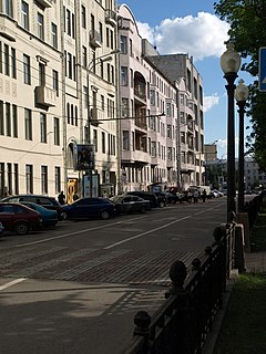
Arbatskaya Square or Arbat Square (Russian : Арба́тская пло́щадь) is one of the oldest squares of Moscow, located on the junction of Gogolevsky Boulevard, Znamenka Street and Arbat Gates Square (in 1925–1993 – part of Arbatskaya Square).

Russian language East Slavic language

Russian is an East Slavic language, which is official in the Russian Federation, Belarus, Kazakhstan and Kyrgyzstan, as well as being widely used throughout Eastern Europe, the Baltic states, the Caucasus and Central Asia. It was the de facto language of the Soviet Union until its dissolution on 25 December 1991. Although, nowadays, nearly three decades after the breakup of the Soviet Union, Russian is used in official capacity or in public life in all the post-Soviet nation-states, as well as in Israel and Mongolia, the rise of state-specific varieties of this language tends to be strongly denied in Russia, in line with the Russian World ideology.

Moscow Capital city of Russia

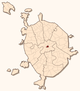
Moscow is the capital and most populous city of Russia, with 13.2 million residents within the city limits, 17 million within the urban area and 20 million within the metropolitan area. Moscow is one of Russia's federal cities.

Gogolevsky Boulevard

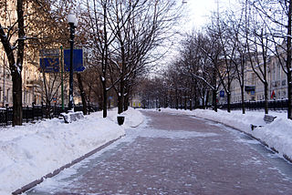
Gogolevsky Boulevard is a boulevard near the Arbat District, Moscow, Russia, named after the writer Nikolai Gogol. It was named Prechistensky Boulevard until 1924, after the nearby street Prechistenka.

The square is home to the Arbatskaya metro station, on Filyovskaya Line.

Moscow Metro rapid transit system in Moscow

The Moscow Metro is a rapid transit system serving Moscow, Russia and the neighbouring Moscow Oblast cities of Krasnogorsk, Reutov, Lyubertsy and Kotelniki. Opened in 1935 with one 11-kilometre (6.8 mi) line and 13 stations, it was the first underground railway system in the Soviet Union. As of 2018, the Moscow Metro excluding the Moscow Central Circle and Moscow Monorail has 224 stations and its route length is 381 km (237 mi), making it the fifth longest in the world. The system is mostly underground, with the deepest section 84 metres (276 ft) underground at the Park Pobedy station, one of the world's deepest.

Present-day square is dominated by the wide avenue of New Arbat, however, prior to redevelopment of the 1960s, the square was located south from this avenue, on the line of Arbat Street and the vestibule of Arbatskaya subway station. Arbat Gates of Bely Gorod were located here; the wall of Bely Gorod was demolished in the 1750s-1770s, the tower in 1792, creating the original Arbat Gates Square.

Bely Gorod human settlement in Russia

Bely Gorod is the central core area of Moscow, Russia beyond the Kremlin and Kitay-gorod.

There was no straight connection between Vozdvizhenka and Arbat: westbound coaches had to make a sharp turn south into Nikitsky Boulevard, past a corner block on this boulevard, then make a turn west into either Arbat, Povarskaya Street, Bolshaya Molchanovka, Malaya Molchanovka or Merzlyakovsky Lane. All these four streets fanned out west from the square. In 1807–1812, it hosted Arbatsky Theater [ ru ], which perished in the Fire of Moscow (1812), as well as most of the neighborhoods around it.

Povarskaya Street street in Moscow

Povarskaya Street, known from 1924–1991 as Vorovsky Street, is a radial street in the center of Moscow, Russia, connecting Arbat Square on Boulevard Ring with Kudrinskaya Square on the Garden Ring. It is known informally as Moscow's Embassy Row, and is home to the finest mansions built in the 1890s and 1900s. Povarskaya Street also houses the Supreme Court of Russia and the Gnessin State Musical College.

Fire of Moscow (1812) 1812 fire

The 1812 Fire of Moscow broke out on 14 September 1812, when Russian troops and most of the remaining residents abandoned the city of Moscow just ahead of Napoleon's vanguard troops entering the city after the Battle of Borodino. The fire all but destroyed the city, which had been mostly abandoned by its residents the previous month.

The Arbat Fountain, originally a fire reservoir (1840s), later a decorative fountain, was located in the south of the square, on the line of Maly Afanasyevsky Lane. In 1945, it was refitted with sculptures and granite slabs in stalinist style, only to be destroyed in the 1960s.

Stalinist architecture architectural style

Stalinist architecture, mostly known in the former Eastern Bloc as Stalinist Empire style or Socialist Classicism, is a term given to architecture of the Soviet Union under the leadership of Joseph Stalin, between 1933, when Boris Iofan's draft for Palace of the Soviets was officially approved, and 1955, when Nikita Khrushchev condemned "excesses" of the past decades and disbanded the Soviet Academy of Architecture. Stalinist architecture is associated with the socialist realism school of art and architecture.

Coordinates: 55°45′07″N37°36′04″E / 55.7519°N 37.6011°E / 55.7519; 37.6011

Geographic coordinate system Coordinate system

A geographic coordinate system is a coordinate system that enables every location on Earth to be specified by a set of numbers, letters or symbols. The coordinates are often chosen such that one of the numbers represents a vertical position and two or three of the numbers represent a horizontal position; alternatively, a geographic position may be expressed in a combined three-dimensional Cartesian vector. A common choice of coordinates is latitude, longitude and elevation. To specify a location on a plane requires a map projection.

Related Research Articles

Red Gate

Red Gate were triumphal arches built in an exuberantly baroque design in Moscow. Gates and arches of this type were common back in 18th century Moscow. However, the Red Gate was the only one that survived until the 20th century. It was demolished in 1928 and the name still survives in an eponymous Moscow Metro station.

Kitay-gorod human settlement in Russia

Kitay-gorod, also referred to as the Great Possad in the 16th–17th centuries, is a cultural and historical area within the central part of Moscow in Russia, defined by the remnants of now almost entirely razed fortifications, narrow streets and very densely built cityscape. It is separated from the Moscow Kremlin by Red Square. Kitay-gorod does not constitute a district (raion), as there are no resident voters, thus, municipal elections are not possible. Rather, the territory has been part of Tverskoy District, and the Central Administrative Okrug authorities have managed the area directly since 2003.

Khamovniki District is a district of Central Administrative Okrug of the federal city of Moscow, Russia. Population: 102,730 (2010 Census); 97,110 (2002 Census).

Arbat Street thoroughfare in Moscow, Russia

Arbat Street, mainly referred to in English as the Arbat, is a pedestrian street about one kilometer long in the historical centre of Moscow, Russia. The Arbat has existed since at least the 15th century, which makes it one of the oldest surviving streets of the Russian capital. It forms the heart of the Arbat District of Moscow. Originally the street formed part of an important trade-route and was home to a large number of craftsmen.

Garden Ring street in Moscow

The Garden Ring, also known as the "B" Ring, is a circular ring road avenue around central Moscow, its course corresponding to what used to be the city ramparts surrounding Zemlyanoy Gorod in the 17th century.

Tverskoy District human settlement in Russia

Tverskoy District is a district of Central Administrative Okrug of the federal city of Moscow, Russia. Population: 75,378 (2010 Census); 75,955 (2002 Census).

Zaryadye human settlement in Russia

Zaryadye is a historical district in Moscow established in 12th or 13th century within Kitai-gorod, between Varvarka Street and Moskva River. The name means "the place behind the rows", i.e., behind the market rows adjacent to the Red Square.

Arbat may refer to:

New Arbat Avenue thoroughfare in Moscow, Russia

New Arbat Avenue is a major street in Moscow running west from Arbat Square on the Boulevard Ring to Novoarbatsky Bridge on the opposite bank of the Moskva River. The modern six-lane avenue, along with two rows of high-rise buildings, was constructed between 1962 and 1968, and was literally cut through the old, narrow streets of the Arbat District.

Tverskoy Boulevard thoroughfare in Moscow, Russia

Tverskoy Boulevard is one of the main thoroughfares in central Moscow. It is a part of the Boulevard Ring and begins at the end of the Nikitsky Boulevard, at the crossing with Bolshaya Nikitskaya Street. The boulevard ends at the Pushkin Square and Tverskaya Street, one of the busiest places in Moscow. East of Tverskaya Street becomes Strastnoy Boulevard.

Rozhdestvensky Boulevard boulevard in Moscow, Russia

Rozhdestvensky Boulevard is a major boulevard in Meshchansky District of Moscow, Russia. It begins at Trubnaya Square (west) and ends at Sretenka Gates in the same district (completing the Boulevard Ring link from Petrovsky Boulevard to Sretensky Boulevard.

Bolshaya Nikitskaya Street thoroughfare in Moscow, Russia

Bolshaya Nikitskaya Street is a radial street that runs west from Mokhovaya Street to Garden Ring in Moscow, between Vozdvizhenka Street (south) and Tverskaya Street (north). Central, eastern part of the street is notable for its educational institutions and theaters, western part beyond the Boulevard Ring has many Neoclassical mansions and competes with nearby Povarskaya Street for the title of Moscow's Embassy Row.

Vozdvizhenka Street

Vozdvizhenka Street,, is a radial street connecting Manege Square and Arbat Square in central Arbat District of Moscow, Russia. The street's name refers to a monastery that existed here since 1450 and perished in the Fire of Moscow (1812). In 1934-1946, it was known as Comintern Street, in 1946-1991 as Kalinin Street Kalinin Prospect.

Slavyanskaya Square

Slavyanskaya Square is the square in the center of Moscow, also known in 1924-1991 as northern side of Nogina Square ; the southern side of former Nogina Square is now called Varvarka Gates Square. These two square separates central Kitai-gorod from eastward Tagansky District. They connect to Varvarka Street (west), Solyanka Street (east), Kitaigorodsky Lane (south), Staraya Square and Lubyansky Lane (north), completing the half-circle of Central Squares of Moscow around Moscow Kremlin and Kitai-gorod.

Sivtsev Vrazhek Lane

Sivtsev Vrazhek is a radial lane in the Central Administrative Okrug of Moscow; it forms the boundary between Arbat and Khamovniki municipal districts. The lane begins at a T-junction with Gogolevsky Boulevard and runs west, roughly parallel to Arbat Street (north) and Prechistenka Street (south), ending at a T-junction with Denezhny Lane, one block short of the Garden Ring. The name of the lane, literally Sivka stream gully, refers to a historical stream now locked in an underground sewer and is only one of two Vrazheks in present-day Moscow.

Main Building of the Ministry of Defense (Russia)

The Main Building of the Russian Defense Ministry is the headquarters of the Russian Ministry of Defense, located in Moscow, Russia.