See also
 | This disambiguation page lists articles about roads and streets with the same name. If an internal link led you here, you may wish to change the link to point directly to the intended article. |
Autoroute 13 may refer to:
| | This disambiguation page lists articles about roads and streets with the same name. If an internal link led you here, you may wish to change the link to point directly to the intended article. |

The autoroute system is a network of freeways within the province of Quebec, Canada, operating under the same principle of controlled access as the Interstate Highway System in the United States and the 400-series highways in neighbouring Ontario. The Autoroutes are the backbone of Quebec's highway system, spanning almost 2,400 km (1,491 mi). The speed limit on the Autoroutes is generally 100 km/h (62 mph) in rural areas and 70–90 km/h (43–56 mph) in urban areas; most roads are made of asphalt concrete.

Autoroute 20 is a Quebec Autoroute, following the Saint Lawrence River through one of the more densely populated parts of Canada, with its central section forming the main route of the Trans-Canada Highway from the A-25 interchange to the A-85 interchange. At 585 km (363.5 mi), it is the longest Autoroute in Quebec. It is one of two main links between Montreal and Quebec City; the other is the A-40.
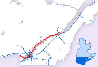
Autoroute 40, officially known as Autoroute Félix-Leclerc outside Montreal and Metropolitan Autoroute/Autoroute Métropolitaine within Montreal, is an Autoroute on the north shore of the St. Lawrence River in the Canadian province of Quebec. It is one of the two major connections between Montreal and Quebec City, the other being Autoroute 20 on the south shore of the St. Lawrence. Autoroute 40 is currently 347 km (215.6 mi) long. Between the Ontario–Quebec boundary and the interchange with Autoroute 25, the route is signed as part of the Trans-Canada Highway.

Autoroute 25 is an Autoroute in the Lanaudière region of Quebec. It is currently 49 km (30.4 mi) long and services the direct north of Montreal's Metropolitan Area. The A-25 has one toll bridge, which is the first modern toll in MMA and one of two overall in Quebec.

Autoroute 50 is an Autoroute in western Quebec, Canada. It links the City of Gatineau and Canada's National Capital Region to the Greater Montreal area. It is nicknamed by many the “Highway of Death” due to the numerous lethal head on collisions.

Route 132 is the longest highway in Quebec. It follows the south shore of the Saint Lawrence River from the border with the state of New York in the hamlet of Dundee, west of Montreal to the Gulf of Saint Lawrence and circles the Gaspé Peninsula. This highway is known as the Navigator's Route. It passes through the Montérégie, Centre-du-Québec, Chaudière-Appalaches, Bas-Saint-Laurent and Gaspésie regions of the province.
Autoroute 440 is a provincial highway that runs across the city of Laval, Quebec from Autoroute 13 to Autoroute 25. It is currently 18.2 km (11.3 mi) long and proceeds across Île Jésus on an east–west axis. It links every highway or expressway that connects Montreal to the North Shore.

Autoroute 13, is a freeway in the urban region of Montreal, Quebec, Canada. Its southern end is at the junction of A-20 on the Island of Montreal near Pierre Elliott Trudeau International Airport. Its northern terminus is at the junction of A-640 near Boisbriand. The road traverses through Laval.

Autoroute 19, also known as Autoroute Papineau, is an autoroute in Quebec. It crosses the Rivière des Prairies via the Papineau-Leblanc Bridge, connecting the borough of Ahuntsic-Cartierville in Montreal and the Duvernay neighbourhood in Laval.
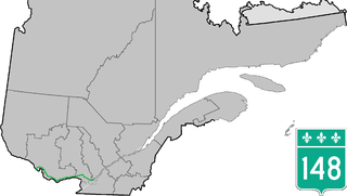
Route 148 is an east-west highway in Quebec, Canada. It runs from junction of Autoroute 13 and Autoroute 440 in Laval in the Montreal region to the Ontario-Quebec border in L'Isle-aux-Allumettes in western Quebec. For most of its length, Route 148 follows the north shore of the Ottawa River where it acted as the principal route between communities in the Outaouais region until the completion of Autoroute 50 in 2012. At the Ontario-Quebec border in L'Isle-aux-Allumettes Route 148 continues into Ontario as Highway 148.
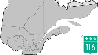
Route 116 is an east/west highway on the south shore of the Saint Lawrence River in Quebec, Canada. Until the mid-1970s it was known as Route 9. Its eastern terminus is in Lévis at the junction of Route 132, and the western terminus is at the junction of Route 134 in Lemoyne part of a concurrency with Route 112 until Saint-Hubert just south of the Saint-Hubert Municipal Airport. The stretch between Lévis and Plessisville does not have much traffic, since Autoroute 20 is not that far from the highway. Between Plessisville and Richmond traffic is heavier as it passes bigger towns, and it is further away from Autoroute 20. From Richmond to Autoroute 20, it is quiet again, before reaching Saint-Hyacinthe, where it becomes a busy four-lane separated highway, going through the growing "South Shore" suburbs of Montreal. From the junction of Autoroute 30 to its western terminus, it is a controlled-access Autoroute-grade expressway. This portion was once envisioned to be part of Autoroute 16. An unofficial extension of Route 116 as thought of by locals, from the western terminus follows the Route 134 limited access expressway to the Jacques Cartier Bridge.
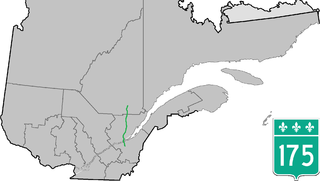
Route 175 is a major north/south highway on both sides of the St. Lawrence River in Quebec, Canada. Its southern terminus is in Saint-Lambert-de-Lauzon at the junction of Route 218 and its northern terminus is in Saguenay at the junction of Route 172, in the former city of Chicoutimi. Route 175 crosses the Saint Lawrence River on the Quebec Bridge, and a little further north of downtown Quebec City, it merges with Autoroute 73 for about 30 km before continuing through the Laurentides Wildlife Reserve as a two-lane divided highway in Stoneham.
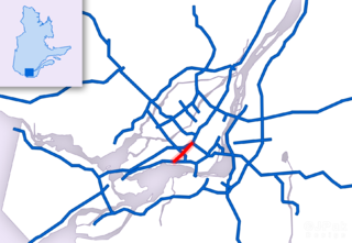
Autoroute 520, Autoroute Côte de Liesse, or Côte-de-Liesse Road is an expressway that connects Montreal's Pierre Elliott Trudeau International Airport with Autoroute 20 at the expressway's western terminus and Autoroute 40 at the expressway's eastern terminus. This route serves as a link to the airport to residents living in the east of Montreal and the West Island as well as the city of Dorval.

Route 125 is a Quebec highway running from Montreal to Saint-Donat, Lanaudière, Quebec in the Lanaudière. The southern section of Route 125 runs parallel to Autoroute 25 in Laval, Mascouche, and Terrebonne. At Saint-Esprit, the Autoroute ends, and 125 continues northwards until the entrance to the Mont Tremblant Provincial Park north of Saint-Donat.

Route 335 is a north-south route from Montreal north into the Lanaudière region of Quebec.
Chomedey is a provincial electoral district in Quebec, Canada that elects members to the National Assembly of Quebec. It is located in the western part of Laval. It takes in part of the Chomedey neighbourhood. It includes most of the territory bounded by the Rivière des Prairies to the south, Autoroute 15 to the east, Autoroute 440 to the north and Autoroute 13 to the west.
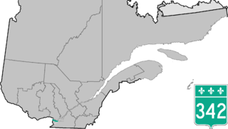
Route 342 is a provincial highway located in the Montérégie region of Quebec west of Montreal. It runs from the Ontario-Quebec border in Pointe-Fortune (at the junctions of Ontario Highway 417 and Autoroute 40 and ends in Vaudreuil-Dorion at the junction of Autoroute 20. Its main purpose serves a service/alternate route to Autoroute 40 and has 4 interchanges with it in Pointe-Fortune, Rigaud and Hudson.
The North Shore is the general term for the northern suburbs of Montreal. The North Shore is located in southwestern Quebec on the northern shores of the Rivière des Prairies and the Rivière des Mille Îles, opposite the Island of Montreal and the Island of Laval. It consists of twenty municipalities that belong to the Laurentides and Lanaudière administrative regions. While the city of Laval is commonly associated with the North Shore, it is not considered part of the North Shore because of its status as an island.