Speed limits on road traffic, as used in most countries, set the legal maximum speed at which vehicles may travel on a given stretch of road. Speed limits are generally indicated on a traffic sign reflecting the maximum permitted speed - expressed as kilometres per hour (km/h) and/or miles per hour (mph). Speed limits are commonly set by the legislative bodies of national or provincial governments and enforced by national or regional police and judicial authorities. Speed limits may also be variable, or in some places nonexistent, such as on most of the Autobahnen in Germany.

The island of Ireland, comprising Northern Ireland and the Republic of Ireland, has an extensive network of tens of thousands of kilometres of public roads, usually surfaced. These roads have been developed and modernised over centuries, from trackways suitable only for walkers and horses, to surfaced roads including modern motorways. The major routes were established before Irish independence and consequently take little cognisance of the border other than a change of identification number and street furniture. Northern Ireland has had motorways since 1962, and has a well-developed network of primary, secondary and local routes. The Republic started work on its motorway network in the early 1980s; and historically, the road network there was once somewhat less well developed. However, the Celtic Tiger economic boom and an influx of European Union structural funding, saw national roads and regional roads in the Republic come up to international standard quite quickly. In the mid-1990s, for example, the Republic went from having only a few short sections of motorway to a network of motorways, dual carriageways and other improvements on most major routes as part of a National Development Plan. Road construction in Northern Ireland now tends to proceed at a slower pace than in the Republic, although a number of important bypasses and upgrades to dual carriageway have recently been completed or are about to begin.

A dual carriageway (BE) or divided highway (AE) is a class of highway with carriageways for traffic travelling in opposite directions separated by a central reservation (BrE) or median (AmE). Roads with two or more carriageways which are designed to higher standards with controlled access are generally classed as motorways, freeways, etc., rather than dual carriageways.

A limited-access road, known by various terms worldwide, including limited-access highway, dual-carriageway, expressway, and partial controlled access highway, is a highway or arterial road for high-speed traffic which has many or most characteristics of a controlled-access highway, including limited or no access to adjacent property, some degree of separation of opposing traffic flow, use of grade separated interchanges to some extent, prohibition of slow modes of transport, such as bicycles, (draught) horses, or self-propelled agricultural machines; and very few or no intersecting cross-streets or level crossings. The degree of isolation from local traffic allowed varies between countries and regions. The precise definition of these terms varies by jurisdiction.

The Autostrade are roads forming the Italian national system of motorways. The total length of the system is about 6,758 kilometres (4,199 mi). In North and Central Italy, the Autostrade mainly consists of tollways managed by Autostrade per l'Italia, a holding company controlled by Cassa Depositi e Prestiti. Other operators include ASTM, ATP, and Autostrade Lombarde in the north-west; Autostrada del Brennero, A4 Holding, Concessioni Autostradali Venete, and Autovie Venete in the north-east; Strada dei Parchi, SALT, SAT, and Autocisa in the center; and CAS in the south.

A controlled-access highway is a type of highway that has been designed for high-speed vehicular traffic, with all traffic flow—ingress and egress—regulated. Common English terms are freeway, motorway, expressway and speedway. Other similar terms include throughway and parkway. Some of these may be limited-access highways, although this term can also refer to a class of highways with somewhat less isolation from other traffic.

The European route E45 goes between Norway and Italy, through Finland, Sweden, Denmark, Germany and Austria. With a length of about 5,190 kilometres (3,225 mi), it is the longest north–south European route.
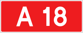
Autostrada A18 is a short, planned motorway in southwestern Poland which is to run from the Polish/German border at Olszyna/Forst-Bademeusel to the Polish Autostrada A4. The highway is part of the European route E36 and the Pan-European corridor IIIA from Berlin to Wrocław.

Road speed limits in Ireland apply on all public roads in the state. These are signposted and legislated for in kilometres per hour. Speed limits are demarcated by regulatory road signs. These consist of white circular signs with a red outline. Speed limits are marked in black with "km/h" below the speed limit. Smaller "repeater" speed limit signs are used along stretches of road where there is no change in speed limit, in order to remind motorists currently on the road and to inform traffic merging from junctions that a certain speed limit applies.

A High-quality dual carriageway (HQDC) is a road category in Ireland. It is defined as an all-purpose dual carriageway road type built to near motorway standards, but without motorway classification or motorway restrictions. High-quality dual carriageways have full grade-separated access and do not have junctions with minor roads. Such roads in the Republic of Ireland have been built as part of the 2000–2006 and 2007–2013 National Development Plans, including interurban routes from Dublin to other cities.

A single carriageway or Undivided highway is a road with one, two or more lanes arranged within a one carriageway with no central reservation to separate opposing flows of traffic. A single-track road has a single lane with passing places for traffic in both directions. Road traffic safety is generally worse for high-speed single carriageways than for dual carriageways due to the lack of separation between traffic moving in opposing directions.

The A7 motorway is a motorway in the Netherlands connecting Zaandam, via the Afsluitdijk, Sneek and Groningen to the German border near Bad Nieuweschans. The entire road is part of the European route E22, with exception of the first kilometer, between the terminus in Zaandam and the interchange Zaandam. The total length is 236 km.

A speed limit is the limit of speed allowed by law for road vehicles, usually the maximum speed allowed. Occasionally, there is a minimum speed limit. Advisory speed limits also exist, which are recommended but not mandatory speeds. Speed limits are commonly set by the legislative bodies of national or local governments.

The Autostrada A10, also known as the Autostrada dei Fiori or the AutoFiori, is an Italian motorway, passing through Liguria and connecting Genoa with Ventimiglia. It connects to the French A8 autoroute, which finishes in Aix-en-Provence, and forms part of European route E80. It is 158.7 kilometres (98.6 mi) long.

The A15 is an Italian autostrada (motorway) connecting Parma and La Spezia through the valleys of the Taro and Magra Rivers. The road is also known as Autostrada della Cisa because it crosses the Northern Apennines at the Cisa pass. The main 101-km expanse of the motorway connects the A1 with the A12, thus directly linking the Po Valley with the Italian Riviera and the Versilia region.
The Tangenziale di Mestre, or Autostrada A57, was opened to traffic on 3 September 1972 in northern Italy.

The A1, also commonly Rruga e Kombit or SH10, is the longest and only toll motorway in Albania, stretching 114 kilometres (71 mi) in the counties of Lezhë and Kukës. It consists for the most part of two traffic lanes and an emergency lane in each driving direction separated by a central reservation.
This article describes the highway systems available in selected countries.

Controlled-access highways in Romania are dual carriageways, grade separated with controlled-access, designed for high speeds. In 2012, legislation amendments defined two types of highways: motorways and expressways.

The Highways in Albania are the central state and main transport network in Albania. The motorways and expressways are both part of the national road network. The motorways are primary roads with a speed limit of 110 kilometres per hour (68 mph). They have white on green road signs such as in Italy and other countries nearby. The expressways are the secondary roads, also dual carriageways, but without an emergency lane. They have a speed limit of 90 kilometres per hour (56 mph). They have white on blue road signs.