Autostrada A91 (Italy)

Last updated
Autostrada A91 Italia.svg
Autostrada A91
Rome – Fiumicino Airport
Italia - mappa autostrada A91.svg
Route information
Maintained by ANAS
Length18.5 km (11.5 mi)
Existed1959–present
Major junctions
From Rome
To Fiumicino Airport
Location
Country Italy
Regions Lazio
Highway system
  • Roads in Italy

The Autostrada A91, also called Autostrada Roma-Fiumicino, is an Italian motorway which connects Rome to the Fiumicino Airport.

Contents

The official "A91" name [1] was assigned in the early 2000s. On many road signs along the route, the characteristic green octagonal marker of the Italian motorways still bears the letter A without number.

History

The motorway was built by its current operator ANAS and finished in 1959 [2] at the same time as the entry into service of the Airport itself (which took place in different phases between 1956 and January 1961). It was initially classified as a State highway, with the name Strada statale 201 dell'Aeroporto di Fiumicino, and became a motorway in 1969. [3]

On the occasion of the Great Jubilee of 2000, the motorway was enlarged with the construction of the third lane between the Grande Raccordo Anulare and the Airport, with the exception of a small stretch of approximately 4 km (about 2.5 miles) towards Rome. Orange light lamps with red LEDs on the sides of the highway were also installed to increase visibility.

In May 2010 a coplanar roadway was completed, to create connections with the commercial areas which had developed meanwhile in the adjacent areas, such as Parco Leonardo or the new Fiera di Roma.

Toll

The 2011 Finance Act introduced a direct toll on the motorways and highways managed directly by ANAS, [4] to reduce the service charge due by the State to the company for the management and maintenance of the road network.

The Act [5] provided the introduction of the new toll system no later than December 2011; according to an attached technical report, it was supposed to be a "free flow" or electronic toll instead of traditional gates. Pending the completion of the connected infrastructures (cameras, control room etc.), the toll was temporarily increased (1 euro for cars and 2 euro for heavy vehicles) at the junction with the A12 (Maccarese-Fregene) and at the A12 Rome West barrier. [6] These temporary flat-rate increases were subsequently eliminated, starting from 4 August 2010, following some appeals lodged by local authorities to the Lazio and Piedmont Regional Administrative Courts (TAR), as well as a Decree of the Council of State: in fact, at the junctions and barriers where toll payment was required, users who did not continue on the motorways would also had to pay for their use, while, according to the judges, the toll cannot be a tax but the payment for the actual use of a service. [7]

Route

The Morandi viaduct on the A91 Motorway. Viadotto Morandi Autostrada per Fiumicino.jpg
The Morandi viaduct on the A91 Motorway.

The highway is 18.5 km (11.5 miles) long; the stretch from the airport to the junction with the Grande Raccordo Anulare is 11.9 km (7.4 miles) long. The highway is mainly a straight path, except for a curved stretch along a bend of the Tiber (within the Magliana urban zone, in the Portuense neighborhood) and three wide curves along the Viaduct of the Magliana, in the last stretch inside Rome (2,5 km).

A91, along with A24, is the only motorway in Rome which penetrates the city within the Grande Raccordo Anulare.

Autostrada A34 Italia.svg Rome – Fiumicino Airport
TypeExit↓km↓↑km↑ProvinceEuropean Route
Italian traffic signs - autostrada.svg Via Laurentina 0.018.5
RM
Italian traffic signs - strada europea 80.svg
AB-AS-grun.svg Via Cristoforo Colombo 0.617.9
AB-AS-grun.svg Via della Magliana 2.6
AB-AS-grun.svg Via Isacco Newton3.115.4
AB-AS-grun.svg Parco de' Medici 6.512.5
AB-Kreuz-grun.svg Italian traffic signs - strada europea 80.svg Autostrada A90 Italia.svg Grande Raccordo Anulare 6.611.9
AB-AS-grun.svg Ponte Galeria – Nuova Fiera di Roma
AB-Kreuz-grun.svg Italian traffic signs - strada europea 80.svg Autostrada A12 Italia.svg Civitavecchia 14.34.2
AB-AS-grun.svg Parco Leonardo/Via Portuense
AB-ende-grun.svg Italian traffic signs - icona aeroporto.svg Leonardo da Vinci–Fiumicino Airport 18.50.0

Related Research Articles

<span class="mw-page-title-main">Autostrada A3 (Italy)</span> Controlled-access highway in Italy

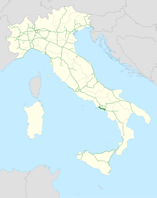
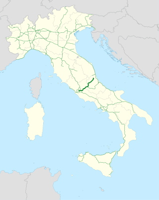
The Autostrada A3 is a motorway in Southern Italy, which runs from Naples to Salerno, in the region Campania.
Until 2017 the route was much longer, going after Salerno further south until Reggio Calabria; on this year, this section became part of the new A2 motorway and of its two spur routes.

<span class="mw-page-title-main">Autostrade of Italy</span> National Motorway System of Italy

The Autostrade are roads forming the Italian national system of motorways. The total length of the system is about 7,016 kilometres (4,360 mi), as of 30 July 2022. In North and Central Italy, the Autostrade mainly consists of tollways managed by Autostrade per l'Italia, a holding company controlled by Cassa Depositi e Prestiti. Other operators include ASTM, ATP, and Autostrade Lombarde in the north-west; Autostrada del Brennero, A4 Holding, Concessioni Autostradali Venete, and Autovie Venete in the north-east; Strada dei Parchi, SALT, SAT, and Autocisa in the center; and CAS in the south.

<span class="mw-page-title-main">Cremera</span> Italian stream connecting to the Tiber

The Cremera is a 36.7-kilometre (22.8 mi) Italian stream in Lazio which runs past Sacrofano, Formello, and Campagnano di Roma before falling into the Tiber about 10 kilometres (6 mi) north of Rome. It connects to the Tiber just as the Via Flaminia intersects the Grande Raccordo Anulare highway, on the proximity of the Labaro Roma Nord railway station, where there is an ancient Roman bridge. The identification with the Fosso della Valchetta is fixed as correct by the account in Livy ii. 49, which shows that the Saxa Rubra were not far off, and this we know to be the Roman name of the post station of Prima Porta, about 12 kilometres (7 mi) from Rome on the Via Flaminia. It is famous for the defeat of the three hundred Fabii, who had established a fortified post on its banks.

<span class="mw-page-title-main">Grande Raccordo Anulare</span> Road in Italy

The GRA or Grande Raccordo Anulare is a toll-free, ring-shaped 68.2 kilometres (42.4 mi) long orbital motorway that encircles Rome. GRA is one of the most important roads in Rome, and traffic reaches 160,000 vehicles per day as of 2011.

<span class="mw-page-title-main">Monterosi</span> Comune in Lazio, Italy

Monterosi is a comune (municipality) in the Province of Viterbo in the Italian region Lazio, located about 30 km (18,64 mi) north of the Grande Raccordo Anulare of Rome, about 40 km (24,85 mi) south of Viterbo.

<span class="mw-page-title-main">Autostrada A24 (Italy)</span>

The Autostrada A24, or Autostrada dei Parchi, is a motorway connecting Rome to Teramo. Starting at the Grande Raccordo Anulare, the A24 runs broadly north-east past L'Aquila and through a 10 km tunnel under the Gran Sasso before reaching Teramo. Strada dei Parchi S.p.A. currently manages the route.

<span class="mw-page-title-main">Ponte Galeria</span> Zona of Rome in Lazio, Italy

Ponte Galeria is the 41st zona of Rome, Italy, identified by the initials Z. XLI. Geographically it was part of Agro Romano. The zone belongs to the Municipio XI.

<span class="mw-page-title-main">Autostrada A13 (Italy)</span>

Autostrada A13 is an Italian motorway which connects Bologna to Padua, passing through Ferrara and Rovigo. It is 116.7 kilometres (72.5 mi) long. Near the two extremities of the track are situated two of the biggest Italian freight villages, in Bologna and Padua. Snow tyres are compulsory from 15 November to 15 April on the whole highway track, according to the Italian directives.

<span class="mw-page-title-main">Autostrada A15 (Italy)</span>

The A15 is an Italian autostrada (motorway) connecting Parma and La Spezia through the valleys of the Taro and Magra Rivers. The road is also known as Autostrada della Cisa because it crosses the Northern Apennines at the Cisa pass. The main 101-km expanse of the motorway connects the A1 with the A12, thus directly linking the Po Valley with the Italian Riviera and the Versilia region.

The GRAP is the orbital motorway surrounding Padua, northern Italy. It is also called Tangenziale di Padova.

<span class="mw-page-title-main">Transport in Rome</span> Roman public transit

Rome has an extensive internal transport system and is one of the most important road, rail and air hubs in Italy.

<span class="mw-page-title-main">Via Cristoforo Colombo</span>

Via Cristoforo Colombo is a street in Rome (Italy) that links the historic centre to Ostia. Along most of its route, the street has three lanes for each direction of movement. With its 27 kilometres (17 mi) length it is the longest Italian road among those included within the borders of a single municipality and, in several stretches, the largest in Italy.

<span class="mw-page-title-main">Rome Urbe Airport</span> Airport in Lazio, Italy

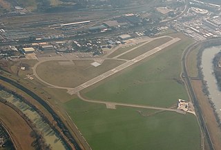
Rome Urbe Airport is a small civilian airport in Rome, situated in the northern part of the city, between Via Salaria and the Tiber River, about 2.7 NM inside the Greater Ring Road, the circular motorway around the city.

<span class="mw-page-title-main">Portuense</span> Quartiere of Rome in Lazio, Italy

<span class="mw-page-title-main">Metropolitan City of Rome Capital</span> Metropolitan city in Lazio, Italy

Metropolitan City of Rome Capital is an area of local government at the level of metropolitan city in the Lazio region of the Italian Republic. It comprises the territory of the city of Rome and 120 other municipalities (comuni) in the hinterland of the city. With more than 4.3 million inhabitants, it is the third largest metropolitan city in Italy.

<span class="mw-page-title-main">Strada statale 4 Via Salaria</span> Italian state highway

Strada statale 4 Via Salaria is an Italian state highway, linking Rome to the Adriatic sea passing through Rieti and Ascoli Piceno. Its route retraces that of the ancient Via Salaria Roman road. It is a single carriageway highway for most of its route.

<span class="mw-page-title-main">Rome–Fiumicino railway</span>

The Rome–Fiumicino railway is an urban railway line in Rome.

<span class="mw-page-title-main">Autostrada A34 (Italy)</span> Motorway in Italy

The Autostrada A34 is an Italian motorway that branches off of the A4 motorway at the Villesse junction going towards Gorizia. The motorway ends after 17 kilometers in Sant'Andrea / Vertoiba, where it continues as the H4 expressway in Slovenia. The highway is managed by Autovie Venete.

<span class="mw-page-title-main">Strada statale 4 dir</span> Italian state highway

Strada statale 4 Dir or SS 4 Dir or SS 4 Salaria Dir is a short Italian state highway, linking Strada statale 4 Via Salaria at Passo Corese to the A1 motorway at Fiano Romano.

References

  1. "Anas – Provvedimento del 13 ottobre 2008". Archived from the original on September 13, 2011.
  2. "Cronologia degli 80 anni dell'ANAS – a pagina 4".
  3. "Cronologia Anas tratta dal libro". Archived from the original on September 14, 2011.
  4. "Pedaggi autostrade". May 27, 2010. Archived from the original on December 25, 2011. Retrieved May 31, 2010.
  5. Decreto Legge numero 78 del 31 maggio 2010
  6. "Manovra finanziaria, il Testo pubblicato dalla Gazzetta Ufficiale" . Retrieved June 6, 2010.
  7. "Pedaggi: Tar Lazio, stop aumenti autostrade e Gra". July 29, 2010. Retrieved May 22, 2014.