Berchtesgaden is a municipality in the district Berchtesgadener Land, Bavaria, in southeastern Germany, near the border with Austria, 30 km (19 mi) south of Salzburg and 180 km (110 mi) southeast of Munich. It lies in the Berchtesgaden Alps, south of Berchtesgaden; the Berchtesgaden National Park stretches along three parallel valleys.
Berchtesgadener Land is a Landkreis (district) in Bavaria, Germany. It is bounded by the district of Traunstein and by the state of Austria.

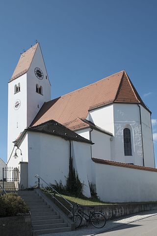
Petting is a municipality in the district Traunstein, Bavaria, Germany. It is located on the shore of the Waginger See, a diluvial lake.

Rosenheim is a city in Bavaria, Germany. It is an independent city located in the centre of the district of Rosenheim, and is also the seat of its administration. It is located on the west bank of the Inn at the confluence of the rivers Inn and Mangfall, in the Bavarian Alpine Foreland. It is the third largest city in Upper Bavaria with over 63,000 inhabitants. Rosenheim is the economic centre and the busiest place in the region.

Traunstein is a town in the south-eastern part of Bavaria, Germany, and is the administrative center of a much larger district of the same name. The town serves as a local government, retail, health services, transport and educational center for the wider district.

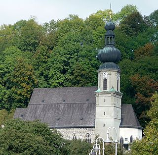
Piding is an approved climatic spa in Bavaria near to the border of Austria close to Bad Reichenhall and Freilassing.

Reit im Winkl is a small village located on the German/Austrian border in the southeastern part of Bavaria, Germany in the Traunstein district, and was previously an immigration and customs control point. It is situated south of Chiemsee and southwest of Ruhpolding – home of the Biathlon World Cup – in the Bavarian Alps and facing towards Tyrol. The village lies next to the Austrian states Tyrol and Salzburg. Kössen in Tyrol is the next village on the river Lofer, before it joins the confluence of the river Tiroler Achen. Reit im Winkl has a population of approximately 2,600.

Traunreut is a town in southeastern Bavaria, Germany in the Traunstein district. It is located at 47°58′N12°35′E. Traunreut lies in the heart of the Chiemgau region between Munich and Salzburg, approximately 10 km east of the Chiemsee, 25 km north of the Alps, and 35 km west of Salzburg. Its population is approximately 21,000. Companies present in the area include Siteco Beleuchtungstechnik GmbH, Dr. Johannes Heidenhain GmbH, Bosch and Siemens Household Appliances, BSH, and other midsize firms.

Hallein is a historic town in the Austrian state of Salzburg. It is the capital of Hallein district.

Bad Ischl is a spa town in Austria. It lies in the southern part of Upper Austria, at the river Traun in the centre of the Salzkammergut region. The town consists of the Katastralgemeinden Ahorn, Bad Ischl, Haiden, Jainzen, Kaltenbach, Lauffen, Lindau, Pfandl, Perneck, Reiterndorf and Rettenbach. It is connected to the village of Strobl by the river Ischl, which drains from the Wolfgangsee, and to the Traunsee, into which the stream empties. It is home to the Kaiservilla, summer residence of Austro-Hungarian monarchs Emperor Franz Joseph I and Empress Elisabeth. In 2024, Bad Ischl will be one of the European Capitals of Culture – the third city in Austria after Graz (2003) and Linz (2009).
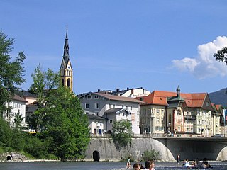
Bad Tölz is a town in Bavaria, Germany and the administrative center of the Bad Tölz-Wolfratshausen district.

Laufen is a town in Berchtesgadener Land district in Bavaria at the Austria–Germany border.
Trostberg is a town in the district of Traunstein, in Bavaria, Germany. It is situated on the river Alz, 19 km northwest of Traunstein. As with other 'old towns' in the region, it is a popular local tourist spot.
Tittmoning is a town in the district of Traunstein, in Bavaria, Germany.

Altaussee is a municipality and spa town in the district of Liezen in Styria, Austria. The small village is nestled on the shores of the Lake Altaussee, beneath the Loser Plateau. Occupying an area of 92 km², Altaussee is home to 1,777 people. The municipality includes two cadastral communities: Altaussee and Lupitsch. The designated climatic spa is within the Salzkammergut region. Altaussee has the biggest salt deposits of Austria, which are still mined today.

Bad Kleinkirchheim is a municipality and spa town in the district of Spittal an der Drau, in Carinthia, Austria.
Hurlach is a municipality in the district of Landsberg in Bavaria in Germany.

Waging am See is a municipality in the district of Traunstein in Bavaria, Germany. The town, classified as a climatic spa, is located at the Waginger See, the warmest lake in Upper Bavaria, with temperatures up to 27 °C.

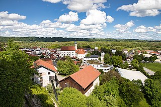
Siegsdorf is a municipality in the district of Traunstein in Bavaria, Germany.