
Banda is a city and a municipal board in Banda district in the state of Uttar Pradesh, India. Banda lies south of the Yamuna river in the Bundelkhand region. It is the administrative headquarters of Banda District. The town is well connected to major cities with railways and state highways. The town is near the right bank of the river Ken, 95 km south-west of Allahabad.

Chhatarpur is a city and a municipality in Chhatarpur district in the state of Madhya Pradesh, India. It is the administrative headquarters of Chhatarpur District.

Datia is the district headquarters of the Datia District in north central Madhya Pradesh, a state of Central India. It is an ancient town, mentioned in the Mahabharata ruled by King 'Dantavakra'. The town is 69 km from Gwalior, 325 km south of New Delhi and 320 km north of Bhopal. About 15 km from Datia is Sonagiri, a sacred Jain hill. Datia is also about 34 km from Jhansi, Uttar Pradesh and 52 km from Orchha. The nearest airport is at Gwalior. It was formerly the seat of the eponymous princely state in the British Raj. Datia is situated near Gwalior and on the border with Uttar Pradesh (U.P.).

Vidisha, anciently known as Besnagar, is a city in the state of Madhya Pradesh, India.

Bhind District is a district of Madhya Pradesh state in central India of Chambal division. The town of Bhind is the district headquarters. Bhind District is situated in Chambal region in the northwest of the state. The geographical coordinates of the district are Latitude 26°36' N and Longitude 78°46' E. It is bounded by Agra, Etawah, Jalaun and Jhansi districts of Uttar Pradesh state to the north and the east, and the Madhya Pradesh districts of Datia to the south, Gwalior to the southwest, and Morena to the west. The geography of the district is characterized by uneven ravines, plain fertile fields and scanty forests. The total area of the district is 4,459 km².

Lalitpur District is one of the districts of Uttar Pradesh state of India. Lalitpur district is a part of Jhansi Division. Lalitpur is the main town and administrative headquarters. The district occupies an area of 5,039 km².

Shivpuri District is a district of Madhya Pradesh state of India. The town of Shivpuri is the district headquarters.
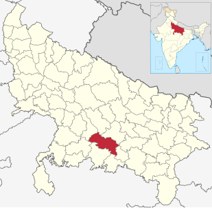
Mauranipur is a city and a municipal board in Jhansi district in the Indian state of Uttar Pradesh, India.Its headquarters is in Jhansi District. It is a textile production centre, known in ancient times as Madhupuri.

Kulpahar is a city in Mahoba district in the Indian state of Uttar Pradesh. It is a historical town in the Bundelkhand region. Before 11 Feb 1995 Kulpahar was a Tehsil of Hamirpur District. On 11 Feb 1995 Mahoba District was carved out of Hamirpur, and Kulpahar is now a part of the Mahoba District. Kulpahar is the largest Subdivision of Uttar Pradesh. Kulpahar is known for its closeness to Khajuraho and other historic places like Mahoba, Charkhari, Kalinjar Rath, Orchha, and Jhansi. This town holds relics of temples and man-made water bodies of the Chandela Dynasty.
Badagaon Dhasan is a town and a Nagar Parishad in Tikamgarh district in the state of Madhya Pradesh, India.
Chirgaon is a town and a municipal board in Jhansi district in the Indian state of Uttar Pradesh, India.

Dhoraji (pronunciation ) is a town situated on the banks of the River Safura, a tributary of the River Bhadar. It is a municipality in the Rajkot district in the state of Gujarat, India.
Pukhrayan is a town and a Municipality in Kanpur Dehat district in the Indian state of Uttar Pradesh. Found to the south-west of Mati on National Highway 25, Pukhrayan is 4 km from Bhognipur.

Jamod is a small town in Jalgaon Jamod taluka in Buldhana district of Maharashtra.

Samba is a city and municipal committee in Samba District in the Indian state of Jammu and Kashmir. Before the formation of Samba District, this town was part of Jammu District. The main industrial area of Bari Brahmana which used to fall under Jammu District has now been included as part of Samba District. The town has a long tradition of involvement in the Army.
Ganj Basoda, sometimes called Basoda, is a city of municipality in the Indian state of Madhya Pradesh. Ganj Basoda is one of the eleven tehsils of Vidisha district.
Alampur is a town and a nagar panchayat in Bhind district in the Indian state of Madhya Pradesh. It is a historical town. Alampur is known for its history, for the chhatri of Malhar Rao Holkar which is in Alampur.
Adikadalayi is a village situated 6 kilometers from Kannur town in Kannur district. It is a tourist area located near the village of Edakkad. It is in this village that the famous Kadalayi Sree Krishna Temple is situated. The temple attracts thousands of devotees from far and near. Adikadalayi Sri Krishna Temple is located in the heart of Adikadalayi.
Fatehpur District is one of the 75 districts of Uttar Pradesh state in northern India. The district covers an area of 4,152 km². The district has a population of 2,632,733. Fatehpur city is the administrative headquarters of the district. Located on the banks of the sacred rivers Ganges and Yamuna, Fatehpur was mentioned in the puranic literature. The ghats of Bhitaura and Asani were described as sacred in the puranas. Bhitaura, the site of the sage Bhrigu, was an important source of learning. Fatehpur district is a part of Allahabad division.
Palra is a village of Bangra Block, Mau Ranipur Tehsil, Jhansi district, in the state of Uttar Pradesh. It is located in the Bangra block of Jhansi. Bangara is 50 km from the district headquarters, namely, Jhansi on NH-76. The village of Palra is located 3 km to the north. The predominant caste is Thakur. Kuswaha and Dhobi are the other major groups who reside here. From palra village there is famous historical temple GAIRAHA TEMPLE which is coming under ASI and good place to see.


