The Cotswolds is a region in central South West England, along a range of rolling hills that rise from the meadows of the upper River Thames to an escarpment above the Severn Valley, Bath and Evesham Vale.

Oxfordshire is a ceremonial county in South East England. The county is bordered by Northamptonshire and Warwickshire to the north, Buckinghamshire to the east, Berkshire to the south, and Wiltshire and Gloucestershire to the west. The city of Oxford is the largest settlement and county town.
Bicester is a historical market town, garden town, and civil parish in the Cherwell district of northeastern Oxfordshire in south-central England that also comprises an eco town development at North West Bicester and a self-build village at Graven Hill. Its local market continues to thrive and is now located on Sheep Street, a very wide pedestrian zone in the conservation area of the town. Bicester is also known for Bicester Village, a nearby shopping centre.
Tilehurst is a suburb of the town of Reading in the county of Berkshire, England. It lies to the west of the centre of Reading; it extends from the River Thames in the north to the A4 road in the south.

Culham is a village and civil parish in a bend of the River Thames, 1 mile (1.6 km) south of Abingdon in Oxfordshire. The parish includes Culham Science Centre and Europa School UK. The parish is bounded by the Thames to the north, west and south, and by present and former field boundaries to the east. It is low-lying and fairly flat, rising from the Thames floodplain in the south to a north-facing escarpment in the north up to 260 feet (80 m) above sea level. The 2011 Census recorded its population as 453.

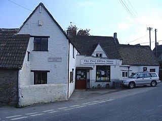
Northleach is a market town and former civil parish, now in parish Northleach with Eastington, in the Cotswold district, in Gloucestershire, England. The town is in the valley of the River Leach in the Cotswolds, about 10 miles (16 km) northeast of Cirencester and 11 miles (18 km) east-southeast of Cheltenham. The 2011 Census recorded the parish's population as 1,854, the same as Northleach built-up-area.

Ambrosden is a village and civil parish in Cherwell, Oxfordshire, England, 3 miles (5 km) southwest of Bicester to which it is linked by the A41 road, and 13 miles (21 km) from Oxford. The 2011 Census recorded the parish's population as 2,248. The parish is bounded by the River Ray to the south, its tributary the River Bure to the west, the outskirts of Bicester to the north and field boundaries to the east.

Headington is an eastern suburb of Oxford, England. It is at the top of Headington Hill overlooking the city in the Thames valley below, and bordering Marston to the north-west, Cowley to the south, and Barton and Risinghurst to the east. The life of the large residential area is centred upon London Road, the main road between London and Oxford.
Risinghurst is an outlying residential area of Oxford, England, just outside the Eastern Bypass Road which forms part of the Oxford ring road. It is about 1 mile (1.6 km) east of the centre of Headington and 3 miles (4.8 km) east of Oxford city centre. It is part of the Risinghurst and Sandhills civil parish and is typical of housing estates built between the wars to house an increasingly prosperous working class who were moving into new urban centres—in this instance to take advantage of the burgeoning motor industry in Oxford.
Luckington is a village and civil parish in the southern Cotswolds, in north-west Wiltshire, England, about 6+1⁄2 miles (10 km) west of Malmesbury. The village is on the B4040 road linking Malmesbury and Chipping Sodbury. The parish is on the county border with Gloucestershire and includes the village of Alderton and the hamlet of Brook End.

Ampney Crucis is a village and civil parish in the Cotswolds, part of the Cotswold District of Gloucestershire, England.

Berinsfield is an English village and civil parish in South Oxfordshire, about 7 miles (11 km) southeast of Oxford. The 2011 Census recorded the parish population as 2,806.

Bledington is a village and civil parish in the Cotswold district of Gloucestershire, England, about four miles southeast of Stow-on-the-Wold and six miles southwest of Chipping Norton. The population of the civil parish in 2014 was estimated to be 490.
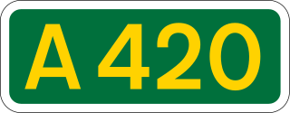
The A420 is a road between Bristol and Oxford in England. Between Swindon and Oxford it is a primary route.
The Oxford Ring Road circles the city of Oxford, England. It is a dual carriageway ring road for most of its length apart from a short section between Woodstock Road and Banbury Road in the north of the city. The severe restrictions on traffic in Oxford city centre mean that it is the only practical way for long-distance traffic to get past Oxford, especially as there are few road bridges over the rivers Isis and Cherwell. Five Park and Rides are close to the ring road.

Marsh Baldon is a village and civil parish about 5 miles (8 km) southeast of Oxford in Oxfordshire. Since 2012 it has been part of the Baldons joint parish council area, sharing a parish council with the adjacent civil parish of Toot Baldon. The 2011 Census population is 310.

Stanton St. John is a village and civil parish in Oxfordshire about 4.5 miles (7 km) northeast of the centre of Oxford. The village is 330 feet (100 m) above sea level on the eastern brow of a group of hills northeast of Oxford, in a slight saddle between two of the hills.

Hailey is a village and civil parish about 2 miles (3 km) north of Witney, Oxfordshire. The village comprises three neighbourhoods: Middletown on the main road between Witney and Charlbury, Poffley End on the minor road to Ramsden and Delly End on Whiting's Lane. The parish extends from the River Windrush in the south, almost to the village of Ramsden and the hamlet of Wilcote in the north, and it includes the hamlet of New Yatt. The 2011 Census recorded the parish's population as 1,208.

Taynton is a village and civil parish about 1+1⁄2 miles (2.4 km) northwest of Burford in West Oxfordshire. The village is on Coombe Brook, a tributary of the River Windrush. The parish is bounded in the south by the River Windrush, in the north partly by Coombe Brook and its tributary Hazelden Brook, in the west by the county boundary with Gloucestershire and in the east by field boundaries. The 2001 Census recorded the parish's population as 108.

Ampney Park is a 16th century manor house at Ampney Crucis, Gloucestershire, England. It is a Grade II listed building.