Beale Air Force Base, California (CDP)

Last updated
Beale AFB
Yuba County California Incorporated and Unincorporated areas Beale AFB Highlighted 0604576.svg
Location of Beale AFB in Yuba County, California
CountryUnited States
StateCalifornia
County Yuba
Area
[1]
  Total10.10 sq mi (26.17 km2)
  Land10.09 sq mi (26.14 km2)
  Water0.01 sq mi (0.03 km2)  0.10%
Elevation
[2]
197 ft (60 m)
Population
 (2020)
  Total1,303
  Density129.10/sq mi (49.85/km2)
Time zone UTC-8 (Pacific (PST))
  Summer (DST) UTC-7 (PDT)
GNIS feature ID2407813
U.S. Geological Survey Geographic Names Information System: Beale Air Force Base, California (CDP)

Beale Air Force Base is a census-designated place (CDP) covering the residential population of Beale Air Force Base in Yuba County, California, United States. Per the 2020 census, the population was 1,303. [3]

Contents

Demographics

Historical population
CensusPop.
2010 1,319
2020 1,303−1.2%
U.S. Decennial Census [4]
2020 [5]

2020 census

Beale AFB CDP, California – Demographic Profile
(NH = Non-Hispanic)
Race / EthnicityPop 2010 [6] Pop 2020 [5] % 2010% 2020
White alone (NH)86178465.28%60.17%
Black or African American alone (NH)109808.26%6.14%
Native American or Alaska Native alone (NH)2331.74%0.23%
Asian alone (NH)41493.11%3.76%
Pacific Islander alone (NH)830.61%0.23%
Some Other Race alone (NH)3170.23%1.30%
Mixed Race/Multi-Racial (NH)831526.29%11.67%
Hispanic or Latino (any race)19121514.48%16.50%
Total1,3191,303100.00%100.00%

Note: the US Census treats Hispanic/Latino as an ethnic category. This table excludes Latinos from the racial categories and assigns them to a separate category. Hispanics/Latinos can be of any race.

2010 Census

The 2010 United States Census [7] reported that Beale AFB had a population of 1,319. The population density was 131.1 inhabitants per square mile (50.6/km2). The racial makeup of Beale AFB was 949 (71.9%) White, 117 (8.9%) African American, 32 (2.4%) Native American, 45 (3.4%) Asian, 8 (0.6%) Pacific Islander, 50 (3.8%) from other races, and 118 (8.9%) from two or more races. Hispanic or Latino of any race were 191 persons (14.5%).

The Census reported that 1,319 people (100% of the population) lived in households, 0 (0%) lived in non-institutionalized group quarters, and 0 (0%) were institutionalized.

There were 382 households, out of which 289 (75.7%) had children under the age of 18 living in them, 330 (87.4%) were opposite-sex married couples living together, 26 (6.8%) had a female householder with no husband present, 10 (2.6%) had a male householder with no wife present. There were 0 (0%) unmarried opposite-sex partnerships, and 4 (3.78%) same-sex married couples or partnerships. 12 households (3.1%) were made up of individuals, and 0 (0%) had someone living alone who was 65 years of age or older. The average household size was 3.45. There were 370 families (96.9% of all households); the average family size was 3.53.

The population was spread out, with 577 people (43.7%) under the age of 18, 151 people (11.4%) aged 18 to 24, 538 people (40.8%) aged 25 to 44, 51 people (3.9%) aged 45 to 64, and 2 people (0.2%) who were 65 years of age or older. The median age was 23.3 years. For every 100 females, there were 98.9 males. For every 100 females age 18 and over, there were 93.7 males.

There were 843 housing units at an average density of 83.8 per square mile (32.4/km2), of which 2 (0.5%) were owner-occupied, and 380 (99.5%) were occupied by renters. The homeowner vacancy rate was 0%; the rental vacancy rate was 44.8%. 8 people (0.6% of the population) lived in owner-occupied housing units and 1,311 people (99.4%) lived in rental housing units.

Related Research Articles

West Athens, California Census-designated place in California, United States

West Athens is a census-designated place (CDP) in Los Angeles County, California. The population was 9,393 at the 2020 census. It is an unincorporated community within the 2nd Supervisorial District of Los Angeles County. West Athens is served by the Los Angeles County Sheriff's Department, operating out of the South Los Angeles Station. The approximate boundaries for West Athens are: 87th Street to the north, Vermont Avenue to the east, El Segundo Boulevard to the south, and approximately Western Avenue to Van Ness Avenue to the west. West Athens is predominantly residential, with commercial uses along its main corridors. Los Angeles Southwest Community College lies within the West Athens neighborhood and city limits.

West Rancho Dominguez, California Census designated place in California, United States

West Rancho Dominguez, formerly known as West Compton, is an unincorporated census-designated place (CDP) located in southern Los Angeles County, California. Per the 2020 census, the population was 24,347. The community lies to the west of the city of Compton. The ZIP Codes encompassing the CDP area are 90220 & 90248.

Madera Acres, California Census-designated place in California, United States

Madera Acres is a census-designated place (CDP) in Madera County, California, United States. It is part of the Madera Metropolitan Statistical Area. The population was 9,162 at the 2020 census, virtually unchanged from 2010.

Parksdale, California Census-designated place in California, United States

Parksdale is a census-designated place (CDP) in Madera County, California, United States. It is part of the Madera Metropolitan Statistical Area. The population was 3,234 at the 2020 census, up from 2,621 in 2010.

Parkwood, California Census-designated place in California, United States

Parkwood is a census-designated place (CDP) in Madera County, California, United States. It is part of the Madera Metropolitan Statistical Area. The population was 2,307 at the 2020 census.

Tamalpais-Homestead Valley, California Census-designated place in California, United States

Tamalpais-Homestead Valley is a census-designated place (CDP) in Marin County, California, United States. The population was 11,492 at the 2020 census.

Bootjack, California Census-designated place in California, United States

Bootjack is an unincorporated community and census-designated place in Mariposa County, California, United States. The population was 661 at the 2020 census, down from 960 in 2010 and 1,588 in 2000, largely due to reductions in the area of the CDP.

Camp Pendleton Mainside, California Census-designated place in California, United States

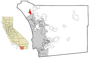
Camp Pendleton Mainside is a census-designated place (CDP) in San Diego County, California, located at the southeast corner of the Marine Corps Base Camp Pendleton. Per the 2020 census, the population was 9,683. It was formerly known as Camp Pendleton North, but its name was changed for the 2020 Census. Along with Camp Pendleton South, it is one of two CDPs located on the base.

Ahwahnee, California Census-designated place in California, United States

Ahwahnee is a census-designated place in Madera County, California, United States. It is located 5.25 miles (8.4 km) west of Yosemite Forks, at an elevation of 2,326 feet (709 m). The population was 2,296 at the 2020 census.

Bass Lake, California Census-designated place in California, United States

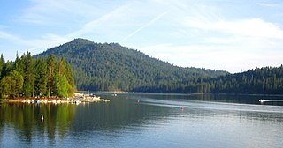
Bass Lake is a census-designated place in Madera County, California, United States. It is located 4.5 miles (7.2 km) southeast of Yosemite Forks, at an elevation of 3,415 feet (1,041 m). The population was 575 at the 2020 census.

La Vina, California Census-designated place in California, United States

La Vina is a census-designated place in Madera County, California, United States. It is located 8 miles (13 km) by road south-southwest of Madera, at an elevation of 230 feet (70 m). The population was 637 at the 2020 census, up from 279 in 2010.

Rolling Hills is an unincorporated community and census-designated place (CDP) in Madera County, California, United States, north of Fresno on State Route 41. It lies at an elevation of 371 feet (113 m). The population was 793 at the 2020 census.

Kingvale, California Census-designated place in California, United States

Kingvale is a census-designated place (CDP) in Placer County and Nevada County, California, United States. The CDP straddles the border of the two counties, with Nevada County to the north and Placer County to the south. It is located near Soda Springs, 5.5 mi (8.9 km) west of Donner Pass. Kingvale was listed on an official map as of 1955. The population was 143 at the 2010 census.

Yosemite Lakes Park, California Census-designated place in California, United States

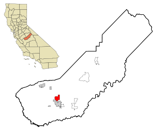
Yosemite Lakes Park is an unincorporated community in Madera County, California. It lies at an elevation of 1,230 feet (370 m). As a census-designated place (CDP) it is known as Yosemite Lakes. It is part of the Madera Metropolitan Statistical Area. The population was 5,022 at the 2020 census.

Greeley Hill, California Census-designated place in California, United States

Greeley Hill is a census-designated place in Mariposa County, California, United States. Greeley Hill sits at an elevation of 3,153 feet (961 m) in the foothills of the Sierra Nevada. The 2020 United States census reported Greeley Hill's population as 927.

Lake Don Pedro, California Census-designated place in California, United States

Lake Don Pedro is a census-designated place (CDP) in Mariposa County, California. The community sits at an elevation of 1,122 feet (342 m). As of the 2020 United States census, the population was 1,765.

Andrews Air Force Base is a census-designated place (CDP) covering the residential population of Andrews Air Force Base/Joint Base Andrews, in Prince George's County, Maryland, Maryland, United States. The population at the 2020 Census was 3,025.

Edwards Air Force Base is a census-designated place (CDP) covering the residential population of Edwards Air Force Base in Kern County, California, United States. Per the 2020 census, the population was 2,135.

Lackland Air Force Base CDP is a census-designated place (CDP) covering the permanent residential population of the Lackland Air Force Base in Bexar County, Texas, United States. Per the 2020 census, the population was 9,467.

Laughlin Air Force Base, Texas (CDP) Census-designated place in Texas, United States

Laughlin Force Base CDP is a census-designated place (CDP) covering the permanent residential population of the Laughlin Air Force Base in Val Verde County, Texas, United States. Per the 2020 census, the population was 1,673.

References

  1. "2020 U.S. Gazetteer Files". United States Census Bureau. Retrieved October 30, 2021.
  2. "Beale Air Force Base". Geographic Names Information System . United States Geological Survey.
  3. "Beale AFB CDP, California". United States Census Bureau . Retrieved May 14, 2022.
  4. "Decennial Census of Population and Housing by Decades". US Census Bureau.
  5. 1 2 "P2 HISPANIC OR LATINO, AND NOT HISPANIC OR LATINO BY RACE – 2020: DEC Redistricting Data (PL 94-171) – Beale AFB CDP, California". United States Census Bureau .
  6. "P2 HISPANIC OR LATINO, AND NOT HISPANIC OR LATINO BY RACE – 2010: DEC Redistricting Data (PL 94-171) – Beale AFB CDP, California". United States Census Bureau .
  7. "2010 Census Interactive Population Search: CA – Beale AFB CDP". U.S. Census Bureau. Archived from the original on 15 July 2014. Retrieved 12 July 2014.