Bel'kopa

Last updated

Coordinates: 50°04′19″N59°35′08″E / 50.07194°N 59.58556°E / 50.07194; 59.58556

Geographic coordinate system Coordinate system

A geographic coordinate system is a coordinate system that enables every location on Earth to be specified by a set of numbers, letters or symbols. The coordinates are often chosen such that one of the numbers represents a vertical position and two or three of the numbers represent a horizontal position; alternatively, a geographic position may be expressed in a combined three-dimensional Cartesian vector. A common choice of coordinates is latitude, longitude and elevation. To specify a location on a plane requires a map projection.

Bel'kopa
Белқопа
Белкопа
بەلقوپا
Kazakhstan adm location map.svg
Red pog.svg
Bel'kopa
Coordinates: 50°04′19″N59°35′08″E / 50.07194°N 59.58556°E / 50.07194; 59.58556
CountryFlag of Kazakhstan.svg  Kazakhstan
Region Aktobe
Elevation 307 m (1,007 ft)
Time zone West Kazakhstan Time (UTC+5)
  Summer (DST) West Kazakhstan Time (UTC+5)

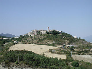
Bel'kopa (also known as Belkopa [1] (Russian : Белкопа, Belkopa, Kazakh : Белқопа, Belqopa, بەلقوپا)) is a town in Aktobe Region, west Kazakhstan. It lies at an altitude of 307 m (1,007 ft). [1]

Russian language East Slavic language

Russian is an East Slavic language, which is official in the Russian Federation, Belarus, Kazakhstan and Kyrgyzstan, as well as being widely used throughout Eastern Europe, the Baltic states, the Caucasus and Central Asia. It was the de facto language of the Soviet Union until its dissolution on 25 December 1991. Although, nowadays, nearly three decades after the breakup of the Soviet Union, Russian is used in official capacity or in public life in all the post-Soviet nation-states, as well as in Israel and Mongolia, the rise of state-specific varieties of this language tends to be strongly denied in Russia, in line with the Russian World ideology.

Kazakh language Turkic language

Kazakh or Kazak belongs to the Kipchak branch of the Turkic languages. It is closely related to Nogai, Kyrgyz, and Karakalpak. Kazakh is the official language of the Republic of Kazakhstan and a significant minority language in the Ili Kazakh Autonomous Prefecture in Xinjiang, China and in the Bayan-Ölgii Province of Mongolia. Kazakh is also spoken by many ethnic Kazakhs through the former Soviet Union, Afghanistan, Iran, Turkey, and Germany.
Aktobe Region Region in Kazakhstan

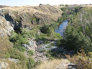
Aktobe Region is a region of Kazakhstan. The Aktobe regional capital is the city of Aktobe, with a population of more than 340,000. The region itself has a population 678,900. The name "Aktobe" comes from Kazakh "Ақ" (white) and "төбе" (hill); supposedly, Aktobe's initial settlers were able to see white mountains far to the north.

Related Research Articles

European route E22 European road route from Wales to Russia

The European route E 22 is one of the longest European routes. It has a length of about 5,320 km (3,310 mi). Many of the E-roads have been extended into Asia since the year 2000; the E 22 was extended on 24 June 2002.

Artieda Place in Aragon, Spain

Artieda is a municipality located in the province of Zaragoza, Aragon, Spain. According to the 2004 census (INE), the municipality has a population of 107 inhabitants.

Budzów, Lower Silesian Voivodeship Village in Lower Silesian, Poland

Budzów is a village in the administrative district of Gmina Stoszowice, within Ząbkowice Śląskie County, Lower Silesian Voivodeship, in south-western Poland. Prior to 1945 it was in Germany.

Bartaz Place in Zangilan, Azerbaijan

Bartaz is a village in the Zangilan Rayon of Azerbaijan.

Góry Kluczkowickie Village in Lublin, Poland

Góry Kluczkowickie is a village in the administrative district of Gmina Opole Lubelskie, within Opole Lubelskie County, Lublin Voivodeship, in eastern Poland. It lies approximately 10 kilometres (6 mi) south of Opole Lubelskie and 50 km (31 mi) south-west of the regional capital Lublin.

Stawy, Świętokrzyskie Voivodeship Village in Świętokrzyskie, Poland

Stawy is a village in the administrative district of Gmina Imielno, within Jędrzejów County, Świętokrzyskie Voivodeship, in south-central Poland. It lies approximately 2 kilometres (1 mi) east of Imielno, 14 km (9 mi) south-east of Jędrzejów, and 35 km (22 mi) south of the regional capital Kielce.

Chańcza, Świętokrzyskie Voivodeship Village in Świętokrzyskie, Poland

Chańcza is a village in the administrative district of Gmina Raków, within Kielce County, Świętokrzyskie Voivodeship, in south-central Poland. It lies approximately 4 kilometres (2 mi) south-east of Raków and 42 km (26 mi) south-east of the regional capital Kielce.

Wielka Wieś, Starachowice County Village in Świętokrzyskie, Poland

Wielka Wieś is a village in the administrative district of Gmina Wąchock, within Starachowice County, Świętokrzyskie Voivodeship, in south-central Poland. It lies approximately 2 kilometres (1 mi) west of Wąchock, 7 km (4 mi) north-west of Starachowice, and 34 km (21 mi) north-east of the regional capital Kielce.

Budy, Krotoszyn County Village in Greater Poland, Poland

Budy is a village in the administrative district of Gmina Rozdrażew, within Krotoszyn County, Greater Poland Voivodeship, in west-central Poland. It lies approximately 6 kilometres (4 mi) north-east of Rozdrażew, 18 km (11 mi) north-east of Krotoszyn, and 80 km (50 mi) south-east of the regional capital Poznań.

Sherman Acres, California Unincorporated community in California, United States

Sherman Acres is an unincorporated community in Calaveras County, California. It lies at an elevation of 7008 feet.

Khelvachauri Municipality Place in Adjara, Georgia

Khelvachauri is a district of Georgia, in the autonomous republic of Adjara. Its main town is Khelvachauri.

Manakhah District District in Sanaa, Yemen

Manakhah District is a district of the Sana'a Governorate, Yemen. As of 2003, the district had a population of 78,932 inhabitants.

Hassi Dahou is a town and commune in Sidi Bel Abbès Province in northwestern Algeria.

Rosengård Centrum Neighbourhood in Skåne County, Skåne, Sweden

Rosengård Centrum is a neighbourhood of Malmö, situated in the Borough of Rosengård, Malmö Municipality, Skåne County, Sweden. It has a shopping center, which opened in 1971.

Lake Kopa

Kopa Lake is a lake in the town of Kokshetau, located in the Akmola Region of Kazakhstan.

Prilepec is a village in Municipality of Prilep.

Alimbetovka Place in Aktobe, Kazakhstan

Alimbetovka is a town in Aktobe Region, west Kazakhstan. It lies at an altitude of 346 m (1,135 ft). It lies just a few kilometres from the Russian border.

Aqqaytym Place in Aktobe, Kazakhstan

Aqqaytym is a town in Aktobe Region, west Kazakhstan. It lies at an altitude of 171 m (561 ft).

Bimmah Sinkhole

Bimmah Sinkhole is a water-filled depression, structurally a sinkhole, in the limestone of eastern Muscat Governorate in the Sultanate of Oman. A lake of turquoise waters, it is 50 m by 70 m wide and approximately 20 m deep. It is only about 600 m away from the sea, between the coastal towns of Ḑibāb and Bimmah. The sinkhole was formed by a collapse of the surface layer due to dissolution of the underlying limestone. However, locals believe that it was created by a meteorite, ‘Hawaiyat Najm’, which translates to ‘The Falling Star’ in Arabic, and hence the name.

Bogetsay Place in Aktobe, Kazakhstan

Bogetsay is a town in Aktobe Region, west Kazakhstan. It lies at an altitude of 270 m (890 ft).

References

  1. 1 2 "Bel'kopa, Kazakhstan - P PPL 610342". GeoNames . Retrieved October 4, 2016.