La Jonquera is a municipality in the comarca of l'Alt Empordà, in Catalonia, Spain. It is situated next to the border with Northern Catalonia, nowadays France, opposite the municipality of Le Perthus.

The Vall de Boí is a narrow, steep-sided valley and a small municipality in the province of Lleida, in the autonomous community of Catalonia, northern Spain. It lies in the northeastern corner of the comarca of Alta Ribagorça, on the edges of the Pyrenees. It is the largest municipality of the region, with its main town being Barruera.

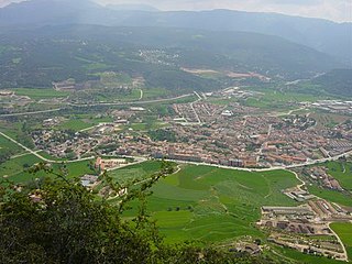
La Bisbal d'Empordà is the county seat of the comarca of Baix Empordà in Catalonia, Spain. The town lies 29 km southeast of Girona, 12 km west of Palafrugell and 19 km northwest of Palamós along road C-66 from Girona to Palafrugell/Palamós, where it becomes C-31. Two other roads branch off at La Bisbal, GI-660 to Calonge and Sant Feliu de Guíxols and GI-664 to Cassà de la Selva; both roads cross the hilly coastal range called the Gavarres, with many twists and turns. The municipality lies on the northern edge of the Gavarres, on either side of the Daró river-bed, a dry tributary of River Ter.

Santa Coloma de Farners is a spa town and capital of the comarca of the Selva, in Catalonia, Spain, and of the judicial district of Santa Coloma. It is situated on the edge of the Selva Depression and of the Guilleries. The local economy is mainly commercial, given the status of the town as capital of the comarca, although summer tourism, agriculture and forestry products also contribute. The urban centre is to the north and west of the main modern communication routes, although the C-253 road links the town with the main N-II route and the AP-7 autopista and to the RENFE railway station at Sils (10 km). The GE-533 runs through the northern part of the municipality, linking it with Vic to the west and with Riudellots de la Selva, Vilobí d'Onyar and Girona-Costa Brava Airport to the east.
Santa Maragarida de Montbui is a municipality in the comarca of the Anoia in Catalonia, Spain. It is situated in the Òdena Basin, immediately to the west of Igualada of which it effectively forms a suburb. The ajuntament is in Sant Maure. Other neighbourhoods in Montbui are the Old Town, el Saió-Coll del Guix and La Mallola.

Bassella is a municipality in the comarca of the Alt Urgell, in Catalonia, Spain. The village of Bassella, one of nine settlement which make up the municipality, is located at the confluence of the Segre river with the Salada river and at the point where the route from Solsona and the potash mines of Cardona meets the route between Lleida and La Seu d'Urgell. The ajuntament is located in Castellnou de Bassella.
Ponts is a municipality and a town in the comarca of the Noguera in the province of Lleida, Catalonia, Spain. It is situated on the left bank of the Segre river near its confluence with the Llobregós river and at the point where the routes from Calaf and Cervera meet the route from Lleida to La Seu d'Urgell.

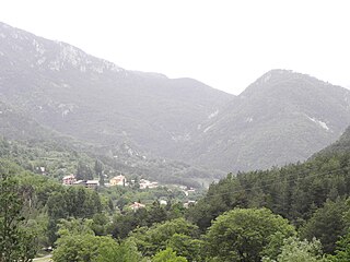
Cantallops is a municipality in the comarca of the Alt Empordà in Girona, Catalonia, Spain. It is situated below the Albera Range, and is linked to La Jonquera by the GI-601 road.
La Coma i la Pedra is a municipality in the comarca of the Solsonès in Catalonia, Spain. It is situated in the Lord valley in the north of the comarca. The Cardener river has its source in the territory of the municipality. The local economy is traditionally based on livestock raising, although there is also a ski resort in the pyrenean massif of Port del Comte and a power station at Gafa. Local roads link the municipality with Sant Llorenç de Morunys and Josa i Tuixén.

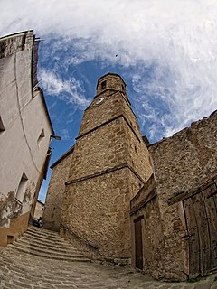
Coll de Nargó is a municipality in the comarca of the Alt Urgell in Catalonia, a region of Spain. It is situated in the Segre valley by the Oliana reservoir. The municipality is served by the C-14 road between Ponts and La Seu d'Urgell, the L-511 road to Isona and the L-401 road to Sant Llorenç de Morunys. The Romanesque church of Sant Climent dates from the eleventh century, and has a rectangular pre-Romanesque bell-tower.

Castellar de n'Hug is a municipality in the comarca of the Berguedà in Catalonia, Spain. It is situated on the southern slopes of the pyrenean range of the Creueta. The Llobregat river has its source on the territory of the municipality. The village is served by the B-403 road, which links it with La Pobla de Lillet and which continues over the Creueta to the comarques of the Ripollès and the Cerdanya.

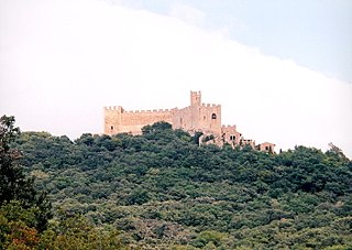
Santa Maria de Besora is a municipality in the comarca of Osona in Catalonia, Spain. It is situated on the north side of the Bellmunt range in the north of the comarca. It is linked to Sant Quirze de Besora and to Vidrà by a local road. Besora castle has an eleventh-century Romanesque church: there is also a preroman chapel at Sant Moí. Santa Maria de Besora became part of Osona in the comarcal revision of 1990: previously it formed part of the Ripollès.
Centelles is a municipality in the comarca of Osona in Catalonia, Spain. It is situated in the upper valley of the Congost River in the south of the comarca. The municipality is served by the C-17 road. The renowned urban planner Ildefons Cerdà was born here.
Pardines is a municipality in the comarca of Ripollès, province of Girona, Catalonia, Spain.

Lluçà is a municipality in the comarca of Osona in Catalonia, Spain. It is subdivided into the town of Santa Eulàlia de Puigoriol, and the much smaller village of Lluçà. This village, prominent because of its monastery, gives its name to the surrounding natural comarca of Lluçanès.

Prats i Sansor is a municipality in the comarca of Cerdanya, province of Lleida, Catalonia, Spain. It is composed by four villages, Prats, Sansor, Capdevila and El Pla.

Guils de Cerdanya is a municipality in the comarca of Cerdanya, province of Girona, Catalonia, Spain.

Meranges is a village in the comarca of Cerdanya, province of Girona, Catalonia, north-eastern Spain.

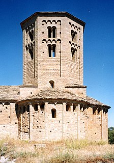
The Churches of the Vall de Boí are a set of nine Early Romanesque churches declared World Heritage Site by UNESCO and located in the Vall de Boí, in the Catalan comarca of Alta Ribagorça.

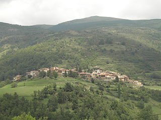
Santa Eugènia de Nerellà is a hamlet located in the municipality of Bellver de Cerdanya, in Province of Lleida province, Catalonia, Spain. As of 2020, it has a population of 18.