The A5117 is a road in Cheshire, England. It runs between Shotwick (53.2374°N 2.9875°W) and Helsby (53.2613°N 2.7814°W) and connects the A550 at Woodbank to the M56. As such it forms a northerly bypass to Chester and a shorter route between the North West and North Wales than the A55. The road is dualled west of the M56. There is roundabout with the A540 and at Dunkirk at the western terminus of the M56. East of the junction the road is single carriageway and crosses the A41 by way of a roundabout at Backford Cross. The A5117 intersects the M53 at Junction 10. This junction is just east of Cheshire Oaks Designer Outlet. The road then continues almost parallel to the M56, which it intersects at Junction 14, at which there is a Motorway service area. The road then continues south east to terminate where it joins the A56 at Helsby.

Keisei Koiwa Station is a train station located in Edogawa, Tokyo, Japan.
The Chanousia Alpine Botanical Garden is an alpine botanical garden located at 2170 meters altitude near Mont Blanc, at the Little St Bernard Pass, in the Italian commune of La Thuile. It was founded by Valdostan abbot and botanist Pierre Chanoux. It is open daily in the warmer months.
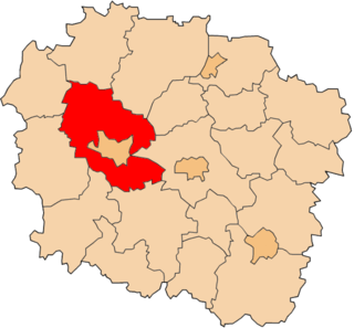
Trzebień is a village in the administrative district of Gmina Dobrcz, within Bydgoszcz County, Kuyavian-Pomeranian Voivodeship, in north-central Poland.
Potarzyca is a village in the administrative district of Gmina Krobia, within Gostyń County, Greater Poland Voivodeship, in west-central Poland.
Płecno is a village in the administrative district of Gmina Czersk, within Chojnice County, Pomeranian Voivodeship, in northern Poland.
Polana is a village in the administrative district of Gmina Czersk, within Chojnice County, Pomeranian Voivodeship, in northern Poland.
Turze is a village in the administrative district of Gmina Pyrzyce, within Pyrzyce County, West Pomeranian Voivodeship, in north-western Poland.

Nučice is a village and municipality in Prague-East District in the Central Bohemian Region of the Czech Republic.
Juscimeira is a municipality in the state of Mato Grosso in the Central-West Region of Brazil.
Podgora (Fojnica) is a village in the municipality of Fojnica, Bosnia and Herzegovina.
Kızılyer is a village in the District of Feke, Adana Province, Turkey.
Avédjin is an arrondissement in the Kouffo department of Benin. It is an administrative division under the jurisdiction of the commune of Toviklin. According to the population census conducted by the Institut National de la Statistique Benin on February 15, 2002, the arrondissement had a total population of 2,869.
Doko is an arrondissement in the Kouffo department of Benin. It is an administrative division under the jurisdiction of the commune of Toviklin. According to the population census conducted by the Institut National de la Statistique Benin on February 15, 2002, the arrondissement had a total population of 11,412.
Houédogli is an arrondissement in the Kouffo department of Benin. It is an administrative division under the jurisdiction of the commune of Toviklin. According to the population census conducted by the Institut National de la Statistique Benin on February 15, 2002, the arrondissement had a total population of 11,688.
Missinko is an arrondissement in the Kouffo department of Benin. It is an administrative division under the jurisdiction of the commune of Toviklin. According to the population census conducted by the Institut National de la Statistique Benin on February 15, 2002, the arrondissement had a total population of 6,422.
Tannou-Gola is an arrondissement in the Kouffo department of Benin. It is an administrative division under the jurisdiction of the commune of Toviklin. According to the population census conducted by the Institut National de la Statistique Benin on February 15, 2002, the arrondissement had a total population of 5,893.

Nahr-e Saleh is a village in Jaffal Rural District, in the Central District of Shadegan County, Khuzestan Province, Iran. At the 2006 census, its population was 295, in 53 families.
Monegaw Township is an inactive township in St. Clair County, in the U.S. state of Missouri.
Walker Township is a township in Vernon County, in the U.S. state of Missouri.


