The Saskatchewan Rivers School Division #119 comprises 33 schools in the Prince Albert, Saskatchewan area, and is the third largest school division in the province. This division has over 9500 students enrolled, with 365 support personnel, 475 teachers, and 88 division owned buses. There are a total of 14 microwave towers in the rural centres of the district, which ensure that rural students have access to high speed networking. There are six community schools, and three schools providing French immersion. A police liaison program is provided in the urban centre where the officer has a school office. This division contains the largest high school in Saskatchewan: Carlton Comprehensive High School. The division is located mainly in the Aspen parkland and boreal forest biomes, and is named for the North Saskatchewan, South Saskatchewan, and Saskatchewan Rivers which are all found in the area it encompasses.

The District of Saskatchewan was a regional administrative district of Canada's Northwest Territories. It was formed in 1882 was later enlarged then abolished with the creation of the provinces of Saskatchewan and Alberta in 1905.

See also Batoche and Batoche

Birch Hills is a town located in Saskatchewan, Canada. It is located southeast of Prince Albert and the reserve of Muskoday First Nation. Directly to the west is the village of St. Louis, and to the east is Kinistino. It is surrounded by, but not part of, Birch Hills Rural Municipality No. 460.
Highway 25 is a provincial highway in the Canadian province of Saskatchewan. It is 27 km (17 mi) long and runs from Highway 2 in St. Louis to Highway 3 near Birch Hills. The highway is a gravel road except for small paved sections near the eastern and western terminuses.
Birch Hills Airport,, is located adjacent to Birch Hills, Saskatchewan, Canada. The airport officially opened on June 5, 1994 and is equipped with radio controlled lighting, lighted wind sock, rotating beacon, security fence and a spray pad to accommodate spray planes.
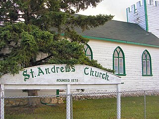
Halcro or St. Andrew's is a district in Saskatchewan, Canada north of St. Louis and south of Prince Albert. Adjacent to the South Saskatchewan River, it was initially settled by Anglo-Metis from Manitoba in the 1870s. Halcro is located in the aspen parkland biome.

Division No. 15 is one of eighteen census divisions in the province of Saskatchewan, Canada, as defined by Statistics Canada. It is located in the north-central part of the province. The most populous community in this division is Prince Albert.
Highway 3 is a major provincial paved undivided highway in the Canadian province of Saskatchewan. It runs from the Alberta border, where it continues west as Alberta Highway 45, to the Manitoba border, and then continues east as Highway 77. Highway 3 is about 615 km (382 mi.) long. The CanAm Highway comprises Saskatchewan Highways 35, 39, 6, 2, as well as 2. 59.7 miles (96.1 km) of Saskatchewan Highway 3 contribute to the CanAm Highway between Melfort and Prince Albert.
Highway 913 is a highway in the Canadian province of Saskatchewan. It runs from Highway 120 to Highway 106. Highway 106 is commonly called the Hanson Lake Highway. The southern terminus is 9.9 kilometers north of Candle Lake Provincial Park, and the north terminus is within the Narrow Hills Provincial Park and 15.2 kilometers north from the Narrow Hills Provincial Park campground area. Highway 913 is about 65.1 kilometres (40.5 mi) long. Highway 913 also connects with Highway 963. Traveling 41.2 kilometres is a concurrency with Highway 912 for 5 kilometres. Highway 913 is gravel its whole length.
Highway 20 is a major road intended for travel by the public between Highway 11 Lumsden to Highway 3 at Birch Hills. Saskatchewan's main roadways are located in the central/southern geographical land area of rolling prairie and grass land in a western Canadian prairie province. This highway is one which runs south to north and is located just east of Saskatoon and just north of Regina. At the northern extremity near Lanigan, the highway helps to service the PCS Lanigan potash mining operation. Down south, the highway is popular for tourists heading out to the Qu'Appelle Valley and resorts and beaches of Last Mountain Lake.
Birch Hills No. 460 is a rural municipality in north-central Saskatchewan, Canada within census division 15. It is located southeast of Prince Albert on Highway 3, and north of Saskatoon. The R.M. is within the Saskatchewan Rivers School Division No. 119.
Carmichael is a special service area within the Rural Municipality of Carmichael No. 109, Saskatchewan, Canada that held village status prior to 2019. The population was 58 at the 2016 Census. Carmichael lies 1 km (1 mi) south of Highway 1 commonly known as the Trans Canada Highway, approximately 158 km (98 mi) east of city of Medicine Hat, Alberta.
Jumping Lake is a lake a short distance south of Birch Hills, Saskatchewan, Canada. It is a small freshwater lake popular locally for migratory bird hunting, and fishing. In addition to being a stopping point for migrating geese and ducks, the lake is home to a population of walleye which occasionally suffer from winterkill. In the mid decades of the twentieth century a beach and recreational facilities existed at the lake frequented by area locals, but these have since been abandoned. The village of Waitville, Saskatchewan was also once found at the eastern edge of the lake which has disappeared for the most part. The countryside surrounding Jumping Lake is typical of the aspen parkland biome of which it is a part.
Fenton, formerly Adams Crossing, is an unincorporated community southeast of Prince Albert, Saskatchewan, Canada. It is a short distance, 13 km west from Birch Hills, Saskatchewan. Fenton is on the banks of the South Saskatchewan River east of Halcro, Saskatchewan and southwest of the Muskoday First Nation. The Fenton Ferry is operational seasonally and hosts mainly local traffic. Fenton has a long history dating back to Anglo-Metis settlement before the Northwest Rebellion. It is situated in the Aspen parkland biome. The Adams' still live on the family homestead, with Lynn Adams being the latest generation as of 2010.
The Meadow Lake Tribal Council (MLTC) is a tribal council representing nine First Nation band governments in the province of Saskatchewan. The council is based in Meadow Lake, Saskatchewan.
Medstead No. 497 is a rural municipality in the Canadian province of Saskatchewan. The municipality is located in Census Division 16 which is a part of SARM Division 6. The seat of the municipality is located in the Village of Medstead.
The Muskoday Bridge is a Canadian traffic bridge that spans the South Saskatchewan River dividing the Muskoday First Nation reserve; the bridge was completed on October 21, 1970. The bridge carries Saskatchewan Highway 3 linking Prince Albert, Saskatchewan with Birch Hills, Saskatchewan.
John Richard Parish Taylor was an English-born political figure in Saskatchewan. He represented Kinistino from 1917 to 1925 and from 1933 to 1944 in the Legislative Assembly of Saskatchewan as a Liberal.

Birch Narrows Dene Nation is a Dene First Nation band government in the boreal forest region of northern Saskatchewan, Canada.