Kiślaki is a village in the administrative district of Gmina Tykocin, within Białystok County, Podlaskie Voivodeship, in north-eastern Poland. It lies approximately 5 kilometres (3 mi) north-west of Tykocin and 33 km (21 mi) north-west of the regional capital Białystok.
Klonowa Góra is a village in the administrative district of Gmina Bakałarzewo, within Suwałki County, Podlaskie Voivodeship, in north-eastern Poland. It lies approximately 5 kilometres (3 mi) east of Bakałarzewo, 15 km (9 mi) west of Suwałki, and 114 km (71 mi) north of the regional capital Białystok.
Hańcza is a village in the administrative district of Gmina Przerośl, within Suwałki County, Podlaskie Voivodeship, in north-eastern Poland. It lies approximately 9 kilometres (6 mi) east of Przerośl, 23 km (14 mi) north-west of Suwałki, and 131 km (81 mi) north of the regional capital Białystok.
Iwaniszki is a village in the administrative district of Gmina Przerośl, within Suwałki County, Podlaskie Voivodeship, in north-eastern Poland. It lies approximately 7 kilometres (4 mi) east of Przerośl, 21 km (13 mi) north-west of Suwałki, and 127 km (79 mi) north of the regional capital Białystok.
Kolonia Przerośl is a village in the administrative district of Gmina Przerośl, within Suwałki County, Podlaskie Voivodeship, in north-eastern Poland.
Kruszki is a village in the administrative district of Gmina Przerośl, within Suwałki County, Podlaskie Voivodeship, in north-eastern Poland. It lies approximately 9 kilometres (6 mi) east of Przerośl, 20 km (12 mi) north-west of Suwałki, and 127 km (79 mi) north of the regional capital Białystok.
Morgi is a village in the administrative district of Gmina Przerośl, within Suwałki County, Podlaskie Voivodeship, in north-eastern Poland. It lies approximately 13 kilometres (8 mi) south-east of Przerośl, 15 km (9 mi) north-west of Suwałki, and 121 km (75 mi) north of the regional capital Białystok.
Prawy Las is a village in the administrative district of Gmina Przerośl, within Suwałki County, Podlaskie Voivodeship, in north-eastern Poland. It lies approximately 7 kilometres (4 mi) north-east of Przerośl, 26 km (16 mi) north-west of Suwałki, and 133 km (83 mi) north of the regional capital Białystok.
Przełomka is a village in the administrative district of Gmina Przerośl, within Suwałki County, Podlaskie Voivodeship, in north-eastern Poland. It lies approximately 10 kilometres (6 mi) east of Przerośl, 23 km (14 mi) north-west of Suwałki, and 130 km (81 mi) north of the regional capital Białystok.

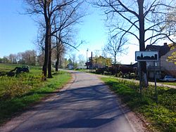
Przeroślpronounced [ˈpʂɛrɔɕl] is a village in Suwałki County, Podlaskie Voivodeship, in north-eastern Poland. It is the seat of the gmina called Gmina Przerośl. It lies approximately 27 kilometres (17 mi) north-west of Suwałki and 131 km (81 mi) north of the regional capital Białystok.
Przystajne is a village in the administrative district of Gmina Przerośl, within Suwałki County, Podlaskie Voivodeship, in north-eastern Poland. It lies approximately 4 kilometres (2 mi) south of Przerośl, 23 km (14 mi) north-west of Suwałki, and 127 km (79 mi) north of the regional capital Białystok.
Śmieciuchówka is a village in the administrative district of Gmina Przerośl, within Suwałki County, Podlaskie Voivodeship, in north-eastern Poland. It lies approximately 10 kilometres (6 mi) south-east of Przerośl, 17 km (11 mi) north-west of Suwałki, and 124 km (77 mi) north of the regional capital Białystok.
Wersele is a village in the administrative district of Gmina Przerośl, within Suwałki County, Podlaskie Voivodeship, in north-eastern Poland. It lies approximately 9 kilometres (6 mi) north-east of Przerośl, 27 km (17 mi) north-west of Suwałki, and 134 km (83 mi) north of the regional capital Białystok.
Zarzecze is a village in the administrative district of Gmina Przerośl, within Suwałki County, Podlaskie Voivodeship, in north-eastern Poland. It lies approximately 8 kilometres (5 mi) north-east of Przerośl, 26 km (16 mi) north-west of Suwałki, and 133 km (83 mi) north of the regional capital Białystok.
Bolesty is a village in the administrative district of Gmina Raczki, within Suwałki County, Podlaskie Voivodeship, in north-eastern Poland. It lies approximately 9 kilometres (6 mi) north-west of Raczki, 15 km (9 mi) west of Suwałki, and 108 km (67 mi) north of the regional capital Białystok.
Dębniak is a village in the administrative district of Gmina Szypliszki, within Suwałki County, Podlaskie Voivodeship, in north-eastern Poland, close to the border with Lithuania. It lies approximately 3 kilometres (2 mi) south-east of Szypliszki, 20 km (12 mi) north-east of Suwałki, and 125 km (78 mi) north of the regional capital Białystok.
Antonielów is a village in the administrative district of Gmina Łęki Szlacheckie, within Piotrków County, Łódź Voivodeship, in central Poland. It lies approximately 9 kilometres (6 mi) north-west of Łęki Szlacheckie, 19 km (12 mi) south of Piotrków Trybunalski, and 64 km (40 mi) south of the regional capital Łódź.
Moczydła is a village in the administrative district of Gmina Jakubów, within Mińsk County, Masovian Voivodeship, in east-central Poland. It lies approximately 4 kilometres (2 mi) north-east of Jakubów, 12 km (7 mi) north-east of Mińsk Mazowiecki, and 49 km (30 mi) east of Warsaw.
Boguszyniec is a village in the administrative district of Gmina Grzegorzew, within Koło County, Greater Poland Voivodeship, in west-central Poland. It lies approximately 8 kilometres (5 mi) north of Grzegorzew, 7 km (4 mi) north-east of Koło, and 124 km (77 mi) east of the regional capital Poznań.