Bongaigaon

Last updated

Bongaigaon
Town
Bongaigaon Town
Bongaigaon metropolis.jpg
Bongaigaon Town view
Nickname(s): 
Commercial and Industrial Hub of Assam
India Assam location map.svg
Red pog.svg
Bongaigaon
Location in Assam, India
Coordinates: 26°28′37″N90°33′30″E / 26.47694°N 90.55833°E / 26.47694; 90.55833
CountryFlag of India.svg  India
State Assam
Region Lower Assam
District Bongaigaon & Chirang district
Government
  Type Municipality
  BodyBongaigaon Municipal Board
  Deputy CommissionerShri Nabadeep Pathak, ACS
  SuperintendentSwapnaneel Deka, (APS)
Area
  Total14 km2 (5 sq mi)
Elevation
62.6 m (205.4 ft)
Population
 (2011)
  Total67,322
  Density4,800/km2 (12,000/sq mi)
Languages
  Official Assamese, Bodo, English
Time zone UTC+5:30 (IST)
Telephone code03664
Vehicle registration AS-19, AS-26
Sex ratio 961 per 1000 male (Census 2011) /
Website bongaigaon.assam.gov.in

Bongaigaon is a town and a municipal board in the Indian state of Assam. Its town area spans across Bongaigaon and Chirang district. It also acts as the district headquarters of Bongaigaon district and commercial and industrial hub of the west part of the state of Assam. The New Bongaigaon Junction railway station is the 12th largest railway station in Northeast Frontier Railway zone which is one of the major railway zones in India.

Contents

Etymology

According to lore, the name 'Bongaigaon' derives from the words 'bon' (wild) and 'gai' (cow). In the distant past, wild cows were often a menace to villagers in this area, due to which the district got its name.[ citation needed ]

History

Bijni Kingdom

The area was ruled by zamindars hailing from the Koch belonging to Indo-Mongoloid ethnic group of peoples from the 16th century to the end of princely states in 1956.[ citation needed ]

Administrative changes under British rule

The original Goalpara district was first created in 1822 by David Scott, an employee of the East India Company and the first Commissioner of newly created North east Rangpur district headquarters at Rangpur town (now in Bangladesh). The newly created Goalpara district was connected with North-east Rangpur district for administration. The area, formerly part of the Bijni Kingdom, which included the undivided Garo Hills district constituted the Undivided Goalpara district area in 1822. In 1866, Garo Hills was separated from the Goalpara district area, and in the same year a new district named "Greater Koch Behar" was created and the remaining portion of Goalpara district was withdrawn from Rangpur and tagged with Koch Behar. In 1874 a new province, the Assam Valley Province, was created by the British government, and Goalpara district area was withdrawn from Koch Behar and tagged with Assam Province, which continues until today. The original Goalpara district is now split into five districts: Goalpara, Dhubri, Kokrajhar, Bongaigoan, and Chirang.[ citation needed ]

Creation of Bongaigaon and modern era

On 14 March 1989, bombs from separatist tribal militants[ who? ] exploded in Bongaigaon, killing 17 and wounding at least 48. [1]

The government of Assam decided in 1989 to create a new district of Bongaigaon, carving out some areas of the Goalpara and Kokrajhar Districts with its headquarters located at Bongaigaon. On 29 September 1989, the creation of Bongaigaon District was declared by the Government of Assam with its headquarters at Bongaigaon. [ citation needed ]

In June 2022, heavy floods in Assam affected the residents of Bongaigaon. [2]

Administration

The Bongaigaon Town Committee was first constituted in the year 1961 and was upgraded to a Municipal Board in the year 1977. Presently the Municipal Area consists of 25 wards covering an area of 14.31 sq m.[ citation needed ]

Bongaigaon is part of Barpeta (Lok Sabha constituency). [3] Phani Bhusan Choudhury is the current M.L.A. of the Bongaigaon constituency.

Geography

Bongaigaon is located at 26°28′37″N90°33′30″E / 26.47694°N 90.55833°E / 26.47694; 90.55833 . [4] It has an average altitude of 62.6 metres. The town is situated 200 km west of the State Capital and has an important place in the communication network of Assam and wider northeast India. The New Bongaigaon railway station is a major hub connecting Assam with the rest of India. This town is also very well connected by road through the National Highways 31 B and 31C. This connectivity and the strategic location of the town in the region has made it an important center in trade and commerce in Western Assam, serving a vast hinterland. It is one of the biggest industrial towns in Lower Assam. The district is part of the Brahmaputra river's basin. [5] [ page needed ]

Climate

Bongaigaon has a borderline monsoon-influenced humid subtropical climate (Köppen Cwa) marginally too cool to be a tropical savanna climate (Aw). During the "cool" season from November to February, afternoons are warm to very warm and mornings are cool. In the "hot" season of March and April, the weather becomes hot and thunderstorm rainfalls increase in frequency to prelude the oppressive monsoon season from June to September where heavy rainfall occurs every afternoon.[ citation needed ]

Demography

Bongaigaon town has a population of 139,650 as per the 2011 census. [ citation needed ]

Healthcare

There are both private and government hospitals in Bongaigaon including:

See also

Related Research Articles

<span class="mw-page-title-main">Bodoland Territorial Region</span> Autonomous Administrative Region in Assam, India

The Bodoland Territorial Region (BTR) is an autonomous division in Assam, India, and a proposed state in Northeast India. It is made up of four districts on the north bank of the Brahmaputra river below the foothills of Bhutan and Arunachal Pradesh. It is administered by an elected body known as the Bodoland Territorial Council which came into existence under the terms of a peace agreement signed in February 2003 and its autonomy was further extended by an agreement signed in January 2020. The region covers an area of over nine thousand square kilometres and is predominantly inhabited by the Bodo people and other indigenous communities of Assam.

<span class="mw-page-title-main">Bongaigaon district</span> District of Assam in India

Bongaigaon district (Prpn:ˈbɒŋgaɪˌgãʊ) is an administrative district in the state of Assam in northeastern India. The district headquarters are located at Bongaigaon. The district occupies an area of 1,093 km2.

<span class="mw-page-title-main">Goalpara district</span> District of Assam in India

Goalpara district is an administrative district of the Indian state of Assam.

<span class="mw-page-title-main">Kokrajhar district</span> Administrative district of Assam, India

Kokrajhar district is an administrative district in Bodoland Territorial Region of Assam. It is predominantly inhabited by the Boro tribe. The district has its headquarters located at Kokrajhar Town and occupies an area of 3,169.22 km2 (1,223.64 sq mi). It has two civil sub-divisions namely Parbatjhora and Gossaigaon and five revenue circles namely Kokrajhar, Dotma, Bhaoraguri, Gossaigaon and Bagribarilll

<span class="mw-page-title-main">Dooars</span> Alluvial floodplains in eastern-northeastern India

The Dooars or Duars are the alluvial floodplains in eastern-northeastern India and southern Bhutan that lie south of the outer foothills of the Himalayas and north of the Brahmaputra River basin. This region is about 30 km (19 mi) wide and stretches over about 350 km (220 mi) from the Teesta River in West Bengal to the Dhansiri River in Udalguri district of Assam. The region forms the gateway to Bhutan. It is part of the Terai-Duar savanna and grasslands ecoregion.

<span class="mw-page-title-main">Dhubri</span> Town in Assam, India

Dhubri is a town and the administrative centre of Dhubri district in the Indian state of Assam. It is an old town on the bank of the Brahmaputra river, with historical significance. In 1883, the town was first constituted as a Municipal Board under the British regime. It is situated about 277.4 kilometres (172 mi) west from Dispur, the state capital of Assam.

Kokrajhar is a town in the Bodoland Territorial Region, an autonomous territory in Assam, one of the North Eastern states of India.

Koch is a Sino-Tibetan language spoken by the Koch people of India and Bangladesh. It is primarily spoken in the Indian states of Meghalaya, West Bengal, and Lower Assam and in the parts of the country Bangladesh, where it serves as a major means of communication among the Koches and other ethnic groups in the region. Koch language is written with Assamese, Bengali, Roman scripts.

<span class="mw-page-title-main">Chirang district</span> District of Assam in India

Chirang District is an administrative district in the Bodoland Territorial Region of Assam state in the North-East of India.

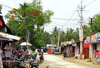
Basugaon (IPA:ˈbɑːsʊˌgɑ̃ʊ) is a Town in Chirang District of Assam, India. It is an industrial town and a Municipal Board area. It is a neighbourhood of Bongaigaon UA, and it is situated approximately 180 km from Guwahati City in the western part of the Lower Assam Region. The name of this town is derived from its high bamboo plantation and bamboo market basically "basu" or "bash" means bamboo and "gaon" means village that is Basugaon, 'The village of bamboo'.

Gossaigaon is one of the fastest-developing towns and the hometown of the state's youngest Raimona National Park in the Bodoland region of Assam, India. This is a sub-divisional headquarter of Kokrajhar district. It shares its boundaries with the neighboring state of West Bengal in the west and Dhubri district to the south. It is one of the BTR's proposed districts. Gossaigaon is well connected by ground transportation and rails. The town serves as a direct route by road to the state's youngest Rupsi Airport located in the southernmost part of the town. Madati and Sankosh are some of the prominent rivers that flow through the heart of the town, and forested areas include such saleable trees as Shorea robusta (sal), Tectona grandis (teak). This place practices organic farming as well as modern agriculture, following recent scientific developments.

Sapatgram is a town and a Municipality Board Area in Dhubri district in the Indian state of Assam.

<span class="mw-page-title-main">Koch people</span> Ethnic group in India and Bangladesh

The Koch are a small trans-border ethnic group of Assam and Meghalaya in India and northern Bangladesh. The group consists of nine matrilineal and strictly exogamous clans, with some of them preserving a hitherto sparsely documented Boro-Garo language called Koch, whereas others have switched to local varieties of Indo-Aryan languages. It is a Scheduled Tribe in Meghalaya, India. Koches want to preserve language and culture and heritage.

<span class="mw-page-title-main">Barauni–Guwahati line</span> Railway section in India

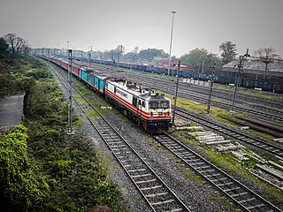
The Barauni–Guwahati railway line connects Barauni, Saharsa, Purnia and Katihar in the Indian state of Bihar and Bongaigaon, Kamakhya and Guwahati in Assam via Siliguri, Jalpaiguri, Cooch Behar and Alipurduar in West Bengal. It is a linkage of prime importance for Northeastern India with Capital of india.

Goalpara region, largely congruous to the historical undivided Goalpara district, is a region that is associated with the people and culture of Goalpara. It is bounded on the north by Bhutan, on the east by the Kamrup region, in the south by Meghalaya and in the west by Cooch Behar and Jalpaiguri in West Bengal and Rangpur in Bangladesh. The natural landmarks are: Sankosh and Brahmaputra rivers on the west, the Manas river on the east in the north bank, and a corresponding region in the south bank; the Garo Hills in the south and Bhutan Hills in the north.

<span class="mw-page-title-main">Lower Assam division</span> Division in Assam, India

Lower Assam division is one of the 5 administrative divisions of Assam in India. It was formed in 1874, consisting of the undivided Kamrup district of Western Assam, undivided Darrang and Nagaon districts of Central Assam and Khasi & Jaintia hills of Meghalaya, created for revenue purposes. The division is under the jurisdiction of a Commissioner, who is stationed at Guwahati. The division currently covers the Western Brahmaputa Valley. Shri Jayant Narlikar, IAS is the current Commissioner of Lower Assam division.

<span class="mw-page-title-main">Kamtapur Liberation Organisation</span> Militant group in India

The Kamtapur Liberation Organisation is a militant organisation based in Northeast India whose objective is to unite the Kamtapur nation from West Bengal and Assam. The proposed state is to comprise all districts in West Bengal and four contiguous districts of Assam which are Cooch Behar, Darjeeling, Jalpaiguri, North and South Dinajpur and Malda, Kokrajhar, Bongaigaon, Dhubri and Goalpara, Kishanganj districts in Bihar, and Jhapa District in Nepal. The KLO was formed to address problems of the Koch Rajbongshi people such as large-scale unemployment, land alienation, perceived neglect of Kamtapuri language, identity, and grievances of economic deprivation.

Assam – 16th largest, 15th most populous and 26th most literate state of the 28 states of the democratic Republic of India. Assam is at 14th position in life expectancy and 8th in female-to-male sex ratio. Assam is the 21st most media exposed states in India. The Economy of Assam is largely agriculture based with 69% of the population engaged in it. Growth rate of Assam's income has not kept pace with that of India's during the Post-British Era; differences increased rapidly since the 1970s. While the Indian economy grew at 6 percent per annum over the period of 1981 to 2000, the same of Assam's grew only by 3.3 percent.

Deshi or Desi people are an indigenous Muslim community residing mostly in Assam and other parts of eastern India. The Deshi Muslim people can be find in Meghalaya, North Bengal, eastern Bihar, Rangpur and Bogura of Bangladesh. In West Bengal and Bihar they are known as Nashya Shaikh. Deshis are Muslim converts from Koch, Mech or other indigenous communities. In July, 2022, the Government of Assam gave them recognition as an "Indigenous Assamese Muslims" community vide an Order.

References

  1. "WORLD : Separatists' Bombs Kill 17 in India". Los Angeles Times. 14 March 1989. Retrieved 28 July 2022.
  2. "Flood situation 'critical' in India's Assam". ca.news.yahoo.com. 20 June 2022. Archived from the original on 22 June 2022. Retrieved 28 July 2022.
  3. "List of Parliamentary & Assembly Constituencies" (PDF). Assam. Election Commission of India. Archived from the original (PDF) on 4 May 2006. Retrieved 5 October 2008.
  4. "Maps, Weather, and Airports for Bongaigaon, India". fallingrain.com. Archived from the original on 26 October 2010. Retrieved 28 July 2022.
  5. "District Report BONGAIGAON" (PDF). commissioned by Ministry of Minority Affairs, Government of India. Archived from the original (PDF) on 23 May 2012. Retrieved 10 January 2012.
  6. "Lower Assam Hospital And Research Centre — Bongaigaon". doctoralia.in. Archived from the original on 1 February 2014. Retrieved 23 January 2014.
  7. "Lower Assam Hospital". Plus.google.com. Retrieved 31 July 2014.
  8. "Swagat Hospital - About - Google+". plus.google.com. Archived from the original on 4 March 2014. Retrieved 23 January 2014.
  9. "Swagat Hospital & Research Centre". swagathospital.com.
  10. "Swagat Hospital BONGAIGAON, Assam". hotfrog.in.
  11. "St. Augustine Hospital — St. John's Rural Mission". stjohnsruralmission.org. Archived from the original on 8 August 2014.
  12. "Bongaigaon branch IMAASB" (PDF). imaasb.com. Archived from the original (PDF) on 8 August 2014.
  13. "New Bongaigaon Railway Hospital". Plus.google.com. Archived from the original on 4 March 2014. Retrieved 31 July 2014.
  14. "New Bongaigaon Railway Hospital". wikimapia.org.
  15. "BRPL Refinery Complex". wikimapia.org.
  16. "The Telegraph - Calcutta : Northeast". telegraphindia.com. Archived from the original on 26 January 2014.