Related Research Articles
Otago is a region of New Zealand located in the southern half of the South Island administered by the Otago Regional Council. It has an area of approximately 32,000 square kilometres (12,000 sq mi), making it the country's second largest local government region. Its population was 246,700 in June 2021.

Omarama is a small town at the junction of State Highways 8 and 83, near the southern end of the Mackenzie Basin, in the South Island of New Zealand. Omarama is in the Waitaki District, in the southern Canterbury region. The Ahuriri River is a short distance to the north of the township. Omarama is 30 km southwest of Twizel, 40 km southeast of Lake Ōhau and 32 km northeast of the Lindis Pass.

The Mackenzie Basin, popularly and traditionally known as the Mackenzie Country, is an elliptical intermontane basin located in the Mackenzie and Waitaki Districts, near the centre of the South Island of New Zealand. It is the largest such basin in New Zealand. Historically famous mainly for sheep farming, the sparsely populated area is now also a popular tourism destination.

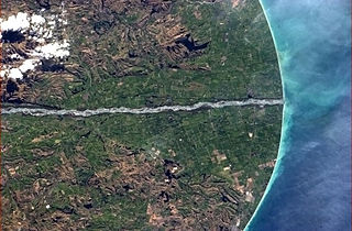
The Waitaki River is a large braided river that drains the Mackenzie Basin and runs some 209 kilometres (130 mi) south-east to enter the Pacific Ocean between Timaru and Oamaru on the east coast of the South Island of New Zealand. It starts at the confluence of the Ōhau River and the Tekapo River, now in the head of the artificial Lake Benmore, these rivers being fed by three large glacial lakes, Pukaki, Tekapo, and Ōhau at the base of the Southern Alps. The Waitaki flows through Lake Benmore, Lake Aviemore and Lake Waitaki, these lakes being contained by hydroelectric dams, Benmore Dam, Aviemore Dam and Waitaki Dam. The Waitaki has several tributaries, notably the Ahuriri River and the Hakataramea River. It passes Kurow and Glenavy before entering the Pacific Ocean. The River lends its name the Waitaki District on the south side of the river bank.

Kurow is a small town in the Waitaki District, New Zealand. It is located on the south bank of the Waitaki River, 60 kilometres (37 mi) northwest of Oamaru.

Waitaki District is a territorial authority that is located in the Canterbury and Otago regions of the South Island of New Zealand. It straddles the traditional border between the two regions, the Waitaki River, and its seat is Oamaru.

Hampden, a small town in North Otago, New Zealand, lies close to the North Otago coast, 35 kilometres south of Oamaru and 80 kilometres north of the city of Dunedin, to both of which it is connected by State Highway 1.
Glenavy is a small town in the South Island of New Zealand. It is located at the southern extreme of the Canterbury region on the alluvial fan of the Waitaki River, three kilometres from the river's outflow into the Pacific Ocean.
Tokarahi is a small village located in the Otago region of the South Island of New Zealand. Its location is a rural setting in the Waiareka Valley, inland from Oamaru. Economic activity is focused on agriculture.

Duntroon is a small farming-town in the Waitaki District of New Zealand's South Island. Although traditionally considered a North Otago town, it is located as of 2018 within the farthest southern reaches of Canterbury. Just north of the town runs the Waitaki River, which forms the traditional border between the two regions, although the official border has moved south to put most of Waitaki District within Canterbury, including Duntroon. To the east of the village runs the Maerewhenua River. Near the village are the Earthquakes, a limestone-cliff formation.
Hakataramea, spelt Hakateramea in some older sources, is a rural village located in the southern Canterbury region of New Zealand's South Island. It is in the Waimate District and sits on the north bank of the Waitaki River at its confluence with the Hakataramea River.

South Canterbury is the area of the Canterbury Region of the South Island of New Zealand bounded by the Rangitata River in the north and the Waitaki River to the south. The Pacific Ocean and ridge of the Southern Alps / Kā Tiritiri o te Moana form natural boundaries to the east and west respectively. Though the exact boundaries of the region have never been formalised, the term is used for a variety of government agencies and other entities. It is one of four traditional sub-regions of Canterbury, along with Mid Canterbury, North Canterbury, and Christchurch city.
The Fork Stream is a river in the Canterbury region of New Zealand. It arises in the Gamack Range and flows south-east into the Tekapo River, which exits at Lake Benmore and eventually via the Waitaki River into the Pacific Ocean. Fraser Stream is a tributary. A high proportion of the stream's flow comes from snow melt.
The Esk River of Hawke's Bay, in the eastern North Island of New Zealand, one of two rivers of that name in the country, is one of Hawke's Bay's major rivers. It flows south from the slopes of Taraponui in the Maungaharuru Range before turning east to reach Hawke Bay 10 kilometres (6 mi) north of Napier. State Highway 5 follows the lower course of the river for several kilometres close to the settlement of Eskdale. The river is probably named after the Esk River in southern Scotland and north-west England.
Livingstone is a small settlement in the Canterbury part of Waitaki District, in the South Island of New Zealand. It is located northeast of Danseys Pass, some 30 kilometres northwest of Oamaru. It is located immediately north of the boundary to Otago.
Paerata is a small settlement immediately to the north of Pukekohe, in the North Island of New Zealand. It is located on State Highway 22 some 10 kilometres (6.2 mi) south of the Manukau Harbour. Wesley College is located close to the northern edge of Paerata.

The Humboldt Mountains or Humboldt Range are one of the many ranges which make up the Southern Alps in the South Island of New Zealand. They lie to the northwest of Lake Wakatipu in the Otago Region. Parts of the range lie within Fiordland National Park, and they form the southern extremity of Mount Aspiring National Park. The range was named by early explorer James McKerrow, and like many geographic features worldwide, it was named in honour of notable scientist Alexander von Humboldt.
Danseys Pass is a locality in Waitaki District in the Canterbury region of New Zealand. The settlement is located approximately halfway between Danseys Pass and Duntroon on the Canterbury side of the pass. The pass and road are named after William Heywood Dansey. He was the lessee of the Otekaike run from 1857 to 1871 who, in 1855 with three companions, was the first European to cross the pass in search for land in the Maniototo district.
Maruakoa is a small farming settlement in Waitaki District, New Zealand. It is located close to the banks of the Kakanui River just south of its emergence form the Kakanui Gorge. It is 18 kilometres northwest of Oamaru and 4 kilometres southwest of Windsor, between the two settlements of Five Forks and Tapui. The name Maruakoa is a Māori word literally meaning "Happy valley".
References
- ↑ Dowling, P. (ed.) (2004). ’’Reed New Zealand atlas’’. Auckland: Reed Publishing. Map 93. ISBN 0 7900 0952 8
- ↑ Reed, A.W. (1975). Place names of New Zealand. Wellington: A.H. & A.W. Reed. p. 47.
- ↑ "Bortons Pond," Lower Waitaki Irrigation Company. Retrieved 9 July 2022.
- ↑ "History," Lower Waitaki Irrigation Company. Retrieved 9 July 2022.
Coordinates: 44°52′50″S170°45′50″E / 44.88056°S 170.76389°E