Peoria and East Peoria, Illinois are separated by the Illinois River, a 240-mile (386km) long body of water that reaches up to a mile across in places along Peoria Lake. The Illinois River is one of six rivers that are included in the Lower Illinois River Basin which extends between Ottawa, Illinois and the Mississippi River at Grafton, Illinois. Three of the six rivers in the Lower Illinois River Basin (Spoon River, Illinois River, and Mackinaw River) are in central Illinois. Their combined length is 534 nautical miles (989km). Of these waterways the Illinois is thought to be the only river large enough to support barge traffic.
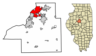
Peoria is the county seat of Peoria County, Illinois, and the largest city on the Illinois River. Established in 1691 by the French explorer Henri de Tonti, Peoria is the oldest European settlement in Illinois, and is named after the Peoria tribe. As of the 2010 census, the city was the seventh-most populated in Illinois, with a population of 115,007. The Peoria Metropolitan Statistical Area had a population of 373,590 in 2011. Until 2018, Peoria was the global and national headquarters for Caterpillar Inc., one of the 30 companies composing the Dow Jones Industrial Average, and listed on the Fortune 100; in the latter year, the company relocated its headquarters to Deerfield, Illinois.
East Peoria is a city in Tazewell County, Illinois, United States. The population was 23,402 at the 2010 census. East Peoria is part of the Peoria, Illinois Metropolitan Statistical Area, located across the Illinois River from downtown Peoria. It is home to many Caterpillar Inc. facilities.
Illinois is a state in the Midwestern region of the United States. It has the 5th largest Gross Domestic Product by state, is the 6th-most populous U.S. state and 25th-largest state in terms of land area. Illinois is often noted as a microcosm of the entire United States. With Chicago in the northeast, small industrial cities and great agricultural productivity in northern and central Illinois, and natural resources such as coal, timber, and petroleum in the south, Illinois has a diverse economic base, and is a major transportation hub. Chicagoland, Chicago's metropolitan area, contains over 65% of the state's population. The Port of Chicago connects the state to other global ports around the world from the Great Lakes, via the Saint Lawrence Seaway, to the Atlantic Ocean; as well as the Great Lakes to the Mississippi River, via the Illinois Waterway on the Illinois River. The Mississippi River, the Ohio River, and the Wabash River form parts of the boundaries of Illinois. For decades, Chicago's O'Hare International Airport has been ranked as one of the world's busiest airports. Illinois has long had a reputation as a bellwether both in social and cultural terms and, through the 1980s, in politics.
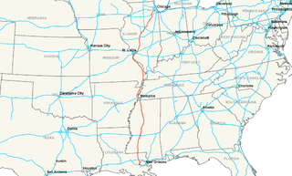
In the Peoria area, there are six bridges that cross the Illinois River. Because of the topography of the cities, alignments of the numerous state routes that cross the Illinois River can be somewhat confusing. However, these routes are generally well marked. All bridges that span the Illinois River are required to be built a minimum of 70 feet (21m) above the average river level, as the Illinois River is the main route for river traffic between New Orleans and Chicago. The Illinois River is part of a waterway system that begins in New Orleans, Louisiana and exits the Atlantic Ocean via Chicago and the Saint Lawrence Seaway.
New Orleans is a consolidated city-parish located along the Mississippi River in the southeastern region of the U.S. state of Louisiana. With an estimated population of 393,292 in 2017, it is the most populous city in Louisiana. A major port, New Orleans is considered an economic and commercial hub for the broader Gulf Coast region of the United States.
Chicago, officially the City of Chicago, is the most populous city in Illinois and the third most populous city in the United States. With an estimated population of 2,716,450 (2017), it is the most populous city in the Midwestern United States. Chicago is the county seat of Cook County, the second most populous county in the United States, and the principal city of the Chicago metropolitan area, which is often referred to as "Chicagoland." The Chicago metropolitan area, at nearly 10 million people, is the third-largest in the United States; the fourth largest in North America ; and the third largest metropolitan area in the world by land area.
Louisiana is a state in the Deep South region of the South Central United States. It is the 31st most extensive and the 25th most populous of the 50 United States. Louisiana is bordered by the state of Texas to the west, Arkansas to the north, Mississippi to the east, and the Gulf of Mexico to the south. A large part of its eastern boundary is demarcated by the Mississippi River. Louisiana is the only U.S. state with political subdivisions termed parishes, which are equivalent to counties. The state's capital is Baton Rouge, and its largest city is New Orleans.
The Cedar Street Bridge carries Illinois Route 8 and Illinois Route 116 over the Illinois River. The bridge is a steel arch design that rises approximately 70 to 80 feet (24 m) above the surface of the river. The name of the bridge comes from the original name of its street on the Peoria side of the river; the street itself is now called MacArthur Highway, while the bridge is still referred to as Cedar Street.
The Bob Michel Bridge carries Illinois Route 40 over the Illinois River just .75 miles (1.21 km) up-river from the Cedar Street Bridge. Illinois 40 terminates at an interchange with Interstate 74 just east of the bridge. The bridge serves as a direct surface route from a major commercial center in East Peoria to the Civic Center in downtown Peoria. When completed in 1993, the Bob Michel Bridge replaced the antiquated Franklin Street Bridge, a bascule and truss bridge, which had been located on an adjacent site since 1913. The Bob Michel Bridge is the only river crossing in the Peoria area to accommodate pedestrians and cyclists.
The Murray Baker Bridge is a landmark cantilever bridge that carries Interstate 74 (I-74) and Illinois Route 29 (IL 29) over the Illinois River from downtown Peoria to East Peoria in central Illinois. According to the Illinois Department of Transportation, the Murray Baker Bridge was built in 1958, and had an original length of 3,216 feet (980 m).
‡This populated place also has portions in an adjacent county or counties
This page is based on this Wikipedia article Text is available under the CC BY-SA 4.0 license; additional terms may apply. Images, videos and audio are available under their respective licenses.
Related Research Articles
The Mississippi River is the second-longest river and chief river of the second-largest drainage system on the North American continent, second only to the Hudson Bay drainage system. Its source is Lake Itasca in northern Minnesota and it flows generally south for 2,320 miles (3,730 km) to the Mississippi River Delta in the Gulf of Mexico. With its many tributaries, the Mississippi's watershed drains all or parts of 32 U.S. states and two Canadian provinces between the Rocky and Appalachian mountains. The main stem is entirely within the United States; the total drainage basin is 1,151,000 sq mi (2,980,000 km2), of which only about one percent is in Canada. The Mississippi ranks as the fourth-longest and fifteenth-largest river by discharge in the world. The river either borders or passes through the states of Minnesota, Wisconsin, Iowa, Illinois, Missouri, Kentucky, Tennessee, Arkansas, Mississippi, and Louisiana.
The Grand Union Canal in England is part of the British canal system. Its main line starts in London and ends in Birmingham, stretching for 137 miles (220 km) with 166 locks. It has arms to places including Leicester, Slough, Aylesbury, Wendover and Northampton.
The Illinois River is a principal tributary of the Mississippi River, approximately 273 miles (439 km) long, in the U.S. state of Illinois. The river drains a large section of central Illinois, with a drainage basin of 28,756.6 square miles (74,479 km2). The drainage basin extends into Wisconsin, Indiana, and a very small area of southwestern Michigan. This river was important among Native Americans and early French traders as the principal water route connecting the Great Lakes with the Mississippi. The French colonial settlements along the rivers formed the heart of the area known as the Illinois Country. After the construction of the Illinois and Michigan Canal and the Hennepin Canal in the 19th century, the role of the river as link between Lake Michigan and the Mississippi was extended into the era of modern industrial shipping. It now forms the basis for the Illinois Waterway.
Interstate 55 (I-55) is a major Interstate Highway in the central United States. As with most interstates that end in a five, it is a major cross-country, north-south route, connecting the Gulf of Mexico to the Great Lakes. The highway travels from LaPlace, Louisiana, at I-10 to Chicago at U.S. Route 41, at McCormick Place. The major cities that I-55 connects to includes Jackson, Mississippi; Memphis, Tennessee; and St. Louis.
The Grantham Canal runs for 33 miles (53 km) from Grantham through 18 locks to West Bridgford, where it joins the River Trent. It was built primarily for the transportation of coal to Grantham. It opened in 1797 and its profitability steadily increased until 1841. It was then sold to a railway company, declined, and was finally closed in 1936. It was used as a water supply for agriculture, and so most of it remained in water after closure, although bridges were lowered. Since the 1970s, the Grantham Canal Society have been working to restore it. Two stretches are now navigable to small vessels. A new route will be required where the canal joins the Trent, as road building has severed the original one.
Illinois Route 40 is a north–south route in central portion of the U.S. state of Illinois. It runs from Interstate 74 in East Peoria north to Illinois Route 78 at Mt. Carroll, just south of U.S. Route 52 and Illinois Route 64. This is a distance of 112.05 miles (180.33 km).
Illinois Route 6 is a 4-lane freeway entirely in Peoria County in central Illinois. It begins as a northern extension of Interstate 474 at Interstate 74 west of Peoria, and ends at Illinois Route 29 at the 9th Mile in Mossville, south of Chillicothe. The freeway currently has a total length of 10.11 miles (16.27 km), including the connector ramp to Illinois 29.
The Peoria-to-Chicago Highway refers to an effort made in the U.S. state of Illinois in the late 1990s to directly connect the cities of Peoria and Chicago with a multilane freeway. Plans for any highway failed due to grass-roots efforts against the highway.
Illinois Route 29 is a two to four lane state road that runs south from U.S. Route 6/Illinois Route 89 at Spring Valley to U.S. Route 51/Illinois Route 16 at Pana, running through Pekin, Peoria and Springfield. The nearest major north–south highway, Interstate 39, runs parallel to Illinois 29, but approximately fifty miles to the east. Illinois 29 is 175.36 miles (282.21 km) long.
Illinois Route 116 is a cross-state rural state highway that runs from U.S. Route 34 by Gladstone east to the intersection of U.S. Route 45 and Old U.S. Route 45, on the north side of Ashkum. This is a distance of 176.07 miles (283.36 km).
Illinois Route 336 is a four-lane freeway/expressway combination that serves western Illinois. It is also used by the Illinois Department of Transportation (IDOT) as a part of Federal-Aid Primary Highway 315 (FAP315) to refer to a future project connecting the cities of Quincy and Peoria via underserved Macomb.
The Industrial Canal is a 5.5 mile (9 km) waterway in New Orleans, Louisiana, United States. The waterway's proper name, as used by the U.S. Army Corps of Engineers and on NOAA nautical charts, is Inner Harbor Navigation Canal (IHNC). The more common "Industrial Canal" name is used locally, both by commercial mariners and by landside residents.
Interstate 155 (I-155) is a north–south spur of I-55 that provides an Interstate connection for the Illinois cities of Peoria and Lincoln. The northern terminus is just east of Peoria, at I-74 exit 101 in Morton. The southern terminus, which is northwest of Lincoln, is located on I-55 at exit 127. The highway is 32.13 miles (51.71 km) long.
The Fort Madison Toll Bridge is a tolled, swinging truss bridge over the Mississippi River that connects Fort Madison, Iowa, and unincorporated Niota, Illinois. Rail traffic occupies the lower deck of the bridge, while two lanes of road traffic occupy the upper deck. The double-decker bridge, which is about a mile long with a swing span of 525 feet (160 m), was the longest and largest double-deck swing-span bridge in the world at the time it was built. Completed in 1927, it replaced an inadequate combination roadway/single-track bridge completed in 1887. The main river crossing consists of four 270-foot (82 m) Baltimore through truss spans and a swing span made of two equal arms, 266 feet (81 m) long. In 1999, it was listed in the National Register of Historic Places under the title, Fort Madison Bridge, ID number 99001035. It was also documented by the Library of Congress Historic American Engineering Record, survey number HAER IA-62. Construction and photographic details were recorded at the time in Scientific American magazine.
Illinois Route 9 (IL 9) is a 218.31-mile-long (351.34 km) cross-state, east–west rural state highway in the central part of the U.S. state of Illinois. It travels from Niota at the Fort Madison Toll Bridge, that crosses the Mississippi River into Iowa, eastward across central Illinois to State Road 26 (SR 26) at the Indiana state line.
Airline Highway is a divided highway in the U.S. state of Louisiana, built in stages between 1925 and 1953 to bypass the older Jefferson Highway. It runs 115.6 miles (186.0 km), carrying U.S. Highway 61 from New Orleans northwest to Baton Rouge and U.S. Highway 190 from Baton Rouge west over the Mississippi River on the Huey P. Long Bridge. US 190 continues west towards Opelousas on an extension built at roughly the same time.
Louisiana Highway 45 (LA 45) is a state highway located in Jefferson Parish, Louisiana. It runs 22.08 miles (35.53 km) in a north–south direction from a dead end at Bayou Barataria in Lafitte to a junction with LA 18 in Marrero.
Louisiana Highway 47 (LA 47) is a state highway located in southeastern Louisiana. It runs 15.91 miles (25.60 km) in a general southeast to northwest direction from the Mississippi River levee in Chalmette to the intersection of Hayne Boulevard and Downman Road in New Orleans.
Interstate 74 (I-74) in the U.S. state of Illinois is a major northwest–southeast Interstate Highway that runs across the central portion of the state. It runs from the Iowa state line at the Mississippi River near the city of Rock Island and runs southeast to the Indiana state line east of Danville, a distance of 220.34 miles (354.60 km). The highway runs through the major cities of Champaign, Bloomington, Peoria, and Moline.