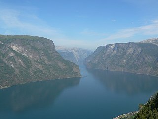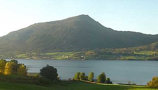
Sogn og Fjordane is a county in western Norway, bordering Møre og Romsdal, Oppland, Buskerud, and Hordaland. The county administration is in the village of Hermansverk in Leikanger municipality. The largest town in the county is Førde.

Kallvatnet (Norwegian) or Gaallajaevrie (Southern Sami) is a lake in the municipality of Rana in Nordland county, Norway. The 28.61-square-kilometre (11.05 sq mi) lake lies about 25 kilometres (16 mi) southeast of the villages of Skonseng and Røssvoll.

Kilvatnet (Norwegian) or Ráhpukjávrre (Lule Sami) is a lake in the municipalities of Hamarøy and Tysfjord in Nordland county, Norway. The lake is located about 4 kilometres (2.5 mi) east of the village of Ulvsvåg.

Tjårdavatnet or Kjårdavatnet (Norwegian) or Čoađgejávri (Northern Sami) is a lake that is located on the border of Norway and Sweden, about 15 kilometres (9.3 mi) south of the village of Elvegård in Norway. The Norwegian side lies in Narvik Municipality in Nordland county and the Swedish side lies in Gällivare Municipality in Norrbotten County. The lake has an area of about 3.63 square kilometres (1.40 sq mi), with 3.5 square kilometres (1.4 sq mi) being in Norway, the tiny remainder is in Sweden.

Langvatnet (Norwegian) or Tjoaddnejávrre (Lule Sami) is a lake that lies on the border between Norway and Sweden. Almost all of the lake is located in Tysfjord Municipality in Nordland county, Norway with a very small part of the lake in Jokkmokk Municipality in Norrbotten County, Sweden. The 5.46-square-kilometre (2.11 sq mi) lake is located about 20 kilometres (12 mi) southeast of the village of Kjøpsvik in Tysfjord.

Stormålvatnet is a lake in the municipality of Hemnes in Nordland county, Norway. It is located about 12 kilometres (7.5 mi) east of the village of Korgen. The river Bjerkaelva flows through the lake on its way to the nearby Ranfjord.

Unna Guovdelisjávri or Vuolip Čoarvejávri is a lake that is located on the border of Norway and Sweden. The Norwegian side lies in Narvik Municipality in Nordland county and the Swedish side lies in Kiruna Municipality in Norrbotten County. The lake lies just east of the lake Gautelisvatnet, about 35 kilometres (22 mi) southeast of the village of Elvegård in Norway. The ending -jávri is the word for "lake" in the Northern Sami language.

Øyarvatnet or Øyarvatn is a lake in Norway. It sits on the border between the municipalities of Valle in Aust-Agder county and Sirdal in Vest-Agder county, about 30 kilometres (19 mi) northeast of the village of Lunde, Sirdal and about 32 kilometres (20 mi) west of Austad in Bygland. The lake is part of the Kvina river system. It is located just to the south of the lake Rosskreppfjorden, which flows into it. The dam at the south end of the 8.05-square-kilometre (3.11 sq mi) lake keeps it at an elevation of 837 metres (2,746 ft).

Rosskreppfjorden is a lake in Norway. The 29.51-square-kilometre (11.39 sq mi) lake lies on the border between the municipalities of Valle and Sirdal. The lake is part of the Kvina river system and has a hydroelectric power plant in a dam on the south end of the lake. The dam keeps the lake at an elevation of about 929 to 890 metres above sea level.

Kolsvatnet is a lake in the municipality of Valle in Aust-Agder county, Norway. It is located about 14 kilometres (8.7 mi) southwest of the village of Valle and about 15 kilometres (9.3 mi) northwest of the village of Rysstad. The lake is located south of the lake Botnsvatnet, east of the mountain Urddalsknuten, and northeast of the lake Rosskreppfjorden. The lake has an area of 2.72 square kilometres (1.05 sq mi) and sits at an elevation of 1,034 metres (3,392 ft) above sea level.

Holden is a lake in the municipality of Verran in Trøndelag county, Norway. It is located about 8 kilometres (5.0 mi) west of the village of Malm and about 10 kilometres (6.2 mi) north of the village of Follafoss. The 13.31-square-kilometre (5.14 sq mi) lake has a dam on the southern end to control the water for hydroelectric power. The lake flows out into the Follaelva river which flows into the Trondheimsfjord at the village of Follafoss.

Finsevatnet is a lake in the municipality of Ulvik in Hordaland county, Norway. The 3.14-square-kilometre (1.21 sq mi) lake lies just south of the village of Finse where Finse Station on the Bergen Line is located. The Finse Tunnel is located just north of the lake. The southeast side of the lake has a dam which regulates the depth of the lake for the purposes of hydro-electric power generation.
Nordmannslågen is a lake in the municipality of Eidfjord in Hordaland county, Norway. At 11.09 square kilometres (4.28 sq mi), it is the largest lake in Hordaland county. The lake lies on the great Hardangervidda plateau in the central part of the Hardangervidda National Park. The lake lies about 35 kilometres (22 mi) southeast of the village of Eidfjord and about 50 kilometres (31 mi) northeast of the town of Odda. The lake is part of the headwaters of the river Numedalslågen.
Oppheimsvatnet is a lake in the municipality of Voss in Hordaland county, Norway. The 3.55-square-kilometre (1.37 sq mi) lake lies in the northern part of the municipality, about 3 kilometres (1.9 mi) east of the village of Vinje. The European route E16 highway runs along the northern side of the lake, right past Oppheim Church which sits in the small village of Oppheim, after which the lake is named. The village of Vasstrondi lies on the southern shore.

Hamlagrøvatnet is a lake on the border of the municipalities of Voss and Kvam in Hordaland county, Norway. The 10.3-square-kilometre (4.0 sq mi) lake is the largest lake in all of Hordaland county. The lake is located about 17 kilometres (11 mi) southeast of the village of Dalekvam and about 10 kilometres (6.2 mi) south of the village of Evanger.
Lønavatnet is a lake in the municipality of Voss in Hordaland county, Norway. The 2.91 km2 (1.12 sq mi) lake lies along the river Strandaelvi which runs from Vinje south to Vossevangen. The lake lies about 4 kilometres (2.5 mi) north of the village of Vossevangen, with the European route E16 highway running along the western shore and Norwegian County Road 309 along the eastern shore.

Movatnet is a lake in the municipality of Levanger in Trøndelag county, Norway. The 6.83-square-kilometre (2.64 sq mi) lake lies immediately to the east of the lake Hoklingen and just to the west of the village of Markabygd.

Straumsetervatnet or Selavatnet is a lake on the border of the municipalities of Åfjord and Verran in Trøndelag county, Norway. The majority of the 4.72-square-kilometre (1.82 sq mi) lake lies in Verran, with the northwestern end of the lake partially lying in Åfjord. The village of Sela lies on the northern side of the lake and the village of Sandsetra at the southeastern end of the lake. The lake is one of the sources for the Folla river system which flows into the Trondheimsfjord at the village of Follafoss.

Bremsnes is a village in Averøy Municipality in Møre og Romsdal county, Norway. The village is located on the northeastern part of the island of Averøya, about midway between the villages of Sveggen and Bruhagen. The village sits along the Norwegian County Road 64 which goes through the Atlantic Ocean Tunnel just north of Bremsnes. That tunnel connects Averøya to the city of Kristiansund to the east. The 0.47-square-kilometre (120-acre) village has a population (2013) of 459, which gives the village a population density of 977 inhabitants per square kilometre (2,530/sq mi). Bremsnes Church is located in this village. The old Bremsnes Municipality existed from 1897 until 1964, and it had its municipal government based here in Bremsnes village.


