
Buckhorn is a home rule-class city in Perry County, Kentucky, in the United States. The population was 144 at the 2000 census. It is centered on the Buckhorn Presbyterian Church, a log structure listed on the National Register of Historic Places. The Buckhorn Children's Center and Buckhorn Lake State Resort Park are also located here.
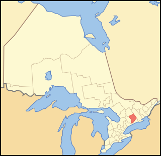
Peterborough County is located in Southern Ontario, Canada. The county seat is Peterborough, which is independent of the county.

Curve Lake First Nation 35 is an Ojibwe Indian reserve 14 km north of Peterborough, Ontario. It serves as the landbase for the Curve Lake First Nation. The reserve occupies a peninsula located between Lake Chemong and Buckhorn Lake, surrounded by the township of Selwyn, as well as several neighbouring small islands in Buckhorn Lake.

Islands in the Trent Waters 36A is a First Nations reserve about 15 kilometres north of Peterborough, Ontario, Canada, on scattered islands in the Kawartha lakes, including Buckhorn Lake, Pigeon Lake, Lower Buckhorn Lake, Lovesick Lake and Stony Lake. The largest concentration of such islands are in Lower Buckhorn and Lovesick Lakes. It is inhabited, mainly seasonally, by members of the Curve Lake, Hiawatha, and Scugog First Nations, who jointly share it.
The Kawartha Lakes (/kə'wɔrθɐ/) are a chain of lakes in south-central Ontario, Canada that form the upper watershed of the Trent River. The lakes are located on the boundary between the Paleozoic limestone regions of the Golden Horseshoe, and the Precambrian granite Canadian Shield of northern and central Ontario.
The Municipality of Trent Lakes is a lower-tier township in the rural, mostly wooded northern section of Peterborough County, Ontario, Canada. The municipality has a primarily cottage and tourist industry based economy but has grown year round residency due to its commute distance to the Greater Toronto Area.

Highlands East is a township located in Haliburton County, Ontario, Canada.
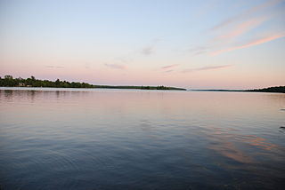
Pigeon Lake is a lake in Ontario, Canada. It is one of a group of lakes called the Kawartha lakes, which are the namesake of the city of Kawartha Lakes, and the Trent-Severn Waterway. Pigeon Lake is 27 km long and up to 3 km wide.
Sandy Lake is a lake in Trent Lakes township, Peterborough County, Ontario, Canada. It is about 5 km west of the community of Buckhorn, 1 km east of Lakehurst, and 25 km north of Peterborough. The lake is typically clear of turbidity and has a slight green color which results from the minerals present in the spring-fed water that feeds the lake. A small creek connects Sandy Lake to the Trent-Severn waterway at Buckhorn Lake. The majority of residences are seasonal.

The Hiawatha First Nation is an Ojibway First Nations reserve located on the north shore of Rice Lake east of the Otonabee River in Ontario, Canada.
King's Highway 36, commonly referred to as Highway 36, was a provincially maintained highway in the Canadian province of Ontario. The highway connected Highway 7 and Highway 35 in Lindsay with Highway 28 in Burleigh Falls, providing access to recreational cottages along the northern shore of several of the Kawartha lakes as well as to multiple communities, including Bobcaygeon. Today it is known as Kawartha Lakes City Road 36 and Peterborough County Road 36.

Lake Buckhorn is a census-designated place (CDP) in Mechanic Township, Holmes County, Ohio, United States. As of the 2010 census it had a population of 601. It is a private, members-only gated community. The community is built around 220-acre (89 ha) Lake Buckhorn, a reservoir impounded in 1967.
Curve Lake 35A is a First Nations reserve on Fox Island, as well as other adjacent islands including Boyd Island, Joe Island, Red Rock Island and Rottenstone Island, in Buckhorn Lake, Ontario, Canada. It is one of three reserves of the Curve Lake First Nation.

Buckhorn Springs is an unincorporated community in Jackson County, Oregon, United States. It lies along Emigrant Creek in the Siskiyou Mountains southeast of Ashland. Buckhorn Springs Road connects the community to Oregon Route 66 near Emigrant Lake.
This page is based on this
Wikipedia article Text is available under the
CC BY-SA 4.0 license; additional terms may apply.
Images, videos and audio are available under their respective licenses.


