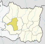
Bhojpur is one of two urban municipalities in Bhojpur District of Province No. 1 of Nepal. It was established on 18 May 2014 merging the existing Bhaisipankha, Bokhim, Bhojpur, Taksar Village Development Committees It is the district headquarters of Bhojpur District, a hilly/mountainous district in Province No. 1. At the time of the 2011 Nepal census it had a population of 27204 with an area of 159.51 square kilometres (61.59 sq mi).

Sindhuli District, a part of Province No. 3, is one of the seventy-Seven districts of Nepal, a landlocked country of South Asia. The district, with Sindhulimadhi Kamalamai as its district headquarters and covers an area of 2,491 km². In 2001, it had a population of 279,821, in 2011 the population was 296,192.
Solukhumbu District (Nepali: सोलुखुम्बु जिल्लाlisten , Sherpa: ཤར་ཁུམ་བུ་རྫོང་ཁ།, Kirat Rai language Wylie: shar khum bu dzong kha) is one of 14 districts of Kirat Province of eastern Nepal. As the name suggests, it consists of the subregions Solu and Khumbu.
Khaling is a Kiranti language spoken in Solukhumbu district, Nepal and in India. It is one of the few Kiranti languages with tonal contrasts, which are of secondary origin.

Triyuga is an urban municipality out of 4 urban municipalities located in the Udayapur district of the Province No. 1 of Nepal. Gaighat is the headquarter of the municipality. According to the 1991 Nepal census, it had a population of 55,291. According to the 2011 Nepal census, Triyuga had 87,557 inhabitants. It is divided into 16 wards. Triyuga Municipality was established on B.S. Chaitra 13, 2053. It was named after Triyuga River. A river which flows through the town. Triyuga is the 3rd largest municipality in Nepal and 1st largest in Province No. 1 in term of size (area). The total area of the municipality is 547.43 square kilometres (211.36 sq mi)

Baikunthe Nepali: बैकुण्ठे is a village development committee in Bhojpur District in the Kosi Zone of eastern Nepal. At the time of the 1991 Nepal census it had a population of 3167 persons living in 575 individual households.
Martadi is a town and seat of Bajura District in the Seti Zone of north-western Nepal. At the time of the 1991 Nepal census it had a population of 4,618 and had 942 houses in the town but now it has increased by growth rate of 2.62.

Kavre Nitya Chandeswori popularly known as "Kavre" is a village development committee in Kavrepalanchok District in the Bagmati Zone of central Nepal. Two of its V.D.C's are included in Dhulikhel Municipality in the year 2015 A.D. At the time of the 2011 Nepal census it had a population of 4927 in 1042 individual households.
Dipsung is a village and Village Development Committee in Khotang District in the Sagarmatha Zone of eastern Nepal. At the time of the 1991 Nepal census, it had a population of 950 living in 205 individual households.
Kharmi is a town and Village Development Committee in Khotang District in the Sagarmatha Zone of eastern Nepal. At the time of the 1991 Nepal census it had a population of 3,807 persons living in 723 individual households.
Sungdel is a village and Village Development Committee in Khotang District in the Sagarmatha Zone of eastern Nepal. At the time of the 1991 Nepal census it had a population of 2,846 persons living in 585 individual households.Its situated at northern east belt of khotang district. Currently, there is a high school, Shree surya Ma. Vi, and four other primary schools as means of education. Peoples running their own hydropower.Mojority of people are Koyee Rai. It is the only one place where Koyee people speaks their mothertone language Koyee. This language is also known as sungdele bhasa. Most of people depends on farming.The highest hill in khotang district Loure is situated in Sungdel. Sungdel is famous for wild bee honey.
Kakani is a Gaunpalika and former village development committee in Nuwakot District in Province No. 3 of central Nepal. At the time of the 1991 Nepal census, the Kakani village development committee administered a population of 7816 living in 1343 individual households.
Lunkhu Deurali is a Village Development Committee in Parbat District in the Dhawalagiri Zone of central Nepal. At the time of the 2011 Nepal census it had a population of 2546 people living in 503 individual households.
Chaumala is a Village Development Committee Recently formed into Gauriganga Municipality in Kailali District in the Seti Zone of western Nepal, near the town of Dhangadhi. At the time of the 2011 Nepal census it had a population of 58,286 living in 5,293 individual households.Chaumala is exactly located 32 km. east from the primary city and municipality of Kailali district, Dhangadhi and almost 60 km. west from another municipality, Tikapur. It lies across the Mahendra Highway, the only highway of Nepal. It has two small markets, one across the highway itself and other beyond the river.
Kshetrapa (Nepali:क्षेत्रपा,) is a village development committee of north-eastern Nepal. At the time of the National Population and Housing Census 2011 it had a population of 2447(1116 Male & 1331 female) people living in 580 individual households. There is one high school named Shree Kshetrawati Higher Secondary School at Peepal Daada,Majhgaun.Through the middle of the village Namdu Jugu road is under construction. Seasonal Bus service is available from Kathmandu but around 170 km ride takes 6 to 8 hours due to narrow, winding roads.Majority of the people staying here from aged back is Jirel then Chettris & Newaar. The original trailhead actually began at Kathmandu of all early Everest expeditions the "classic route to Everest", on the summit—passed through Kshetrapa as alternate to the other route which connect at yarsa,Kavre through Kiratichhap heading to Jiri.
Bhuji is a village development committee in Ramechhap District in the Janakpur Zone of north-eastern Nepal. At the time of the 1991 Nepal census it had a population of 2285 people living in 450 individual households.
Letang, "लेटाङ " is a Municipality in Morang District in the Kosi Zone of south-eastern Nepal formed by merging existing Village Development Committees Letang Jante,_Nepal warrangi and Bhogateni. It is a municipality and the urban core of a rapidly growing urban agglomerate in Nepal. It has neighbouring municipalities like Koshi Haraicha, Belbari, Pathari-Sanischare etc.. At the time of the 2011 Nepal census it had a population of 18,552 people living in 4,359 individual households. It is situated at the bank of Chisang River. It is located 46 km North east of Biratnagar 394 km east of Kathmandu, at the northern edge of the Terai plain below the Hills.More than 70% of the people in this VDC are engaged in agriculture. Temples including Rajarani temple, Laxmi Narayan Mandir, Laxmi Panchayan Mandir etc. lies here. The main ethnic groups here are Limbu, Brahmin, Chhetri, Magar, Rai, Tamang etc. The villages including Phadani, Budhabare, Kheruwa, Khaireni, Kirtiman, Kamalpur, Lokhra, Kuinkunda, Biran etc. lies here. Among them Letang Bazaar is most developed and Rajarani has religious and tourism importance being old village in Letang. This Letang Municipality is one of the developed municipality of Morang district with various utilities including drinking water, electricity, communication etc. District-famous schools and campus including Letang Campus, Shanti Bhagawati School Shree Shiksha Vikash M. V. (Kheruwa), Laxmi School, Galaxy Academy, Green Valley School, Minaruwa School, Letang Secondary Boarding School, Bal Niketan School, Pathibhara Boarding School lies here. The town Letang Bazaar is also a part of municipality. Many developmental efforts are active in this area. There is also uneven population distribution in this VDC. Many national politicians, players and film actors such as Babu Bogati, Praween Khatiwada, Ram Bhujel are also from this village. Far more, yearly Rajarani Festival (Mohatshob) is also celebrated by various organizations for its popularity and fame. There is the eastern regional training academy of Nepal Army and also the eastern regional training centre of Agricultural Development Bank, though the bank does not exist nearby.
Amarapuri is a town in Gaidakot Municipality in Nawalparasi District in the Lumbini Zone of southern Nepal. It became a municipality in May 2014 by merging the existing Mukundapur, Amarapuri, Gaidakot, Nawalparasi, VDCs. At the time of the 1991 Nepal census it had a population of 5,451 living in 967 households. Amarapuri has three high schools, the Shree Laxmi Higher Secondary School, Amar Jyoti Higher Secondary School and Amar English Higher Secondary Boarding School.

Ram Prasad Rai ( March 1,1909 – Unknown) was an Nepali revolutionary, guerrilla leader, military theorist and organizer of the Liberation Army in East part of Nepal.Rai was major figure of the Nepal's Revolution of 1951.And following the Revolution, Rai never accepted the out-come of the revolution and continued fighting against the Ranas.

Chaudandigadhi is a municipality in Udayapur District of Province No. 1 in Nepal that was established on 10 March 2017 by merging the former Village development committees Chaudandi, Sithdipur, Hadiya and Sundarpur with the former municipality Beltar Basaha. At the time of the 2011 Nepal census, the localities out of which Chaudandigadhi would be formed had a joint population of 48,574 people living in 10,519 individual households. It is surrounded by Belka Municipality in the east, Triyuga in the west, the districts of Khotang and Bhojpur in the north and Sunsari District in the south.