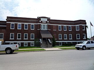
Newberry is a village in the Upper Peninsula of the U.S. state of Michigan and the county seat of Luce County. Located within McMillan Township at its southern end, it shares some administrative responsibilities with the surrounding township. The population was 1,519 at the 2010 census.

The Connecticut Lakes are a group of lakes in Coos County, northern New Hampshire, United States, situated along the headwaters of the Connecticut River. They are accessed via the northernmost segment of U.S. Route 3, between the village of Pittsburg and the Canada port of entry south of Chartierville, Quebec. The lakes are located within the boundaries of Pittsburg, but are far from the town center. Connecticut Lakes State Forest adjoins them.

Lake Minnewanka is a glacial lake located in the eastern area of Banff National Park in Canada, about five kilometres northeast of the Banff townsite. The lake is 21 km (13 mi) long and 142 m (466 ft) deep, making it the 2nd longest lake in the mountain parks of the Canadian Rockies.

Crawford Lake Conservation Area is a conservation area owned and operated by Conservation Halton near the community of Campbellville in Milton, Halton, Ontario, Canada. It is categorized as a regional environmentally sensitive area, an Ontario Area of Natural and Scientific Interest, and part of the Niagara Escarpment world biosphere reserve. The conservation area contains Crawford Lake, a reconstructed Iroquoian village, and several hiking trails.
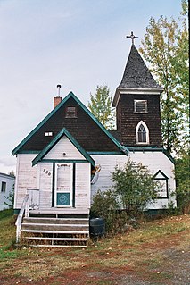
Fort Fraser is an unincorporated community of about 500 people, situated near the base of Fraser Mountain, close to the village municipality of Fraser Lake and the Nechako River. It can be found near the geographical centre of British Columbia, Canada, 44 km (27 mi) west of Vanderhoof on the Yellowhead Highway. Originally established in 1806 as a North West Company fur trading post by the explorer Simon Fraser, it is one of present-day British Columbia's oldest permanent European-founded settlements. The area around the community is also recorded as the site of the first land in British Columbia cultivated by non-First Nations people.

Stari Ledinci, also known simply as Ledinci, is a suburban settlement of Petrovaradin, Novi Sad, Serbia. The population of Stari Ledinci numbered 823 people in the 2002 census. Most of the inhabitants of the village are ethnic Serbs.
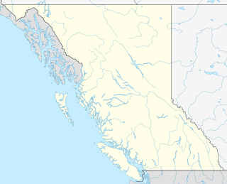
Tweedsmuir North Provincial Park and Protected Area is a provincial park in British Columbia, Canada, which along with Tweedsmuir South Provincial Park and Entiako Provincial Park and Protected Area were once part of Tweedsmuir Provincial Park, then B. C.'s largest park, 9,810 square kilometres (3,790 sq mi) located in the Coast Range. Tweedsmuir gained park status in 1938 and Wells Gray Provincial Park in 1939, the earliest large parks established in the provincial parks system. Tweedsmuir North Provincial Park and Protected Area was re-designated a park and protected area as the latter classification allows resource extraction and other economic activities not permitted in full park designations. Entiako Provincial Park and Protected Area is located on the south flank of the Nechako River watercourse.

Fraser Lake is a village in northern British Columbia, Canada. It's located on the southwest side of Fraser Lake between Burns Lake and Vanderhoof alongside the Yellowhead Highway.

The North Shore is a township in the Canadian province of Ontario, located in the Algoma District. The township had a population of 497 in the Canada 2016 Census. It is along the north shore of the North Channel of Lake Huron, with its main communities all along Highway 17.
Below is a partial list of alleged sightings of unidentified flying objects or UFOs in Canada.

Spanish is a town in the Canadian province of Ontario, located on Trans-Canada Highway 17 in the Algoma District near the border of the Sudbury District. Formerly known as the Township of Shedden, the municipality adopted its current status and name in 2004, taking the name of its largest community.
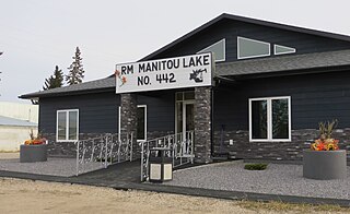
The Rural Municipality of Manitou Lake No. 442 is a rural municipality in the Canadian province of Saskatchewan in north western Division 6. The population of this R.M is 590 people. Manitou Lake is named for the Algonquian word meaning “mysterious being.” It covers 13.3 km2, with an average depth of 3.8 m. The village of Marsden lies near its centre, but is technically not part of the rural municipality.
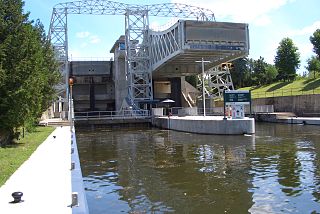
Kirkfield is a village located in the city of Kawartha Lakes, in the Canadian province of Ontario. The unincorporated village was named in 1864 after the initial name, Novar, was rejected by the government. A list of 8 possible choices was then offered. The village, being predominantly Scottish at the time, chose Kirkfield, after Kirk' o' Field in Edinburgh. It is home to Lock 36 of the Trent-Severn Waterway, a hydraulic lift lock which connects Canal Lake and the artificially flooded Mitchell Lake. Travellers and commuters pass through Kirkfield regularly while travelling on Highway 48 west towards Highway 12 and east towards Highway 35.

Shawnigan Lake is a lake on southern Vancouver Island, located to the west of Saanich Inlet and to the south of the Cowichan Valley region. Its aboriginal name in the Hunquminum language is Shaanii'us.
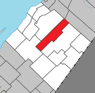
Tourville is a municipality in the L'Islet RCM in Quebec, Canada. It is located in the Chaudière-Appalaches administrative region.

Wasaya Airways LP is a 51% First Nations owned domestic airline with its headquarters in Thunder Bay, Northern Ontario, Canada. Its main hubs are the Thunder Bay International Airport and the Sioux Lookout Airport, however, it also offers a charter and cargo service from a base in Red Lake and Pickle Lake. In 2003, Wasaya Airways bought the rights to serve remote First Nations communities from Bearskin Airlines. The airline also supplies food, clothing, hardware and other various supplies to 25 remote communities in Ontario.

Kovilambakkam is a rural village which is located within Chengalpattu district, Tamil Nadu, India. It is administered by the Kovilambakkam Village Panchayat, which is under control of the St.Thomas Mount Panchayat Union and Tambaram Taluk.


