The Buryats, numbering approximately 500,000, are the largest indigenous group in Siberia, mainly concentrated in their homeland, the Buryat Republic, a federal subject of Russia. They are the major northern subgroup of the Mongols.

Ulan-Ude is the capital city of the Republic of Buryatia, Russia; it is located about 100 kilometers (62 mi) southeast of Lake Baikal on the Uda River at its confluence with the Selenga. According to the 2010 Census, 404,426 people lived in Ulan-Ude; up from 359,391 recorded in the 2002 Census, making the city the third largest in the Russian Far East by population.
An Autonomous Soviet Socialist Republic (ASSR) of the Union of Soviet Socialist Republics was a type of administrative unit in the Union of Soviet Socialist Republics (USSR) created for certain nations. The ASSRs had a status lower than the union republics of the USSR, but higher than the autonomous oblasts and the autonomous okrugs.

The Republic of Buryatia is a federal subject of Russia, located in Siberia in Asia. Formerly part of the Siberian Federal District, it is now part of the Russian Far East as of November 2018 in accordance with a decree issued by Russian President Vladimir Putin. Its capital is the city of Ulan-Ude. Its area is 351,300 square kilometers (135,600 sq mi) with a population of 972,021.
Selsoviet is a shortened name for a rural council and for the area governed by such a council (soviet). The full names for the term are, in Belarusian: се́льскi Саве́т, Russian: се́льский Сове́т, Ukrainian: сільська́ ра́да. Selsoviets were the lowest level of administrative division in rural areas in the Soviet Union. After the dissolution of the Soviet Union, they were preserved as a third tier of administrative-territorial division throughout Ukraine, Belarus, and some of the federal subjects of Russia.

Severobaikalsk is a town in the Republic of Buryatia, Russia, located on the northern end of Lake Baikal at the mouth of the Tyya River, 440 kilometers (270 mi) northwest of Ulan-Ude and 490 kilometers (300 mi) northeast of Irkutsk. Population: 24,929 (2010 Census); 25,434 (2002 Census); 28,336 (1989 Census).

Novy Uoyan is an urban locality in Severo-Baykalsky District of the Republic of Buryatia, Russia, located in the basin of the Upper Angara River, 550 kilometers (340 mi) from Ulan-Ude, the capital of the republic. As of the 2010 Census, its population was 3,963.

The Head of the Republic of Buryatia, formerly President of the Republic of Buryatia, is the highest office within the Government of Republic of Buryatia, Russia. Since the dissolution of the Soviet Union, three people have served in this position.

Bauntovsky District is an administrative and municipal district (raion), one of the twenty-one in the Republic of Buryatia, Russia. It is located in the northeast of the republic. The area of the district is 66,816 square kilometers (25,798 sq mi). Its administrative center is the rural locality of Bagdarin. As of the 2010 Census, the total population of the district was 9,667, with the population of Bagdarin accounting for 49.0% of that number.

Bichursky District is an administrative and municipal district (raion), one of the twenty-one in the Republic of Buryatia, Russia. It is located in the south of the republic. The area of the district is 6,201 square kilometers (2,394 sq mi). Its administrative center is the rural locality of Bichura. As of the 2010 Census, the total population of the district was 25,352, with the population of Bichura accounting for 36.1% of that number.

Khorinsky District is an administrative and municipal district (raion), one of the twenty-one in the Republic of Buryatia, Russia. It is located in the center of the republic. The area of the district is 13,431 square kilometers (5,186 sq mi). Its administrative center is the rural locality of Khorinsk. As of the 2010 Census, the total population of the district was 18,467, with the population of Khorinsk accounting for 44.1% of that number.

Kizhinginsky District is an administrative and municipal district (raion), one of the twenty-one in the Republic of Buryatia, Russia. It is located in the south of the republic. The area of the district is 7,871 square kilometers (3,039 sq mi). Its administrative center is the rural locality of Kizhinga. As of the 2010 Census, the total population of the district was 16,509, with the population of Kizhinga accounting for 38.6% of that number.

Pribaykalsky District is an administrative and municipal district (raion), one of the twenty-one in the Republic of Buryatia, Russia. It is located in the center of the republic. The area of the district is 15,472 square kilometers (5,974 sq mi). Its administrative center is the rural locality of Turuntayevo. As of the 2010 Census, the total population of the district was 26,856, with the population of Turuntayevo accounting for 22.0% of that number.

Yeravninsky District is an administrative and municipal district (raion), one of the twenty-one in the Republic of Buryatia, Russia. It is located in the east of the republic. The area of the district is 25,600 square kilometers (9,900 sq mi). Its administrative center is the rural locality of Sosnovo-Ozerskoye. As of the 2010 Census, the total population of the district was 18,705, with the population of Sosnovo-Ozerskoye accounting for 32.8% of that number.
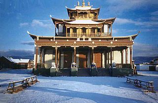
Historically, Buddhism was incorporated into Siberia in the early 17th century. Buddhism is considered as one of Russia's traditional religions, legally a part of Russian historical heritage. Besides the historical monastic traditions of Buryatia, Kalmykia and Tuva, Buddhism is now widespread all over Russia, with many ethnic Russian converts.

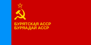
The state flag of the Republic of Buryatia, or simply flag of Buryatia, is one of the official symbols of the Republic of Buryatia—a subject of the Russian Federation.

Selenginsk is an urban locality in Kabansky District of the Republic of Buryatia, Russia, located at the head of the Selenga River delta about 30 kilometers (19 mi) from Lake Baikal and about 50 kilometers (31 mi) northwest of Ulan-Ude, the capital of the republic. As of the 2010 Census, its population was 14,546.
Buddhism in Buryatia—a regional form of Buddhism.
The Anthem of the Republic of Buryatia is one of the state symbols of the Republic of Buryatia together with the flag and the coat of arms.