California Historical Landmarks in San Luis Obispo County, California

Last updated
Map all coordinates using: OpenStreetMap  ·  Google Maps
Download coordinates as: KML  ·  GPX

This list includes properties and districts listed on the California Historical Landmark listing in San Luis Obispo County, California. Click the "Map of all coordinates" link to the right to view a Google map of all properties and districts with latitude and longitude coordinates in the table below.

California Historical Landmark buildings, structures, sites, or places in California determined to have historical significance

California Historical Landmarks (CHLs) are buildings, structures, sites, or places in the U.S. state of California that have been determined to have statewide historical landmark significance.

San Luis Obispo County, California County in California, United States

San Luis Obispo County, officially the County of San Luis Obispo, is a county located in the southern region of the U.S. state of California. As of the 2010 census, the population was 269,637. The county seat is San Luis Obispo.

Image [1] Landmark nameLocationCity or townSummary
Ah Louis Store Ah Louis Store.jpg
Ah Louis Store
802 Ah Louis Store 800 Palm St.
35°16′54″N120°39′51″W / 35.281533°N 120.664167°W / 35.281533; -120.664167 (Ah Louis Store)
San Luis Obispo
Atascadero Administration Building Atascadero City Hall - Atascadero, CA - DSC05365.JPG
Atascadero Administration Building
958 Atascadero Administration Building 6500 Palma Ave.
35°29′22″N120°40′03″W / 35.48945°N 120.667467°W / 35.48945; -120.667467 (Atascadero Administration Building)
Atascadero
Dallidet Adobe Dallidet Adobe and Gardens.JPG
Dallidet Adobe
720 Dallidet Adobe 1309 Toro at Pacific
35°16′51″N120°39′23″W / 35.280967°N 120.6565°W / 35.280967; -120.6565 (Dallidet Adobe)
San Luis Obispo
Estrella Adobe Church Estrella Adobe Church.JPG
Estrella Adobe Church
542 Estrella Adobe Church On Airport Rd.
35°40′50″N120°38′27″W / 35.680510°N 120.640757°W / 35.680510; -120.640757 (Estrella Adobe Church)
Paso Robles
Hearst San Simeon State Historical Monument Hearst Castle Casa Grande September 2012 panorama 2.jpg
Hearst San Simeon State Historical Monument
640 Hearst San Simeon State Historical Monument Hearst San Simeon State Historical Monument
San Simeon
Nitt Witt Ridge NitwitRidge.jpg
Nitt Witt Ridge
939 Nitt Witt Ridge Nitt Witt Ridge, 881 Hillcrest Dr.
35°34′00″N121°05′43″W / 35.566794°N 121.095321°W / 35.566794; -121.095321 (Nitt Witt Ridge)
Cambria
Mission San Luis Obispo de Tolosa MissionSanLuisEntrance.jpg
Mission San Luis Obispo de Tolosa
325 Mission San Luis Obispo de Tolosa Monterey between Chorro and Broad Sts.
35°16′51″N120°39′52″W / 35.280704°N 120.664542°W / 35.280704; -120.664542 (Mission San Luis Obispo de Tolosa)
San Luis Obispo
Mission San Miguel Arcangel MissionSanMiguelPlaza2008.JPG
Mission San Miguel Arcángel
326 Mission San Miguel Arcángel 775 Mission Street San Miguel
35°44′41″N120°41′53″W / 35.744722°N 120.698056°W / 35.744722; -120.698056 (Mission San Miguel Arcángel)
San Miguel
Morro Rock Morro Rock 1.jpg
Morro Rock
821 Morro Rock Off shore
35°22′10″N120°52′03″W / 35.369431°N 120.86755°W / 35.369431; -120.86755 (Morro Rock)
Morro Bay
Rancho Nipomo Rancho Nipomo Dana Adobe and re-enactor.jpg
Rancho Nipomo
1033 Rancho Nipomo 6715 Oakglen Ave.
35°02′N120°29′W / 35.03°N 120.49°W / 35.03; -120.49 (Rancho Nipomo)
Nipomo
Rios-Caledonia Adobe RiosCaledoniaAdobeEastSide.jpg
Rios-Caledonia Adobe
936 Rios-Caledonia Adobe 700 Mission St.
35°44′17″N120°41′56″W / 35.738056°N 120.698889°W / 35.738056; -120.698889 (Rios-Caledonia Adobe)
San Miguel Private property
Santa Margarita de Cortona Asistencia Santa Margarita Asistencia 1881 painting.jpg
Santa Margarita de Cortona Asistencia
364 Santa Margarita de Cortona Asistencia Rancho Santa Margarita Hay Barn
35°24′02″N120°36′44″W / 35.400556°N 120.612222°W / 35.400556; -120.612222 (Santa Margarita de Cortona Asistencia)
Santa Margarita Private property
Sebastian Store SEBASTIAN STORE, SAN LUIS OBISPO COUNTY, CA.jpg
Sebastian Store
726 Sebastian Store San Simeon Rd.
35°38′36″N121°11′29″W / 35.643383°N 121.191367°W / 35.643383; -121.191367 (Sebastian Store)
San Simeon

Related Research Articles

San Luis Obispo, California City in California, United States

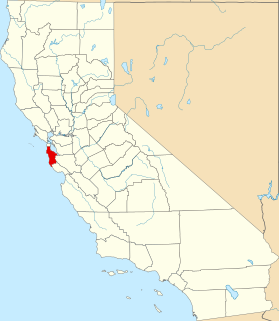
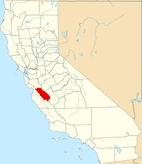
San Luis Obispo, or SLO for short, is a city in the U.S. state of California, located roughly midway between Los Angeles and San Francisco on the Central Coast of Southern California. The population was 45,119 at the 2010 census. The population of San Luis Obispo County was 269,637 in 2010.

Santa Margarita de Cortona Asistencia

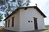
The Santa Margarita de Cortona Asistencia was established in 1787 as an asistencia ("sub-mission") to Mission San Luis Obispo de Tolosa, then in the Spanish Las Californias Province. Its site is near the present day city of Santa Margarita, in San Luis Obispo County, central California.

National Register of Historic Places listings in San Diego County, California Wikimedia list article

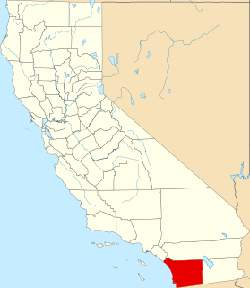
This is a list of the National Register of Historic Places listings in San Diego County, California.

National Register of Historic Places listings in Santa Clara County, California Wikimedia list article

This is a list of the National Register of Historic Places listings in Santa Clara County, California.

National Register of Historic Places listings in San Bernardino County, California Wikimedia list article

This is a list of the National Register of Historic Places listings in San Bernardino County, California.

National Register of Historic Places listings in San Joaquin County, California Wikimedia list article

This is a list of the National Register of Historic Places listings in San Joaquin County, California.

National Register of Historic Places listings in San Mateo County, California Wikimedia list article

This is a list of the National Register of Historic Places listings in San Mateo County, California.

National Register of Historic Places listings in San Benito County, California Wikimedia list article

This is a list of the National Register of Historic Places listings in San Benito County, California.

San Luis Obispo Octagon Barn place in California listed on National Register of Historic Places

The Pereira Octagon Barn of San Luis Obispo is a historically and culturally important structure on the Central Coast of California. It was built in 1906 by Henri LaFranchi, John Damaso, and a third, unknown man. Since there were no other octagonal barns in the area, the builders may have worked from patterns of octagonal construction in farm journals or catalogs.

Rancho Nipomo

Rancho Nipomo was a 37,888-acre (153.33 km2) Mexican land grant in present day San Luis Obispo County, California given in 1837 by Governor Juan B. Alvarado to William Goodwin Dana. The grant encompassed present day Nipomo. The ranch is designated as a California Historical Landmark.

List table of the properties and districts — listed on the California Historical Landmarks — within City and County of San Francisco, California.

List table of the properties and districts — listed on the California Historical Landmarks — within San Benito County, Northern California.

List table of the properties and districts — listed on the California Historical Landmarks — within San Bernardino County, Southern California.

A list including the properties and districts listed on the California Historical Landmarks in San Diego County, Southern California.

This list includes properties and districts listed on the California Historical Landmark listing in San Joaquin County, California. Click the "Map of all coordinates" link to the right to view a Google map of all properties and districts with latitude and longitude coordinates in the table below.

List table of the properties and districts — listed on the California Historical Landmarks — within San Mateo County, California.

Estrella Adobe Church

The Estrella Adobe Church, an adobe dwelling built in 1879, is a California Historical Landmark (#542). It fell into disuse and was in ruins when, according to the marker, the Paso Robles Women's Club History and Landmarks Committee restored the structure in 1952.

Dallidet Adobe historical landmark in San Luis Obispo, California

The Dallidet Adobe and Gardens is a California Historical Landmark (#720) in San Luis Obispo, California. The site was originally the property of Pierre Hypolite Dallidet, who came to San Francisco in search of gold in 1850.

References

See also

National Register of Historic Places listings in San Luis Obispo County, California Wikimedia list article

This is a list of the National Register of Historic Places listings in San Luis Obispo County, California.