Buildings, sites, districts, and objects in California listed on the National Register of Historic Places:

This is a list of the National Register of Historic Places listings in Los Angeles County, California.
This is a list of the National Register of Historic Places listings in San Diego County, California.

This is a list of the National Register of Historic Places listings in Ventura County, California.

This is a list of the National Register of Historic Places listings in Santa Clara County, California.

This is a list of the National Register of Historic Places listings in Riverside County, California.

This is a list of the National Register of Historic Places listings in San Bernardino County, California.

This is a list of the National Register of Historic Places listings in Kern County, California.
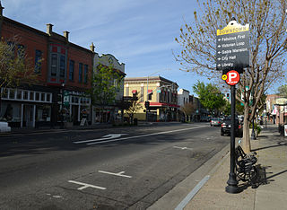
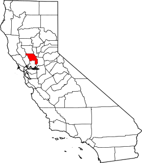
The Downtown Woodland Historic District is a historic district in Woodland, California. The district encompasses roughly 370 acres (1.5 km2) and 59 contributing buildings. It is a California Historical Landmark and is listed as a historic district on the National Register of Historic Places.
List table of the properties and districts — listed on the California Historical Landmarks — within Calaveras County, California.
Properties and districts listed as California Historical Landmarks within Kern County.
List table of the properties and districts — listed on the California Historical Landmarks in Los Angeles County, Southern California.
This list includes properties and districts listed on the California Historical Landmark listing in Monterey County, California, United States. Click the "Map of all coordinates" link to the right to view an online map of all properties and districts with latitude and longitude coordinates in the table below.
List table of the properties and districts — listed on the California Historical Landmarks — within City and County of San Francisco, California.
List table of the properties and districts listed on the California Historical Landmarks within Riverside County, southern California.
This list includes properties and districts listed on the California Historical Landmark listing in Sacramento County, California. Click the "Map of all coordinates" link to the right to view a Google map of all properties and districts with latitude and longitude coordinates in the table below.
List table of the properties and districts — listed on the California Historical Landmarks — within Sonoma County, California.
List table of the properties and districts — listed on the California Historical Landmarks — within San Mateo County, California.
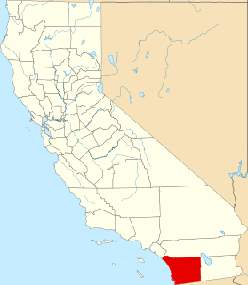
This list includes properties and districts listed on the California Historical Landmark listing in Ventura County, California. Click the "Map of all coordinates" link to the right to view a Google map of all properties and districts with latitude and longitude coordinates in the table below.