Camaligan, Camarines Sur

Last updated
Camaligan
Municipality of Camaligan
Camaligan Church facade.jpg
Etymology: Tagalog: kamalig + an ("place of sheds")
Nickname(s): 
The Small Town with a Big Heart
Anthem: Camaligan Kong Namomótan
My Beloved Camaligan
Ph locator camarines sur camaligan.png
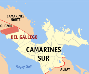
Map of Camarines Sur with Camaligan highlighted
Philippines location map (square).svg
Red pog.svg
Camaligan
Location within the Philippines
Coordinates: 13°37′30″N123°09′25″E / 13.625°N 123.1569°E / 13.625; 123.1569 Coordinates: 13°37′30″N123°09′25″E / 13.625°N 123.1569°E / 13.625; 123.1569
Country Flag of the Philippines.svg  Philippines
Region Bicol Region (Region V)
Province Camarines Sur
District 3rd district
Barangays 13 (see Barangays)
Government
[1]
  Type Sangguniang Bayan
   Mayor Marilou Marquez-Hirose
   Vice Mayor Diano S. Ibardaloza, Jr. [2]
   Municipal Council
  CongressmanGabriel H. Bordado Jr.
  Electorate15,562 voters (2019)
Area
[3]
  Total4.68 km2 (1.81 sq mi)
Population
 (2015 census) [4]
  Total24,109
  Density5,200/km2 (13,000/sq mi)
Demonym(s) Camaligueño (masculine)
Camaligueña (feminine)
Time zone UTC+8 (PST)
ZIP code
4401
PSGC
IDD : area code +63(0)54
Climate type tropical rainforest climate
Income class 5th municipal income class
Revenue (₱)58,700,476.23 (2016) [5]
Poverty incidence 18.45% (2012) [6]
Native languagesCentral Bikol
Tagalog
Feast dateJune 13 (Poblacion)
Catholic diocese Archdiocese of Caceres
Patron saints St. Anthony of Padua
St. Teresa of Calcutta

Camaligan, officially the Municipality of Camaligan, is a 5th class municipality in the province of Camarines Sur, Philippines. According to the 2015 census, it has a population of 24,109 people. [4]

Camarines Sur Province in Bicol Region, Philippines

Camarines Sur is a province located in the Bicol Region in Luzon of the Philippines. Its capital is Pili and the province borders Camarines Norte and Quezon to the northwest, and Albay to the south. To the east lies the island province of Catanduanes across the Maqueda Channel.

Philippines Republic in Southeast Asia

The Philippines, officially the Republic of the Philippines, is an archipelagic country in Southeast Asia. Situated in the western Pacific Ocean, it consists of about 7,641 islands that are broadly categorized under three main geographical divisions from north to south: Luzon, Visayas and Mindanao. The capital city of the Philippines is Manila and the most populous city is Quezon City, both part of Metro Manila. Bounded by the South China Sea on the west, the Philippine Sea on the east and the Celebes Sea on the southwest, the Philippines shares maritime borders with Taiwan to the north, Japan to the northeast, Vietnam to the west, Palau to the east, and Malaysia and Indonesia to the south.

Contents

With an area of 468.8 hectares (1,158 acres), it is the smallest municipality in Camarines Sur, but it is the densest, having an approximation of 5,200 persons per square kilometer, [7] which is almost twice the density of the neighboring City of Naga of 2,456 per square kilometer. [8]

Naga, Camarines Sur Independent Component City in Bicol Region, Philippines

Naga, officially the City of Naga, or simply Naga City, is a 2nd class independent component city in the Bicol Region, Philippines. According to the 2015 census, it has a population of 196,003 people.

The town is home to the oldest known pre-colonial site in the Bicol region, dating 500 AD to 600 AD, making it an undeclared important archaeological zone. [9]

Archaeological site Place in which evidence of past activity is preserved

An archaeological site is a place in which evidence of past activity is preserved, and which has been, or may be, investigated using the discipline of archaeology and represents a part of the archaeological record. Sites may range from those with few or no remains visible above ground, to buildings and other structures still in use.

Barangays

Camaligan is politically subdivided into 13 barangays. [10]

Barangay Village in Philippines

A barangay or baranggay, sometimes referred to as barrio, is the smallest administrative division in the Philippines and is the native Filipino term for a village, district or ward. In metropolitan areas, the term often refers to an inner city neighbourhood, a suburb or a suburban neighborhood. The word barangay originated from balangay, a kind of boat used by a group of Austronesian peoples when they migrated to the Philippines.

BarangaysClassPopulation [11] Barangay Head
DugcalRural4,464Gabriel Jr. DV. Flores
MarupitRural4,510Delia B. Mansor
San FranciscoRural745Eden G. Torallo
San Jose-San Pablo (Poblacion)Rural671Eden B. Bon
San Juan-San Ramon (Poblacion)Rural982Emeterio M. Avila
San Lucas (Poblacion)Rural578Cyril O. Agomaa
San Marcos (Poblacion)Rural1,388Danilo I. Villamor
San Mateo (Poblacion)Rural1,508Carlos Q. Mariscal, Jr.
San RoqueRural3,585Rolando P. Marasigan
Santo Domingo (Poblacion)Rural618Maria Teresa A. Ruiz
Santo Tomas (Poblacion)Rural810Maria Jasmin M. Trinidad
SuaRural2,154Servando Santa Ana
TarosananRural2,096Loretta A. Acabado

History

Etymology

The origin of the town and its name can be traced back to the early settlers of the place. Known as the cortadores, or woodcutters, to the early Spanish colonizers who came to the place in the early 1700s, the settlers cut timbers from nearby mountains located upriver or around San Miguel Bay and made this as their form of living. Out of these timbers, they hewed out canoes or bancas which they stored under small sheds or huts. Later, when these sheds became abundant in the area, as they were made the permanent dwelling places by these canoe makers, the place was called "Camaligan", which means "a place where many sheds can be found", by combining the root word kamalig (or shed) and the locative suffix -an. The sheds served to shelter the canoe makers and protect their boats from the natural elements. Hence, the name and origin of the town is historically tied to the Bicol River and its early inhabitants. [12]

San Miguel Bay bay

San Miguel Bay is a large bay in the Bicol Peninsula of Luzon island in the Philippines. It encompasses the provinces of Camarines Norte and Camarines Sur.

Bicol River river in the Philippines

The Bicol River is the eighth largest river in the Philippines in terms of drainage basin size with an estimated catchment area of 3,770 square kilometres (1,460 sq mi). The river drains the southwestern part of the island of Luzon and passes through Camarines Sur province in the Bicol Region.

"Catagbacan" was the oldest known name of Camaligan. Moreover, according to D. Adolfo Puya y Ruiz, in his “Camarines Sur – Descripcion General De Està Provincia En Luzon” (Manila: 1887), Camaligan was called "Kinamaligan" before. [12]

Pre-colonial era

The town of Camaligan is a known archeological site. In 2016 to 2017, hundreds of artifacts, including shells, jar fragments, tools, other deposits, pig bones, deer bones, stingray cartilage, shark cartilage, and at least fifteen (15) pre-colonial human remains, were found in the area, which marked a revolutionary phase in Bicol archaeology. The shells and tools found in the town was dated back 1,500 years ago or approximately 500 to 600 AD. The site contained no trace of Chinese, Southeast Asian, or South Asian trade links, making Camaligan a pure pre-colonial Bicolano site. [9] [13]

Spanish era

The settlers of the religious visita of Nueva Caceres, which was then under its ecclesiastical jurisdiction, arrived in the town by the 17th century. [12] The pre-colonial cemetery and community center were transformed by the Spanish into the town's current church compound to diminish native belief systems and instill catholicism. [14] During this time, Camaligan had five barrios in its jurisdiction, namely Marupit, Doncal (now Dugcal), Sua, San Roque and Tarosanan. Each barrio has a small wooden chapel. [12]

On 5 June 1795, a petition to the Spanish religious authorities was sent by the natives and signed by the supposedly officials of the place, to request for a resident curate. The officials’ names were Andre Casa, Diego, Lobao, Simeon de la Cruz, Manuel del Espiritu Santo, Fernando Valenzuela, Agustin del Espiritu Santo, Marcos David, Domingo Flores, Pedro Negre, Bartolome Rodriguez and Valentine de los Santos. Fray Rafael de Benavente was appointed as the first parish priest. [12]

American era

In 1902, the municipality was officially established through an act of the Philippine legislature. It also named Pedro Bustamante as the first municipal mayor. This event of the creation of the Municipality of Camaligan was brought about by a historical fact when the town was eventually separated from being as an annex of Nueva Caceres (now Naga City). [12]

Culture

The people of Camaligan derived their socio-cultural identity as river people from the existence of the river. Bicol River is an important resource for irrigation and fertilization of the land where agriculture and fishing is still considered as a major industry. The place’s festivals, songs and dances found their roots and inspiration from the river. Hence, the river ecology has bred its own distinct community. [12]

Festivals

Religious and cultural festivals are being held in the town.

Demographics

In the 2015 census, the population of Camaligan was 24,109 people, [4] with a density of 5,200 inhabitants per square kilometre or 13,000 inhabitants per square mile.

Population census of Camaligan
YearPop.±% p.a.
1918 2,133    
1939 3,005+1.65%
1948 7,362+10.47%
1960 8,529+1.23%
1970 7,821−0.86%
1975 9,853+4.74%
1980 10,989+2.21%
1990 15,436+3.46%
1995 17,411+2.28%
2000 19,188+2.11%
2007 20,758+1.09%
2010 22,254+2.56%
2015 24,109+1.54%
Source: Philippine Statistics Authority [4] [15] [16] [17]

Climate

Camaligan has a significant amount of rainfall during the year. This is true even for the driest month. According to the Köppen climate classification system, Camaligan has a tropical rainforest climate or Af. The average annual temperature is 27.1 °C in Camaligan. About 2527 mm of precipitation falls annually. [18]

Climate data for Camaligan, Camarines Sur
MonthJanFebMarAprMayJunJulAugSepOctNovDecYear
Average high °C (°F)32
(90)
31
(88)
34
(93)
36
(97)
37
(99)
37
(99)
36
(97)
34
(93)
35
(95)
34
(93)
33
(91)
32
(90)
34
(94)
Average low °C (°F)27
(81)
27
(81)
29
(84)
31
(88)
32
(90)
32
(90)
31
(88)
30
(86)
30
(86)
29
(84)
28
(82)
28
(82)
30
(85)
Average precipitation mm (inches)39.34
(1.55)
68.7
(2.70)
26.73
(1.05)
66.19
(2.61)
84.49
(3.33)
178.89
(7.04)
244.27
(9.62)
188.3
(7.41)
160.98
(6.34)
445.0
(17.52)
135.5
(5.33)
367.8
(14.48)
2,006.19
(78.98)
Average rainy days161813152328302426272529274
Source: World Weather Online [19]

Economy

Bicol River serves as a natural source of irrigation and fertilization to the town where agriculture is still considered as a major industry. [12]

Out of the 468 hectares total land area, 175 hectares are devoted to rice production, all of which are irrigated and fertilized by the river through its occasional flooding. [12]

Tourism

St. Anthony of Padua Parish Church is one of the oldest churches in the province of Camarines Sur. [14] The church is one of the favorite spots for Visita Iglesia in the province. [20]

Santo Domingo Chapel is an old chapel which was a former burial ground during pre-colonial times. It is a central archeological site where a lot of burial jars, porcelains and skeleton bones were found during the diggings. [14]

Sira, or fish, is a small wharf painted with festive colors that is constructed on the riverside of barangay San Francisco. This also serves as a dock for banca passengers. [14]

After the initial launching of Camaligan River Park in 1 June 2014, its tourism industry began to be more active. Its continuous improvements attracted many visitors, mostly coming from the City of Naga, to come and enjoy walking along the riverside. [21]

M/B Camaligan is a motorboat which docks beside Camaligan River Park. Also known as Camaligan River Cruise, it is also a floating restaurant which crosses the Bicol River. Launched last 6 February 2019, it is the newest attraction which promotes the river culture of the town. [21]

Government & Politics

Camaligan is being headed by a mayor who is being elected by its residents.

The current mayor of the town is Marilou Marquez-Hirose. [22] Last May 2019 Election, she has been re-elected for her third and last term as the Municipal Mayor. [2]

Since 1902, thirty (30) mayors already headed the town.

TermMayor [12]
1902-1903Pedro Bustamante
1904-1905Quintin Bagsic
1905-1906Catalino Alayan
1906-1907Fabian Garcia
1908-1909Tomas Salvador
1909-1911Jose Agapor
1912-1915Mauricio Cordial
1916-1919Liberato Montiveros
1920-1923Antonio Santa Ana
1924-1927Pedro Flores
1928-1931Vidal Custodio
1932-1935Elias Agna de Dios
1936-1941Teotimo Rebuquiao
1942-1944Felipe Cuadrante
1944Glecerio Blas
1945Andres Diez
1946-1947Julio Capucao
1948-1951Francisco A. Aurellano
1952-1955Buenaventura Plantado
1956-1963Agapito T. Loriaga
1964-1967Dalmacio Aurellano
1968-1971Agapito T. Loriaga
1972-1986Dalmacio Aurellano
1986Napoleon Valiente
1986-1987Amelito Belen
1987Fabian A. Valenciano
1987-1988Priscilla T. Aurellano
1988-1995Manuel N. Prado
1995-2004Rolando C. Eduardo
2004-2007Pablo N. Prado
2007-2010Rolando C. Eduardo
2010-2013Emmanuel T. Prado
2013–PresentMarilou Marquez-Hirose

Educational institutions

Camaligan has one (1) high school, six (6) elementary schools and thirteen (13) preschools. At present, there is no existing tertiary school in the town.

High School

Elementary Schools

Preschools

Archaeology

Camaligan is Bicol region's oldest known pre-colonial site, filled with numerous stone tools, jar fragments, shell middens, pig and deer bones, shark and ray cartilages, and other artifacts and biofacts. The site also homes to fifteen human skeletons of pre-colonial Ibalons. The site is so rare and vital as it does not contain any evidences of trade contact with China, Southeast Asian neighbors or South Asia, making it one of the very few pre-colonial sites in the Philippines with distinct Filipino artifacts and biofacts unaffected by outside trade. Both the University of the Philippines and University of California, Los Angeles have been pushing for the town's declaration as an "Important Archaeological Site." Scholars have also been pushing for the site's nomination in the UNESCO World Heritage List. [9] [13]

In a documentary made by GMA News TV, it was found that the artifacts and biofacts were not limited to the town proper. In fact, during a road-widening project conducted in September 2017 by the national government, hundreds of human bone fragments, animal bones, burial and ceremonial jar fragments, and stone tools were found after digging only the edges of the road. The documentary also found many Camaligueños to own artifacts they have found in their own land. Due to these findings, the town's reputation as a vital pre-colonial Ibalon archaeological site was solidified. [23]

Notable people

Related Research Articles

Tiwi, Albay Municipality of the Philippines in the province of Albay

Tiwi,, is a 1st class municipality in the Province of Albay, Philippines. According to the 2015 census, it has a population of 53,120 people.

Baao, Camarines Sur Municipality in Bicol Region, Philippines

Baao,, officially the Municipality of Baao, is a 3rd class municipality in the province of Camarines Sur, Philippines. According to the 2015 census, it has a population of 58,849 people.

Bula, Camarines Sur Municipality in Bicol Region, Philippines

Bula,, officially the Municipality of Bula, is a 2nd class municipality in the province of Camarines Sur, Philippines. According to the 2015 census, it has a population of 69,430 people.

Calabanga Municipality in Bicol Region, Philippines

Calabanga, officially the Municipality of Calabanga, Banwaan kan Calabanga, is a 1st class municipality in the province of Camarines Sur, Philippines. According to the 2015 census, it has a population of 83,033 people.

Canaman, Camarines Sur Municipality in Bicol Region, Philippines

Canaman, officially the Municipality of Canaman, is a 4th class municipality in the province of Camarines Sur, Philippines. According to the 2015 census, it has a population of 34,210 people.

Del Gallego, Camarines Sur Municipality in Bicol Region, Philippines

Del Gallego, officially the Municipality of Del Gallego, is a 4th class municipality in the province of Camarines Sur, Philippines. According to the 2015 census, it has a population of 25,397 people.

Goa, Camarines Sur Municipality in Bicol Region, Philippines

Goa, officially the Municipality of Goa, is a 2nd class municipality in the province of Camarines Sur, Philippines. According to the 2015 census, it has a population of 63,308 people.

Libmanan, Camarines Sur Municipality in Bicol Region, Philippines

Libmanan, officially the Municipality of Libmanan, is a 1st class municipality in the province of Camarines Sur, Philippines. According to the 2015 census, it has a population of 108,716 people. The town is home to the Morales Ruins, a 1937 architectural Art Deco masterpiece in the heart of the historic town. The Art Deco building is reportedly designed by a Filipino national artist.

Magarao Municipality in Bicol Region, Philippines

Magarao, officially the Municipality of Magarao, is a 4th class municipality in the province of Camarines Sur, Philippines. According to the 2015 census, it has a population of 25,694 people.

Milaor Municipality in Bicol Region, Philippines

Milaor, officially the Municipality of Milaor, is a 4th class municipality in the province of Camarines Sur, Philippines. According to the 2015 census, it has a population of 31,150 people.

Minalabac, Camarines Sur Municipality in Bicol Region, Philippines

Minalabac, officially the Municipality of Minalabac, is a 3rd class municipality in the province of Camarines Sur, Philippines. According to the 2015 census, it has a population of 52,390 people.

Ocampo, Camarines Sur Municipality in Bicol Region, Philippines

Ocampo, officially the Municipality of Ocampo, is a 3rd class municipality in the province of Camarines Sur, Philippines.

Pamplona, Camarines Sur Municipality in Bicol Region, Philippines

Pamplona, officially the Municipality of Pamplona, is a 4th class municipality in the province of Camarines Sur, Philippines. According to the 2015 census, it has a population of 36,390 people.

Pili, Camarines Sur Municipality in Bicol Region, Philippines

Pili,, officially the Municipality of Pili, is a 1st class municipality and the capital town of the province of Camarines Sur, Philippines. According to the 2015 census, it has a population of 89,545 people.

Sagñay Municipality of the Philippines in the province of Camarines Sur

Sagñay, [ˈsaŋaj], officially the Municipality of Sagñay, is a 4th class municipality in the province of Camarines Sur, Philippines. According to the 2015 census, it has a population of 34,546 people.

Sipocot, Camarines Sur Municipality in Bicol Region, Philippines

Sipocot, officially the Municipality of Sipocot, is a 1st class municipality in the province of Camarines Sur, Philippines. According to the 2015 census, it has a population of 64,855 people.

Tigaon, Camarines Sur Municipality in Bicol Region, Philippines

Tigaon, officially the Municipality of Tigaon, is a 3rd class municipality in the province of Camarines Sur, Philippines. According to the 2015 census, it has a population of 55,272 people.

Camaligan River Park Linear park in Camaligan, Philippines

Camaligan River Park, also known as Camaligan Wharf, is a linear park in Camaligan, Camarines Sur, Philippines. Located beside the Bicol River, it is the only park being built inside the Municipality of Camaligan.

St. Anthony of Padua Parish Church (Camaligan) Church in Camarines Sur, Philippines

The St. Anthony of Padua Parish Church, originally known as Camaligan Church, is a Roman Catholic church in Camaligan, Camarines Sur, Philippines. It is the one of the two parish churches of the Roman Catholic Archdiocese of Caceres located in the town of Camaligan. The parish was established in 1795. The first church structure of Camaligan that was made of stones and woods was burnt in the year 1856. The current church architecture was only completed in 1857, a year after the original structure was burnt. Though, it is still considered as one of the oldest churches in Camarines Sur that is very rich in religious and cultural history, and a popular spot for Visita Iglesia.

References

  1. "Municipality". Quezon City, Philippines: Department of the Interior and Local Government. Retrieved 31 May 2013.
  2. 1 2 3 "Halalan 2019 CAMALIGAN, CAMARINES SUR Results". ABS-CBN. 22 May 2019. Retrieved June 16, 2019.
  3. "Province: Camarines Sur". PSGC Interactive. Quezon City, Philippines: Philippine Statistics Authority . Retrieved 12 November 2016.
  4. 1 2 3 4 Census of Population (2015). "Region V (Bicol Region)". Total Population by Province, City, Municipality and Barangay. PSA . Retrieved 20 June 2016.
  5. "Camarines Sur : Cities and Municipalities Competitiveness Index". Makati City, Philippines: National Competitiveness Council (Philippines). Archived from the original on 2018-07-14. Retrieved 29 October 2017.
  6. "PSA Releases the 2012 Municipal and City Level Poverty Estimates". Quezon City, Philippines: Philippine Statistics Authority. Archived from the original on 28 January 2017. Retrieved 28 January 2017.
  7. "Camaligan, Province of Camarines Sur". PhilAtlas. nd. Retrieved June 16, 2019.
  8. Brinkhoff, Thomas (31 October 2017). "Naga: City in Luzon". City Population. Retrieved 16 June 2019.
  9. 1 2 3 Escandor, Juan Jr."1500-yr-old artifacts found in CamSur". Inquirer.net. 18 August 2017. Retrieved June 16, 2019.
  10. "Camaligan:DILG Region V Camarines Sur". DILG Region V. Retrieved 16 June 2019.
  11. "Countryside in Figures: Camarines Sur 2018". PSA CamSur. PSA CamSur. 2018. p. 53. Retrieved 12 June 2019.
  12. 1 2 3 4 5 6 7 8 9 10 Marcaida, Dominador Jr. "Camaligan Town and Municipality History". Academia. 30 September 2016. Retrieved June 16, 2019.
  13. 1 2 Escandor, Juan Jr."Hispanic burial ground unearthed in Camsur". Lifestyle.inq. 31 July 2017. Retrieved June 16, 2019.
  14. 1 2 3 4 "Historic Camaligan". I Know Places. 30 March 2019. Retrieved June 16, 2019.
  15. Census of Population and Housing (2010). "Region V (Bicol Region)". Total Population by Province, City, Municipality and Barangay. NSO . Retrieved 29 June 2016.
  16. Censuses of Population (1903–2007). "Region V (Bicol Region)". Table 1. Population Enumerated in Various Censuses by Province/Highly Urbanized City: 1903 to 2007. NSO.
  17. "Province of Camarines Sur". Municipality Population Data. Local Water Utilities Administration Research Division. Retrieved 17 December 2016.
  18. "Climate-Data.org". Climate Sahara: Temperature, Climograph, Climate table for Sahara - Climate-Data.org. 9 August 2015. Retrieved 17 February 2019.
  19. "Camaligan, Camarines Sur: Average Temperatures and Rainfall". World Weather Online. Retrieved 29 October 2017.
  20. "VISITA IGLESIA IN CAMARINES SUR, PHILIPPINES – 7 CHURCH IN 7 DAYS ITINERARY". Two Monkeys Travel. 2 February 2019. Retrieved 13 June 2019.
  21. 1 2 "#NCDTravels: Camaligan Floating Restaurant/River Cruise". Naga City Deck. 26 February 2019. Retrieved 13 June 2019.
  22. "2016 Election Results: Councilor, Lone District of Camaligan". Rappler. 19 May 2019. Retrieved June 16, 2019.
  23. "iJuander: Mga kagamitang nagmula sa sinaunang sibilisasyon, namataan sa Camarines Sur". Youtube. GMA Public Affairs. 21 September 2017. Retrieved 16 June 2019.
  24. "Miss Philippines Earth 2007 Winners". Mukamo. Mukamo. 6 July 2018. Retrieved 18 February 2019.