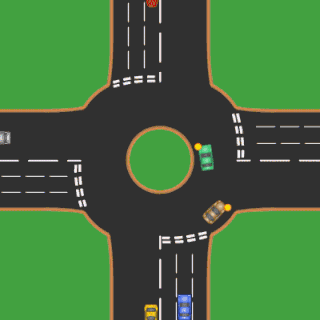
A roundabout is a type of circular intersection or junction in which road traffic is permitted to flow in one direction around a central island, and priority is typically given to traffic already in the junction.

An intersection is an at-grade junction where two or more roads meet or cross. Intersections may be classified by number of road segments, traffic controls, and/or lane design.

Traffic lights, also known as traffic signals, traffic lamps, traffic semaphore, signal lights, stop lights, robots, and traffic control signals, are signalling devices positioned at road intersections, pedestrian crossings, and other locations to control flows of traffic.
Level of service (LOS) is a qualitative measure used to relate the quality of motor vehicle traffic service. LOS is used to analyze roadways and intersections by categorizing traffic flow and assigning quality levels of traffic based on performance measure like vehicle speed, density, congestion, etc.

Bus rapid transit (BRT), also called a busway or transitway, is a bus-based public transport system designed to improve capacity and reliability relative to a conventional bus system. Typically, a BRT system includes roadways that are dedicated to buses, and gives priority to buses at intersections where buses may interact with other traffic; alongside design features to reduce delays caused by passengers boarding or leaving buses, or purchasing fares. BRT aims to combine the capacity and speed of a metro with the flexibility, lower cost and simplicity of a bus system.

A diamond interchange is a common type of road junction, used where a freeway crosses a minor road.

A single-point urban interchange, also called a single-point interchange (SPI) or single-point diamond interchange (SPDI), is a type of highway interchange. The design was created in order to help move large volumes of traffic through limited amounts of space safely and efficiently.

An arterial road or arterial thoroughfare is a high-capacity urban road. The primary function of an arterial road is to deliver traffic from collector roads to freeways or expressways, and between urban centres at the highest level of service possible. As such, many arteries are limited-access roads, or feature restrictions on private access.

A diverging diamond interchange (DDI), also called a double crossover diamond interchange (DCD), is a type of diamond interchange in which the two directions of traffic on the non-freeway road cross to the opposite side on both sides of the bridge at the freeway. It is unusual in that it requires traffic on the freeway overpass to briefly drive on the opposite side of the road from what is customary for the jurisdiction. The crossover "X" sections can either be traffic-light intersections or one-side overpasses to travel above the opposite lanes without stopping, to allow nonstop traffic flow when relatively sparse traffic.
A junction is where two or more roads meet.
Intersection Capacity Utilization
(ICU) method is a tool for measuring a roadway intersection's capacity. It is ideal for transportation planning applications such as roadway design, congestion management programs and traffic impact studies. It is not intended for traffic operations or signal timing design. ICU is also defined as "the sum of the ratios of approach volume divided by approach capacity for each leg of intersection which controls overall traffic signal timing plus an allowance for clearance times." The ICU tells how much reserve capacity is available or how much the intersection is overcapacity. The ICU does not predict delay, but it can be used to predict how often an intersection will experience congestion.
Lost time is the term within traffic engineering for the time during which no vehicles are able to pass through an intersection despite the traffic signal displaying a green (go) signal. The total lost time is the sum of two separate elements: start-up lost time and clearance lost time. Start-up lost time happens when a traffic signal changes from red (stop) to green (go). Some amount of time elapses between the signal changing from red to green and the first queued vehicle moving through the intersection. There is then an additional amount of time for the next vehicle to begin moving and pass through the intersection, and so on. The total time taken for all waiting drivers to react and accelerate is the start-up lost time. Clearance lost time is the time lost to stopping a line of vehicles at the end of a green phase. Lost time is always measured in seconds.

The bowtie is a type of road intersection which replaces left turns or right turns, with roundabouts on the cross street. It is an alternative to the Michigan left intersection.

The Highway Capacity Manual (HCM) is a publication of the Transportation Research Board of the National Academies of Science in the United States. It contains concepts, guidelines, and computational procedures for computing the capacity and quality of service of various highway facilities, including freeways, highways, arterial roads, roundabouts, signalized and unsignalized intersections, rural highways, and the effects of mass transit, pedestrians, and bicycles on the performance of these systems.

The normal function of traffic lights requires more than slight control and coordination to ensure that traffic and pedestrians move as smoothly, and safely as possible. A variety of different control systems are used to accomplish this, ranging from simple clockwork mechanisms to sophisticated computerized control and coordination systems that self-adjust to minimize delay to people using the junction.
TRANSYT-7F is a traffic simulation and signal timing optimization program. The primary application of TRANSYT-7F is signal timing design and optimization. TRANSYT-7F features genetic algorithm optimization of cycle length, phasing sequence, splits, and offsets. TRANSYT-7F combines a detailed optimization process with a detailed macroscopic simulation model.

Cycling infrastructure refers to all infrastructure which may be used by cyclists. This includes the same network of roads and streets used by motorists, except those roads from which cyclists have been banned, plus additional bikeways that are not available to motor vehicles, such as bike paths, bike lanes, cycle tracks and, where permitted, sidewalks, plus amenities like bike racks for parking and specialized traffic signs and signals. Cycling modal share is strongly associated with the size of local cycling infrastructure.

An offset T-intersection is an at-grade road intersection where a conventional four leg intersection is split into two three-leg T-intersections to reduce the number of conflicts and improve traffic flow. Building the offset T-intersections as continuous green T-intersections, there is a single stop on the arterial road, only. A higher volume of through traffic on the cross road, or on unsignalized intersections, a rebuild to a conventional four-leg intersection may be adequate, also when the offset is a few feet only like staggered junctions causing slower traffic for a longer time on the arterial road.

A split intersection is a rarely built at-grade variant of the diamond interchange. Compared to a conventional four-leg intersection or road crossing, the arterial road is split into separate carriageways by 200 to 300 feet, allowing a queue of left turning vehicles behind a completed turn into the crossroad without any conflict to oncoming traffic. On the crossroad, the four leg intersection is being replaced by two intersections. The beginning one-way traffic at the fourth leg makes the intersections reduce the number of conflicts similar to a three leg T-intersection to improve traffic flow.