Capellanía (wetland)

Last updated
Capellanía Wetland
Humedal de Capellanía

Capella pan part.jpg

Capellanía Wetland
Colombia Bogota location map.png
Green pog.svg
Location in Bogotá
Location Fontibón, Bogotá
Flag of Colombia.svg  Colombia
Coordinates 4°40′30″N74°7′50″W / 4.67500°N 74.13056°W / 4.67500; -74.13056 Coordinates: 4°40′30″N74°7′50″W / 4.67500°N 74.13056°W / 4.67500; -74.13056
Area 27.03 ha (66.8 acres)
Elevation 2,542 m (8,340 ft)
Administrator EAAB - ESP
Website Humedal de Capellanía

Capellanía (Spanish : Humedal de Capellanía) is a wetland situated in the locality of Fontibón as one of the Wetlands of Bogotá, Colombia. It forms part of the Fucha River basin on the Bogotá savanna. Since 1995, it has been split into two due to the construction of the Avenida La Esperanza. This has caused rapid deterioration and the wetland is likely to disappear because of the industries that surround it, the current transportation projects of the area, and future developments approved by the district. The wetland covers 27 hectares (67 acres). [1]

Spanish language Romance language

Spanish or Castilian is a Western Romance language that originated in the Castile region of Spain and today has hundreds of millions of native speakers in the Americas and Spain. It is a global language and the world's second-most spoken native language, after Mandarin Chinese.

Fontibón Locality of Bogotá in Bogotá D.C., Colombia

Fontibon is the 9th locality of Bogotá. It is located in the west of the city. This district is mostly inhabited by middle class residents.

Wetlands of Bogotá

Wetlands of Bogotá, Colombia are important areas of the capital city, and their development has become increasingly important for the area north of the Andes. A reserve for fauna and flora, the wetlands provide for the preservation and reproduction of a wide variety of mammals, reptiles and birds. These include more than 70 species of migratory birds, as well as many endemic plant species. The wetlands are part of the Bogotá River basin.

Contents

Flora and fauna

Due to the industrial activities around the wetland, it hardly hosts fauna. [2]

Flora

Flora registered in the wetland are among others kikuyu grass ( Pennisetum clandestinum ), southern bulrush ( Scirpus californicus ) and larger bur-marigold ( Bidens laevis ). [2]

<i>Pennisetum clandestinum</i> species of plant

The tropical grass species Pennisetum clandestinum is known by several common names, most often kikuyu grass, as it is native to the region of East Africa that is home to the Kikuyu people. Because of its rapid growth and aggressive nature, it is categorised as a noxious weed in some regions. However, it is also a popular garden lawn species in Australia, New Zealand, South Africa and the southern region of California in the United States, as it is inexpensive and drought-tolerant. In addition, it is useful as pasture for livestock grazing and serves as a food source for many avian species, including the long-tailed widowbird. The flowering culms are very short and "hidden" amongst the leaves, giving this species its specific epithet (clandestinum).

<i>Schoenoplectus californicus</i> species of plant, totora

Schoeneoplectus californicus is a species of sedge known by the common names California bulrush, southern bulrush and giant bulrush. It is also sometimes called "tule", but the closely related Schoenoplectus acutus is the species most often referred to by that name.

<i>Bidens laevis</i> species of plant

Bidens laevis is a species of flowering plant in the daisy family known by the common names larger bur-marigold and smooth beggarticks. It is native to South America, Mexico, and the southern and eastern United States. It grows in wetlands, including estuaries and riverbanks.

See also

Biodiversity of Colombia

Colombia is the country with the second-highest biodiversity in the world, behind Brazil. As of 2016, 56,343 species are registered in Colombia, of which 9,153 are endemic. The country occupies the first position worldwide in number of orchids and birds, second position in plants, amphibians, butterflies and fresh water fish, third place in species of palm trees and reptiles and globally holds the fourth position in biodiversity of mammals.

Bogotá savanna

The Bogotá savanna is a montane savanna, located in the southwestern part of the Altiplano Cundiboyacense in the center of Colombia. The Bogotá savanna has an extent of 4,251.6 square kilometres (1,641.6 sq mi) and an average altitude of 2,550 metres (8,370 ft). The savanna is situated in the Eastern Ranges of the Colombian Andes.

Thomas van der Hammen Natural Reserve Forest reserve

The Thomas van der Hammen Natural Reserve or Thomas van der Hammen Forest Reserve is an area of the Bogotá savanna that is under environmental protection. The natural reserve was declared as such in year 2000 by the Ministry of Environment and Sustainable development. It takes its name from the Dutch-Colombian geologist Thomas van der Hammen who devoted his life to the research of the region. The surface area of the protected reserve is approximately 1,395 hectares and it is located in the north of Bogotá.

Related Research Articles

El Burro

El Burro is a wetland, part of the Wetlands of Bogotá, in the locality Kennedy, Bogotá, Colombia. The wetland on the Bogotá savanna covers about 19 hectares and is crossed by the Avenida Ciudad de Cali.

Techo, Bogotá Barrio in Distrito Capital, Colombia

Techo is a neighbourhood (barrio) of Bogotá, Colombia, part of the locality Kennedy. It contains a wetland of the same name, part of the Wetlands of Bogotá, Colombia. The wetland covers about 11 hectares.

Córdoba (wetland) swamp in Colombia

Córdoba is a wetland, part of the Wetlands of Bogotá in Bogotá, Colombia. It is situated on the Bogotá savanna in the locality Suba between the Avenida Boyacá and Avenida Córdoba and the streets Calle 127 and Calle 116, close to the TransMilenio stations Shaio and namesake station Humedal Córdoba. The wetland covers about 40 hectares.

Jaboque

Jaboque is a wetland, part of the Wetlands of Bogotá, located in the locality Engativá, Bogotá, Colombia. The wetland, close to the Bogotá River on the Bogotá savanna covers an area of 148 hectares. The wetland is close to El Dorado International Airport in the Juan Amarillo River basin.

La Vaca

La Vaca or Techovita is a small wetland, part of the Wetlands of Bogotá, located in the locality Kennedy, Bogotá, Colombia. The wetland, in the Tunjuelo River basin on the Bogotá savanna covers an area of about 8 hectares. La Vaca is close to the Avenidad Ciudad de Cali.

Techo (wetland)

Techo is a wetland, part of the Wetlands of Bogotá, located in the neighbourhood Techo in the locality Kennedy, Bogotá, Colombia. The wetland on the Bogotá savanna covers an area of about 11.6 hectares. Techo is located in the basins of the Bogotá River and its main tributaries Fucha and Tunjuelo.

La Conejera swamp in Colombia

La Conejera is a wetland, part of the Wetlands of Bogotá, located in the locality Suba, Bogotá, Colombia. The wetland, in the Juan Amarillo River basin on the Bogotá savanna covers an area of 58.9 hectares.
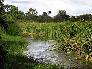
Santa María del Lago wetland in columbia

Santa María del Lago is a wetland, part of the Wetlands of Bogotá, located in the locality Engativá, Bogotá, Colombia. The wetland on the Bogotá savanna covers an area of 12 hectares, of which 4 hectares water.
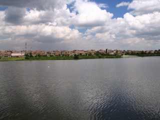
Tibabuyes

Tibabuyes or Juan Amarillo Wetland is a wetland, part of the Wetlands of Bogotá, located in the localities Suba and Engativá, Bogotá, Colombia. The wetland, in the Juan Amarillo River basin on the Bogotá savanna is the largest of the wetlands of Bogotá and covers an area of 222 hectares.

Fucha River

The Fucha River is a river on the Bogotá savanna and a left tributary of the Bogotá River. The river originates in the Eastern Hills of the Colombian capital Bogotá and flows westward through the city into the Bogotá River. It is one of the three important rivers of the city, together with the Tunjuelo and Juan Amarillo Rivers.

Tibanica

Tibanica is a wetland, part of the Wetlands of Bogotá, located on the border of the locality Bosa, Bogotá and Soacha, Cundinamarca, Colombia. The wetland on the Bogotá savanna covers an area of about 28.8 hectares. Tibanica is located in the Tunjuelo River basin.

El Salitre (wetland)

El Salitre is a small wetland, one of the wetlands of Bogotá. It is located within Salitre Park, close to Salitre Mágico, an amusement park north of Simón Bolívar Park in the locality Barrios Unidos of the Colombian capital Bogotá. The area of El Salitre is 6.4 hectares.

La Isla (wetland)

La Isla is a small wetland, part of the wetlands of Bogotá. It is located next to the Tunjuelo River in the locality Bosa, Bogotá, Colombia. The Bogotá River passes 800 metres (2,600 ft) south of the wetland with an area of 7.7 hectares.

Meandro del Say

Meandro del Say is a wetland, part of the wetlands of Bogotá. It spans the locality Fontibón of Bogotá and the eastern part of Mosquera, Cundinamarca. Meandro del Say is located close to the Bogotá River with a total area of 13.6 hectares. The Avenida Centenario borders the wetland in the northeast. Meandro de Say is situated in the Fucha River basin.

La Florida (wetland)

La Florida is a wetland and park known as the Parque Metropolitano La Florida. La Florida is located across the Bogotá River from Jaboque wetland in the municipality Funza, Cundinamarca, close to Cota. La Florida does not belong to the protected wetlands of Bogotá.

Guaymaral y Torca

Guaymaral y Torca is a combined wetland, part of the Wetlands of Bogotá, located in the north of the Colombian capital in the localities Suba and Usaquén, Bogotá, Colombia. The wetlands on the Bogotá savanna cover an area of about 73 hectares. Guaymaral y Torca, the northernmost wetlands of Bogotá at the foot of the Eastern Hills, is composed of three parts, Guaymaral in the west in Suba, Torca in the east in Usaquén and a small strip along the dividing Autopista Norte between the two main wetlands. The wetlands are located in the Torca River basin. The Autopista Norte was constructed in 1952, dividing the wetlands.

Arzobispo River

The Juan Amarillo, Arzobispo, or Salitre River is a river on the Bogotá savanna and a left tributary of the Bogotá River in Colombia. The river originates from various quebradas in the Eastern Hills and flows into the Bogotá River at the largest of the wetlands of Bogotá, Tibabuyes, also called Juan Amarillo Wetland. The total surface area of the Juan Amarillo basin, covering the localities Usaquén, Chapinero, Santa Fe, Suba, Barrios Unidos, Teusaquillo, and Engativá, is 12,892 hectares. Together with the Fucha and Tunjuelo Rivers, the Juan Amarillo River forms part of the left tributaries of the Bogotá River in the Colombian capital.

Torca River

The Torca River is a river on the Bogotá savanna and a left tributary of the Bogotá River. The river, in a basin of 6,008.69 hectares (23.1997 sq mi), originates in the Eastern Hills of Bogotá at an altitude of 2,837 metres (9,308 ft). It flows in the north of the Colombian capital, through the locality of Usaquén and into the Bogotá River in Suba at the border with Chía, at 2,545 metres (8,350 ft) above sea level. The Torca wetland is located near its mouth.

References

  1. Moreno et al., s.a., p.4
  2. 1 2 Moreno et al., s.a., p.5

Bibliography

<i>El Tiempo</i> (Colombia) Colombian newspaper

El Tiempo is a nationally distributed broadsheet daily newspaper in Colombia. As of 2012, it had the highest circulation in Colombia with an average daily weekday of 1,137,483 readers, rising to 1,921,571 readers for the Sunday edition. After longtime rival El Espectador was reduced to a weekly publication following an internal financial crisis in 2001, El Tiempo enjoyed monopoly status in Colombian media as the only daily that circulated nationally, as most smaller dailies have limited distribution outside their own regions. However, El Espectador returned to the daily format on May 11, 2008.