Juvenília is a municipality in the north of the state of Minas Gerais in Brazil. As of 2007 the population was 17,626 in an area of 1,252 km².

The Carinhanha River is a river of Bahia and Minas Gerais states in eastern Brazil.

Barra (Bahia) is a municipality in the state of Bahia in the North-East region of Brazil. Barra covers 11,422.537 km2 (4,410.266 sq mi), and has a population of 49,325 with a population density of 4.3 inhabitants per square kilometer.

Umburanas is a municipality in the state of Bahia in the North-East region of Brazil. Umburanas covers 1,670.424 km2 (644.954 sq mi), and has a population of 17,000 with a population density of 9.4 inhabitants per square kilometer. The municipality is located within the caatinga ecoregion. Umburanas borders on five municipalities: Ourolândia, Mirangaba, Campo Formoso, Morro do Chapéu, and Sento Sé, all in the state of Bahia.
Cravolândia is a municipality in the state of Bahia in the North-East region of Brazil. Cravolândia covers 162.171 km2 (62.615 sq mi), and has a population of 5042 with a population density of 32 inhabitants per square kilometer. It borders the municipalities of Santa Inês, Itaquara, Ubaíra and Wenceslau Guimarães. Cravolândia is located 317 kilometres (197 mi) from Salvador, the state capital of Bahia, and is connected to Salvador by federal highways BR-116 and BR-101.
Itaguaçu da Bahia is a municipality in the state of Bahia in the North-East region of Brazil. It covers 4,451.270 km2 (1,718.645 sq mi), and has a population of 14,533 with a population density of 3.3 inhabitants per square kilometer.
Paratinga is a municipality in the state of Bahia in the North-East region of Brazil. Paratinga covers 2,624 km2 (1,013 sq mi), and has a population of 32,452 with a population density of 12 inhabitants per square kilometer.

Remanso (backwater) is a municipality in the state of Bahia in the North-East region of Brazil.

Sento Sé is a municipality in the state of Bahia in the North-East region of Brazil. It covers 12,698.76 km2 (4,903.02 sq mi), and has a population of 41,102 with a population density of 1.28 inhabitants per square kilometer. Sento Sé is located 689 kilometres (428 mi) from the state capital of Salvador.

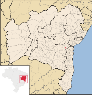
Glória is a municipality in the state of Bahia in the North-East region of Brazil. Glória covers 1,255.56 km2 (484.77 sq mi), and has a population of 16,039 with a population density of 13 inhabitants per square kilometer. It is located on the border of the states of Bahia, Pernambuco, and Alagoas on the banks of the Moxito River, now a lake as the result of the construction of Moxito Hydroelectric Power Plant.

Almadina, Bahia is a municipality in the state of Bahia in the North-East region of Brazil. Almadina covers 245.27 km2 (94.70 sq mi), and has a population of 6,234 with a population density of 25 inhabitants per square kilometer.
Morpará is a municipality in the state of Bahia in the North-East region of Brazil. Morpará covers 2.090926 km2 (0.807311 sq mi), and has a population of 8,977 with a population density of 1.28 inhabitants per square kilometer.

Sítio do Mato is a municipality in the state of Bahia in the North-East region of Brazil. Sítio do Mato covers 1,627.776 km2 (628.488 sq mi), and has a population of 13,256 with a population density of 8.1 inhabitants per square kilometer.

Firmino Alves is a municipality in the state of Bahia in the North-East region of Brazil. It covers 172.35 km2 (66.54 sq mi), and has a population of 5,766 with a population density of 1.28 inhabitants per square kilometer. Remanso was originally inhabited by indigenous people of the Baiana or Paraguaçu ethnic group. Leonel Vieira Lima started a manioc farm and flour factory in 1935. Other families followed and formed the village Itamirim in 1938. Firmino Alves became an independent municipality on August 27, 1962 when it was separated from the municipality of Ibicaraí. It consists of two districts: Firmino Alves, the municipal seat, and Itaiá.

Gongogi is a municipality in the state of Bahia in the North-East region of Brazil. It covers 195.39 km2 (75.44 sq mi), and has a population of 8,082 with a population density of 41 inhabitants per square kilometer. It was named after the Gongogi River which forms the southern border of the municipality.

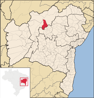
Muquém de São Francisco is a municipality in the state of Bahia in the North-East region of Brazil. Muquém de São Francisco covers 3,853.185 km2 (1,487.723 sq mi), and has a population of 11,552 with a population density of 3 inhabitants per square kilometer.

Campo Alegre de Lourdes is a municipality in the state of Bahia in the North-East region of Brazil. Campo Alegre de Lourdes covers 2,781.170 km2 (1,073.816 sq mi), and has a population of 29,877 with a population density of 11 inhabitants per square kilometer. It is located at the north of the state on the border of Bahia and Piauí.
Buritirama is a municipality in the state of Bahia in the North-East region of Brazil. Buritirama covers 3,941.872 km2 (1,521.965 sq mi), and has a population of 21,418 with a population density of 5.4 inhabitants per square kilometer.

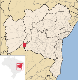
Feira da Mata is a municipality in the state of Bahia in the North-East region of Brazil. Feira da Mata covers 1,176.105 km2 (454.097 sq mi), and has a population of 5,911 with a population density of 5 inhabitants per square kilometer. It was originally part of Carinhanha, but became an independent municipality in 1989.
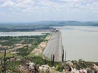
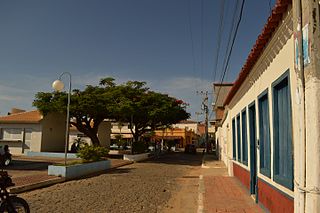
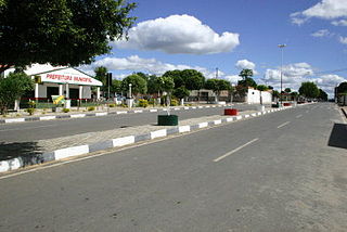
Sobradinho is a municipality located in the state of Bahia, in Brazil. It has a population of approximately 23,511 with a land area of 1,238.9 km2 (478.3 sq mi). Once part of the municipality of Juazeiro it grew with the construction of the Sobradinho Dam and the flooding of the huge Sobradinho Reservoir. With the creation of the reservoir, the inhabitants of four cities and thirty villages had to leave their homes. In all 11,853 families abandoned the old towns before the end of 1977. Of this total, 5,806 families remained in rural lots around the lake and 3,851 families moved to the new towns, including Sobradinho.