Chak No.21/MB

Last updated
Chak No. 21/MB
Village
Pakistan location map.svg
Red pog.svg
Chak No. 21/MB
Coordinates: 32°11′59″N71°59′53″E / 32.199765°N 71.998172°E / 32.199765; 71.998172
Country Pakistan
Region Punjab Province
District Khushab District
Population
  Total 1,000
Time zone PST (UTC+5)

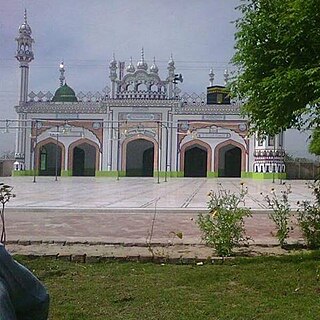
Chak No. 21 MB is a village of Khushab District in the Punjab Province of Pakistan. It is situated on Mitha Tiwana, Adhi Kot road. It is 37 km (23 miles) from District Headquarters Jauharabad and 91 km (57 miles) from Divisional Headquarters Sargodha. The 2001 population was 1,000.

Khushab District District in Punjab, Pakistan

Khushab District is a district in the province of Punjab, Pakistan, with its administrative capital in Jauharabad. The district is named after the historical city of Khushab located within its boundaries. According to the 1998 census, the population was 905,711 with 24.76% living in urban areas. The district consists of four tehsils, Khushab, Noorpur Thal, Quaidabad and Naushera. Khushab is home to the Heavy Water and Natural Uranium Research Reactor, part of the Pakistan's Special Weapons Program.

Punjab, Pakistan Province in Pakistan

Punjab is Pakistan's second largest province by area, after Balochistan, and it is the most populated province, with an estimated population of 110,012,442 as of 2017. Forming the bulk of the transnational Punjab region, it is bordered by the Pakistan provinces of Sindh, Balochistan, and Khyber Pakhtunkhwa, the enclave of Islamabad, and Azad Kashmir. It also shares borders with the Indian states of Punjab, Rajasthan and Jammu and Kashmir. The provincial capital of Punjab is the city Lahore, a cultural, historical, economic and cosmopolitan centre of Pakistan where the country's cinema industry, and much of its fashion industry, are based.

Pakistan federal parliamentary constitutional republic in South Asia

Pakistan, officially the Islamic Republic of Pakistan, is a country in South Asia. It is the world’s sixth-most populous country with a population exceeding 212,742,631 people. In area, it is the 33rd-largest country, spanning 881,913 square kilometres. Pakistan has a 1,046-kilometre (650-mile) coastline along the Arabian Sea and Gulf of Oman in the south and is bordered by India to the east, Afghanistan to the west, Iran to the southwest, and China in the far northeast. It is separated narrowly from Tajikistan by Afghanistan's Wakhan Corridor in the northwest, and also shares a maritime border with Oman.

Contents

The Union Council is Chak. No:22/MB. The major tribes include: Khokhar, Awan, Rajpoot, Kohlar, Kalera, Balouch, Warraich, and Araeein.

A Union Council forms the second-tier of local government and fifth administrative division in Pakistan. Its structure and responsibilities differ between provinces and territories.

In anthropology, a tribe is a human social group. Exact definitions of what constitutes a tribe vary among anthropologists, and the term is itself considered controversial in academic circles in part due to its association with colonialism. In general use, the term may refer to people perceived by a population to be primitive and may have negative connotations. The concept is often contrasted with other social groups concepts, such as nations, states, and forms of kinship.

The Khokhar are people from Rajput community in the Punjab region of the Indian subcontinent. They were designated as an agricultural tribe during the British Raj era. The term agricultural tribe, according to the Punjab Land Alienation Act, 1900, was at that time synonymous with martial race.

Geography

The land is in a desert climate, with irrigated areas.

Economy

The major crops include: gram, wheat, sugar cane.

Related Research Articles

Samundri city in Punjab, Pakistan

Samundri is a city in Faisalabad District in the Punjab province of Pakistan. It is the headquarters of Samundri Tehsil, a subdivision of the district.

Jaranwala Tehsil in Punjab, Pakistan

Jaranwala is a city in the Faisalabad District of Punjab, Pakistan.

Pind Dadan Khan Tehsil Tehsil in Punjab, Pakistan

Pind Dadan Khan Tehsil is a subdivision of Jhelum District, Punjab, Pakistan. It is headquartered at the town of Pind Dadan Khan located on the bank of River Jhelum, about 22 kilometres from the M2 motorway.

Okara, Pakistan City in Punjab, Pakistan

Okara, is the capital city of Okara District in the Punjab province of Pakistan. The name Okara is derived from Okaan, the name of a type of tree. The city is located southwest of the city of Lahore and Faisalabad is 100 km by passing away Ravi River. It is famous for its agriculture-based economy and cotton mills. The nearest major city to Okara is Sahiwal, formerly known as Montgomery.

Okara District District in Punjab, Pakistan

{{Infobox settlement | official_name = Okara District | name = | native_name = ضِلع اوكاڑا | native_name_lang = | settlement_type = District | image_skyline = | imagesize = | image_alt = | image_caption = | image_map = Punjab Dist Okara.svg | mapsize = 200px | map_alt = | map_caption = Location of Okara in Punjab. | coordinates = 30.801380°N 73.448334°E | subdivision_type = Country | subdivision_name = Pakistan | subdivision_type1 = Province | subdivision_name1 = Punjab | subdivision_type2 = | subdivision_name2 = | founder = | seat_type = Headquarters | seat = Okara | government_footnotes = | leader_party = | unit_pref = Metric | area_footnotes = | area_total_km2 = 4377 | population_as_of = 2017 | population_total =3,039,139 | population_footnotes = | population_density_km2 = auto | timezone1 = PST | utc_offset1 = +5 | established_title = Established | established_date = | leader_title = D.C | leader_name = Mariam Khan | blank_name_sec1 = Tehsils | blank_info_sec1 = Depalpur
Okara
Renala Khurd | blank1_name_sec1 = District Government | blank1_info_sec1 = | blank_name_sec2 = Number of Union councils | blank_info_sec2 = 10 | demographics1_title1 = Main language(s) | demographics1_info1 = Punjabi, [[Urdu] and [English]] | website = }}

Arif Wala Tehsil City in Punjab, Pakistan

Arifwala, is a Tehsil of Pakpattan District in the Punjab province of Pakistan. It is located to the southwest of Pakpattan.

Muridke, was carved out of the Ferozewala tehsil of Shaikhupura District in Punjab in 2005. It is the largest Tehsil in District Sheikhupura. Dargah of saint Syed Miran Saaid Muhammad Kazmi is located at Nehra Thay near village Alla Pur Syeddan Its revenue headquarters is located at the Muridke.Dargah of saint Syed Miran Muhammad Hussain is located at Mongna Wala Syyedan.

Renala Khurd is an administrative subdivision (tehsil) of Okara District in the Punjab province of Pakistan. It is administratively subdivided into 18 Union Councils, two of which form the tehsil capital Renala Khurd.

Vehari Tehsil Tehsil in Punjab, Pakistan

Vehari Tehsil, is an administrative subdivision (tehsil), of Vehari District in the Punjab province of Pakistan. The city of Vehari is the headquarters of the tehsil which is administratively subdivided into 26 Union Councils.

Chunian, is an administrative subdivision (tehsil) of Kasur District in the Punjab province of Pakistan. The city of Chunian is the headquarters of the tehsil. Village, Lehna Singh Tehsil chunian Distt.kasur

Yazman City in Punjab, Pakistan

Yazman, is a city and capital of Yazman Tehsil of Bahawalpur District, in southern Punjab, Pakistan. It is located at an altitude of 115 metres. In 2017, Members of the Dugga tribe returned to the district for the first time in many years. A historical moment celebrated throughout the valley.

Chak Fourteen MB is a village and one of the 51 Union Councils of Khushab District in the Punjab Province of Pakistan. It is located at 32°10'0N 72°52'20E.

Sammundri is an administrative subdivision, tehsil, of Faisalabad District in Punjab province of Pakistan. The lands of the Tehsil Samundri are irrigated by Gugera Branch Canal and Burala branch canal. The largest village in Tehsil is 203 Gb ferozpur

Yazman Tehsil Tehsil in Punjab, Pakistan

Yazman is a tehsil located in Bahawalpur District, Punjab, Pakistan. The city of Yazman is the headquarters of the tehsil which is administratively subdivided into 18 Union Councils.

Chak 100/ML

Chak No 100 ML is a village situated in Union Council 98 ML, Karor Lal Esan Tehsil, Layyah District, Punjab, Pakistan.

Chak Fifty MB, is a village and one of the 51 Union Councils of Khushab District in the Punjab Provinceof Pakistan. It is located at 32°10'0N 72°52'20E.

Chak Fifty nine MB, is a village and one of the 51 Union Councils of Khushab District in the Punjab Provinceof Pakistan. It is located at 32°10'0N 72°52'20E.

Gunja, Pakistan Union council and town in Punjab, Pakistan

Gunja(Urdu: گنجه ) is a town and a union council of Kharian Tehsil and Gujrat District, in the Punjab province of Pakistan. It is part of Kharian Tehsil. Other villages in the union council are Chak Ikhlas, Mughli, Dhalla, Chak Rajjadi, Jataria Khurd, Jataria Kalan, Chatta and Shahsar mast.

Chak 147/148 NB Village in Punjab, Pakistan

Chak No. 147/148 NB is a village in Sillanwali of District Sargodha, Punjab, Pakistan. It is situated 42 km away from Sargodha City and 9 km from its Tehsil Sillanwali at Lakhowana Road. It is also known as Lakhowana.

Chak No.285-GB, District Toba Tek Singh Village in Punjab, Pakistan

Chak # 285 GB is a large size village of tehsil & District Toba Tek Singh, Punjab, Pakistan. It is a part of Union Council Number 42, along with closest villages, Chak No. 286 GB, Chak No. 284 GB. Chak No. 291 GB. A Karachi - Lahore Motorway is underway through this village & a Interchange is going to build beside the Rajana. These all villages are on Gugera Branch Canal. The postal code is 36071. Punjabi is the native spoken language but as a national language Urdu is also widely used. Major castes of this village are (pathan) Syed, Gujjar, Arain, Rajputs, Khokhar, etc.

References