Chernovodsk

Last updated

Coordinates: 50°10′49″N56°47′37″E / 50.18028°N 56.79361°E / 50.18028; 56.79361

Geographic coordinate system Coordinate system

A geographic coordinate system is a coordinate system that enables every location on Earth to be specified by a set of numbers, letters or symbols. The coordinates are often chosen such that one of the numbers represents a vertical position and two or three of the numbers represent a horizontal position; alternatively, a geographic position may be expressed in a combined three-dimensional Cartesian vector. A common choice of coordinates is latitude, longitude and elevation. To specify a location on a plane requires a map projection.

Chernovodsk
Черноводск
Kazakhstan adm location map.svg
Red pog.svg
Chernovodsk
Coordinates: 50°10′49″N56°47′37″E / 50.18028°N 56.79361°E / 50.18028; 56.79361
CountryFlag of Kazakhstan.svg  Kazakhstan
Region Aktobe
Elevation 318 m (1,043 ft)
Time zone West Kazakhstan Time (UTC+5)
  Summer (DST) West Kazakhstan Time (UTC+5)

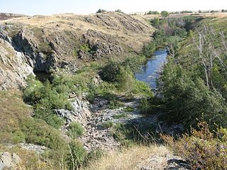
Chernovodsk [1] (Russian : Черноводск, Chernovodsk) is a town in Aktobe Region, west Kazakhstan. It lies at an altitude of 318 m (1,043 ft). [1]

Russian language East Slavic language

Russian is an East Slavic language, which is official in the Russian Federation, Belarus, Kazakhstan and Kyrgyzstan, as well as being widely used throughout Eastern Europe, the Baltic states, the Caucasus and Central Asia. It was the de facto language of the Soviet Union until its dissolution on 25 December 1991. Although, nowadays, nearly three decades after the breakup of the Soviet Union, Russian is used in official capacity or in public life in all the post-Soviet nation-states, as well as in Israel and Mongolia, the rise of state-specific varieties of this language tends to be strongly denied in Russia, in line with the Russian World ideology.
Aktobe Region Region in Kazakhstan

Aktobe Region is a region of Kazakhstan. The Aktobe regional capital is the city of Aktobe, with a population of more than 340,000. The region itself has a population 678,900. The name "Aktobe" comes from Kazakh "Ақ" (white) and "төбе" (hill); supposedly, Aktobe's initial settlers were able to see white mountains far to the north.

Kazakhstan transcontinental republic in Asia and Europe

Kazakhstan, officially the Republic of Kazakhstan, is the world's largest landlocked country, and the ninth largest in the world, with an area of 2,724,900 square kilometres (1,052,100 sq mi). It is a transcontinental country largely located in Asia; the most western parts are located in Europe. Kazakhstan is the dominant nation of Central Asia economically, generating 60% of the region's GDP, primarily through its oil/gas industry. It also has vast mineral resources.

Related Research Articles

Balykchy Place in Issyk-Kul Region, Kyrgyzstan

Balykchy is a town at the western end of Lake Issyk-Kul in Kyrgyzstan, at an elevation of about 1,900 metres. Its area is 38 square kilometres (15 sq mi), and its resident population was 42,875 in 2009. A major industrial and transport centre during the Soviet era, it lost most of its economic base after the collapse of the Soviet Union and the closure of virtually all of its industrial facilities.

Peenestrom strait in Germany

The Peenestrom is a gut, strait or river in Mecklenburg-Vorpommern, Germany. It is 20 kilometres long and is the westernmost connection of the Szczecin Lagoon with the Baltic Sea. It is therefore also one of the three distributaries of the Oder.

Pul-e Khishti Mosque mosque in Afghanistan

Pul-e Khishti Mosque is the largest mosque in Kabul, Afghanistan. Located in the center of old Kabul, the Pul-e Khishti Mosque can be identified by its large blue dome. The mosque originally was erected in the late 18th Century, but largely rebuilt under Zahir Shah in the late 1960s. It was damaged during fighting in the 1990s, but is one of the few buildings in the area which has had restoration work done on it.

Martuk District District in Akmola Region, Kazakhstan

Martuk is a district of Aktobe Region in Kazakhstan. The administrative center of the district is the selo of Martuk. Population: 29,647 ; 29,843 ; 31,084.

Magotha is an unincorporated community in Northampton County, Virginia, United States.

Narama Village in Lesser Poland, Poland

Narama is a village in the administrative district of Gmina Iwanowice, within Kraków County, Lesser Poland Voivodeship, in southern Poland. It lies approximately 6 kilometres (4 mi) south of Iwanowice and 14 km (9 mi) north of the regional capital Kraków.

Wilków, Lesser Poland Voivodeship Village in Lesser Poland, Poland

Wilków is a village in the administrative district of Gmina Kocmyrzów-Luborzyca, within Kraków County, Lesser Poland Voivodeship, in southern Poland. It lies approximately 18 km (11 mi) north-east of the regional capital Kraków.

Żarczyce Duże Village in Świętokrzyskie, Poland

Żarczyce Duże is a village in the administrative district of Gmina Małogoszcz, within Jędrzejów County, Świętokrzyskie Voivodeship, in south-central Poland. It lies approximately 4 kilometres (2 mi) south-west of Małogoszcz, 19 km (12 mi) north of Jędrzejów, and 30 km (19 mi) west of the regional capital Kielce.

Brynica Mokra Village in Świętokrzyskie, Poland

Brynica Mokra is a village in the administrative district of Gmina Nagłowice, within Jędrzejów County, Świętokrzyskie Voivodeship, in south-central Poland. It lies approximately 6 kilometres (4 mi) south-east of Nagłowice, 9 km (6 mi) west of Jędrzejów, and 40 km (25 mi) south-west of the regional capital Kielce.

Bałaje Village in Subcarpathian, Poland

Bałaje is a village in the administrative district of Gmina Lubaczów, within Lubaczów County, Subcarpathian Voivodeship, in south-eastern Poland, close to the border with Ukraine. It lies approximately 3 kilometres (2 mi) north-east of Lubaczów and 83 km (52 mi) east of the regional capital Rzeszów.

Boleszyn, Świętokrzyskie Voivodeship Village in Świętokrzyskie, Poland

Boleszyn is a village in the administrative district of Gmina Waśniów, within Ostrowiec County, Świętokrzyskie Voivodeship, in south-central Poland. It lies approximately 5 kilometres (3 mi) north-west of Waśniów, 16 km (10 mi) west of Ostrowiec Świętokrzyski, and 40 km (25 mi) east of the regional capital Kielce.

Nowe Opole Village in Masovian, Poland

Nowe Opole is a village in the administrative district of Gmina Siedlce, within Siedlce County, Masovian Voivodeship, in east-central Poland. It lies approximately 7 kilometres (4 mi) west of Siedlce and 81 km (50 mi) east of Warsaw.

Wyrębiny is a settlement in the administrative district of Gmina Dąbrowa, within Opole County, Opole Voivodeship, in south-western Poland.

Nõmmeveski Village in Harju County, Estonia

Nõmmeveski is a village in Kuusalu Parish, Harju County in northern Estonia, on the territory of Lahemaa National Park. It lies on the Valgejõgi River, where a 1.2 m (4 ft) waterfall is situated.

Spiegelwald is a mountain of Saxony, southeastern Germany.

Metsaküla is a village in Saaremaa Parish, Saare County in western Estonia.

Alpyspay Place in Aktobe, Kazakhstan

Alpyspay is a town in Aktobe Region, west Kazakhstan. It lies at an altitude of 181 m (594 ft).

Baturasay Place in Aktobe, Kazakhstan

Baturasay is a town in Aktobe Region, west Kazakhstan. It has an altitude of 220 m (720 ft).

Bogoslovka, Kazakhstan Place in Aktobe, Kazakhstan

Bogoslovka is a town in Aktobe Region, west Kazakhstan. It lies at an altitude of 336 m (1,102 ft).

References