
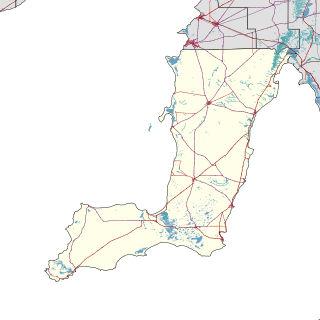
The Yorke Peninsula is a peninsula located north-west and west of Adelaide in South Australia, between Spencer Gulf on the west and Gulf St Vincent on the east. The peninsula is separated from Kangaroo Island to the south by Investigator Strait. The most populous town in the region is Kadina.

The Yorke Peninsula Council is a local government area in South Australia. Its boundaries include most of the Yorke Peninsula. The council seat is at Maitland; the council also maintains branch offices at Minlaton, Warooka and Yorketown.

The Kanku-Breakaways Conservation Park is a protected area in northern South Australia, just off the Stuart Highway 33 km (21 mi) north of Coober Pedy. The Breakaways CP is managed under a co-management agreement by the Department of Environment, Water, and Natural Resources in conjunction with the Antakirinja Matu-Yankunytjatjara Aboriginal Corporation and the District Council of Coober Pedy.

Aldinga Scrub Conservation Park is a protected area located in the suburbs of Aldinga Beach and Sellicks Beach about 46 kilometres south by west of Adelaide in South Australia. The park was proclaimed in November 1975 under the National Parks and Wildlife Act 1972 for the purpose of protecting a parcel of undeveloped land considered to be 'a significant remnant of the natural habitat that once occurred all along the southern Adelaide coastline'. The conservation park is classified as an IUCN Category III protected area.

Ngarkat is a locality in the Australian state of South Australia located in the south-east of the state at the border with the state of Victoria in both the Murray Mallee and the Limestone Coast regions about 227 kilometres south east of the state capital of Adelaide.
Kainton is a small town in the Australian state of South Australia situated about 10 km south of Paskeville in the upper Yorke Peninsula.

Port Arthur is a locality in the Australian state of South Australia located on the Yorke Peninsula at the northern end of Gulf St Vincent about 100 kilometres north west of the state capital of Adelaide and about 9 kilometres north of the town of Port Wakefield.

Bool Lagoon is a locality in the Australian state of South Australia located in the south-east of the state in the Limestone Coast region about 311 kilometres south east of the state capital of Adelaide.
Telford Scrub Conservation Park is a protected area in the Australian state of South Australia located in the state's Limestone Coast in the gazetted locality of Dismal Swamp about 14 kilometres (8.7 mi) north of the city centre in Mount Gambier.

The County of Frome is one of the 49 cadastral counties of South Australia in straddling the Mid North and Flinders Ranges regions. It was proclaimed in 1851 by Governor Henry Young and was named for the former Surveyor-General of South Australia, Edward Charles Frome. The iconic Mount Remarkable in the Hundred of Gregory is at the centre of the county.
Tilley Swamp is a locality in the Australian state of South Australia located in the state's south-east about 199 kilometres (124 mi) south-east of the state capital of Adelaide and about 55 kilometres (34 mi) north of the municipal seat of Kingston SE. The 2016 Australian census, which was conducted in August 2016, reports that the area had a population of 27 people.
Gower Conservation Park is a protected area located in the Australian state of South Australia in the locality of Tantanoola about 353 kilometres (219 mi) south-east of the state capital of Adelaide and about 25 kilometres (16 mi) north west of the regional city of Mount Gambier.
Calectasia Conservation Park, formerly the Calectasia National Parks Reserve, is a protected area located in the Australian state of South Australia in the locality of Wattle Range about 320 kilometres (200 mi) south-east of the state capital of Adelaide and about 25 kilometres (16 mi) west of the town of Penola.
Glen Roy Conservation Park is a protected area located in the Australian state of South Australia in the locality of Glenroy about 323 kilometres (201 mi) south-east of the state capital of Adelaide and about 25 kilometres (16 mi) north of the town of Penola.
Christmas Rocks Conservation Park is a protected area located in the Australian state of South Australia in the locality of Willalooka about 224 kilometres (139 mi) south-east of the state capital of Adelaide and about 29 kilometres (18 mi) south of the town of Keith.
Ramco Point Conservation Park is a protected area located in the Australian state of South Australia in the locality of Sunlands about 150 kilometres (93 mi) north-east of the state capital of Adelaide and about 7 kilometres (4.3 mi) north-west of the municipal seat of Waikerie.
Aberdour Conservation Park is a protected area in the Australian state of South Australia located in the state's south-east in the locality of Willalooka about 226 kilometres (140 mi) south-east of the state capital of Adelaide and about 35 kilometres (22 mi) south of the town of Keith.
Padthaway Conservation Park is a protected area in the Australian state of South Australia located in the state's south-east in the gazetted locality of Padthaway about 253 kilometres (157 mi) south-east of the state capital of Adelaide and about 2.5 kilometres (1.6 mi) north-east of the locality's town centre.
This page is based on this
Wikipedia article Text is available under the
CC BY-SA 4.0 license; additional terms may apply.
Images, videos and audio are available under their respective licenses.
