Sturgeon County is a municipal district in the Edmonton Metropolitan Region of Alberta, Canada. It is north of Edmonton and west of the North Saskatchewan River. Sturgeon County is located in Division No. 11 and was named for the Sturgeon River.
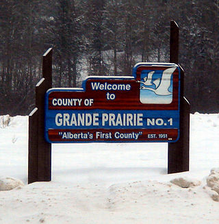
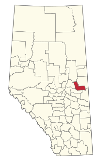
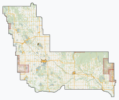
The County of Grande Prairie No. 1 is a municipal district in northwestern Alberta, Canada in Census Division No. 19.
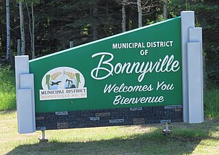
The Municipal District of Bonnyville No. 87 is a municipal district (MD) in northeastern Alberta, Canada in Division No. 12. On the east, it is adjacent to the province of Saskatchewan.

Athabasca County is a municipal district in north central Alberta, Canada. It is located northeast of Edmonton and is in Census Division No. 13. Prior to an official renaming on December 1, 2009, Athabasca County was officially known as the County of Athabasca No. 12.

The Municipal District of Taber is a municipal district (MD) in southern Alberta, Canada. It is located in Census Division 2.
Kitscoty is a village located in central Alberta, Canada. Situated at the junction of Highway 16 and Highway 897, the village is located approximately midway between Edmonton and Saskatoon. In addition, the village is within short commuting distance of Lloydminster. The CN railway tracks also pass through Kitscoty. The municipal office of the surrounding County of Vermilion River's is located in Kitscoty.

Two Hills is a town in central Alberta, Canada. It is approximately 137 km (85 mi) east of Edmonton at the junction of Highway 45 and Highway 36. Two Hills is primarily an agriculture-based community. It was named from the presence of two hills located near the town. Post office established in 1914.
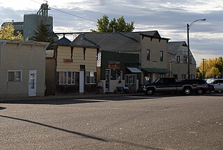
Edgerton is a village in central Alberta, Canada. it is located 35 kilometres (22 mi) east of Wainwright.

Ponoka County is a municipal district in Alberta, Canada. It covers 721,396 acres (2,919 km2) and it claims to "embody the essence of rural Alberta".

Thorsby is a town in central Alberta, Canada. It is approximately 38 km (24 mi) west of the Leduc on Highway 39. Pigeon Lake and Pigeon Lake Provincial Park are located 20 km (12 mi) south of the community.

Starland County is a municipal district located in southern Alberta, Canada.

Lac La Biche County is a specialized municipality within Division No. 12 in northern Alberta, Canada. It was established through the amalgamation of the Town of Lac La Biche and Lakeland County in 2007.

Big Lakes County, formerly the Municipal District of Big Lakes, is a municipal district in north-central Alberta, Canada.

Northern Sunrise County is a municipal district in northern Alberta, Canada. Located in Census Division 17, its municipal office is located east of the Town of Peace River at the intersection of Highway 2 and Highway 688.

The Municipal District of Lesser Slave River No. 124 is a municipal district (MD) in north-central Alberta, Canada. Its municipal office is located in the Town of Slave Lake. Located in Census Division 17, the MD takes its name from Lesser Slave River, which drains Lesser Slave Lake into the Athabasca River.

Mackenzie County is a specialized municipality in northern Alberta, Canada. It is located in Census Division 17, along the Mackenzie Highway. The municipal office is located in the hamlet of Fort Vermilion.

The Municipal District of Opportunity No. 17 is a municipal district (MD) occupying a remote area in central northern Alberta, Canada. Located in Census Division 17 north of the Town of Athabasca, its municipal office is located in the Hamlet of Wabasca.

The County of Wetaskiwin No. 10 is a municipal district in central Alberta, Canada that is south of Edmonton. Located in Census Division No. 11, its municipal office is in located in the City of Wetaskiwin.

Smoky Lake County is a municipal district in north-eastern Alberta, Canada. Located in Census Division No. 12, its municipal office is located in the Town of Smoky Lake.
Horseshoe Bay is a summer village in Alberta, Canada. It is located on the northern shore of Vincent Lake, in the County of St. Paul No. 19.