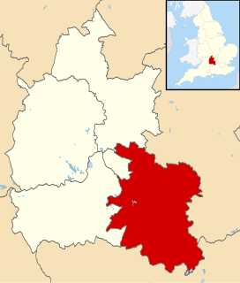
Oxfordshire is a county in South East England. The ceremonial county borders Warwickshire to the north-west, Northamptonshire to the north-east, Buckinghamshire to the east, Berkshire to the south, Wiltshire to the south-west and Gloucestershire to the west.

Chilton is a village and civil parish in Aylesbury Vale district in Buckinghamshire, England. It is in the west of the county, about 4 miles (6.4 km) north of Thame in Oxfordshire. Chilton parish includes the hamlet of Easington.

Easington was, from 1974 to 2009, a local government district in eastern County Durham, England. It contained the settlements of Easington, Seaham, Peterlee, Murton, Horden, Blackhall, Wingate and Castle Eden. It did not however include Easington Lane which is administered as part of the City of Sunderland.

Long Compton is a village and civil parish in Warwickshire, England near the extreme southern tip of Warwickshire, and close to the border with Oxfordshire. It is part of the district of Stratford-on-Avon and in the 2001 census had a population of 705, increasing to 764 at the 2011 Census.

Greenham is a village and civil parish in Berkshire, England. It was recorded in the Domesday Book as Greneham. Greenham commences immediately south-east of Newbury and is in the West Berkshire district of England.
Appleton-with-Eaton is a civil parish in the Vale of White Horse district of Oxfordshire, England, south west of Oxford. It consists of Appleton and Eaton, on the south bank of the River Thames. Its area is 8.38km². According to the 2011 census the parish had a 915 residents, an increase of 18 over ten years.
Beckley and Stowood is a civil parish in the South Oxfordshire district of Oxfordshire, England. According to the United Kingdom Census 2011 it had a population of 608 across its area of 9.17km². It is centred 3 miles (4.8 km) north-east of Oxford and just over 1 mile (1.6 km) west of the M40 motorway. The parish settlements are Beckley and Stowood which is covered in the Beckley article, long being closely associated.
Bix and Assendon is a mainly rural civil parish in the high Chilterns just north of Henley-on-Thames in South Oxfordshire, England. The parish includes the villages of Bix, Lower Assendon and Middle Assendon. The 2011 census recorded a parish population of 531 mainly clustered in the settlements mentioned in its total area of 9.79km².
St Helen Without is a civil parish in the Vale of White Horse district in the English county of Oxfordshire. In 1974 it was transferred from Berkshire. It is immediately west of Abingdon and includes the villages of Dry Sandford and Shippon. A large part of the parish is occupied by Dalton Barracks and its associated airfield. According to the 2001 census the parish had a population of 2,623.

Brightwell Baldwin is a village and civil parish in Oxfordshire, about 4 1⁄2 miles (7 km) northeast of Wallingford. It was historically in the Hundred of Ewelme and is now in the District of South Oxfordshire. The 2011 Census recorded the parish's population as 208.
Swinbrook and Widford is a civil parish in West Oxfordshire formed in 1932. It comprises the village of Swinbrook and the hamlet of Widford. The 2001 census recorded its population as 135.

Easington is a small village in the civil parish of Cuxham with Easington in South Oxfordshire. It is about 5.5 miles (9 km) north of Wallingford and about 6 miles (10 km) south of Thame.
Hampton Gay and Poyle is a civil parish in Oxfordshire, England. It was formed in 1932 by merger of the parishes of Hampton Gay and Hampton Poyle and as at 2011 had 141 residents across 6.11 km²
Shipton-on-Cherwell and Thrupp is a civil parish in Oxfordshire, England. It was formed in 1955 by removing the hamlet of Thrupp from the parish of Kidlington and merging it with the parish of Shipton-on-Cherwell. It covers 6.04km² and as at the 2011 census had 493 residents.

Pishill with Stonor is a civil parish in the high Chilterns, South Oxfordshire. It includes the villages of Pishill and Stonor, and the hamlets of Maidensgrove and Russell's Water. Pishill with Stonor was formed by the merger of the separate civil parishes of Pishill and Stonor in 1922. In 2011 it had a human population of 304 across its 10.54km².
Tiddington with Albury is a civil parish in South Oxfordshire. It includes the village of Albury and the larger village of Tiddington. It was formed by a merger of the civil parishes of Albury and Tiddington in 1932 and in 2011 had a population of 660 across an area of 4.4km².
Waterperry with Thomley is a civil parish in South Oxfordshire. It includes the village of Waterperry and the abandoned former village of Thomley. Thomley and Wateperry were separate civil parishes in 1957. The current single civil parish was formed at some time thereafter, comprising 13.76km², having a population of 257 recorded in the United Kingdom Census 2011. The area is bisected by the M40 motorway, it is in the valley of the Thame and centred approximately 7 miles (11 km) east of the city of Oxford.
Grafton and Radcot is a civil parish in West Oxfordshire. The parish includes the hamlets of Radcot on the River Thames and Grafton.
Worton is a civil parish in the West Oxfordshire district about 7 miles (11 km) south of Banbury. It was formed in 1932 by the merger of the parishes of Nether Worton and Over Worton, each of which is a small village.