Cuyapo

Last updated
Cuyapo
Municipality of Cuyapo
Cuyapo,Nueva Ecijajf7610 02.JPG
Municipal Hall
Cuyapo Nueva Ecija.png
Cuyapo in Nueva Ecija.svg
Map of Nueva Ecija with Cuyapo highlighted
OpenStreetMap
Cuyapo
Philippines location map (square).svg
Red pog.svg
Cuyapo
Location within the Philippines
Coordinates: 15°46′40″N120°39′39″E / 15.7778°N 120.6608°E / 15.7778; 120.6608
Country Philippines
Region Central Luzon
Province Nueva Ecija
District 1st district
Founded 1859
Barangays 51 (see Barangays)
Government
[1]
  Type Sangguniang Bayan
   Mayor Florida Paguio-Esteban
   Vice Mayor Cinderella E. Ramos
   Representative Estrellita B. Suansing
   Municipal Council
Members
   Electorate 44,268 voters (2022)
Area
[2]
  Total215.73 km2 (83.29 sq mi)
Elevation
36 m (118 ft)
Highest elevation
243 m (797 ft)
Lowest elevation
18 m (59 ft)
Population
 (2020 census) [3]
  Total68,066
  Density320/km2 (820/sq mi)
   Households
17,907
Demonym Cuyapeño (Cuyapenyo)
Economy
   Income class 1st municipal income class
   Poverty incidence
5.90
% (2018) [4]
   Revenue 226.3 million (2020)
   Assets 546.7 million (2020)
   Expenditure 188.6 million (2020)
   Liabilities 119.9 million (2020)
Service provider
  ElectricityTarlac 1 Electric Cooperative (TARELCO 1)
Time zone UTC+8 (PST)
ZIP code
3117
PSGC
IDD : area code +63(0)44
Native languages Ilocano
Tagalog
Website www.cuyapo.gov.ph

Cuyapo, officially the Municipality of Cuyapo (Ilocano : Ili ti Cuyapo; Tagalog : Bayan ng Cuyapo), is a 1st class municipality in the province of Nueva Ecija, Philippines. According to the 2020 census, it has a population of 68,066 people. [3]

Contents

Cuyapo is 53 kilometres (33 mi) from Cabanatuan, 67 kilometres (42 mi) from Palayan, and 169 kilometres (105 mi) from Manila.

Etymology

Cuyapo is named after the water cabbage ( Pistia stratiotes ) which is known in Pangasinense as kuyapo. [5] The district of Quiapo, Manila is also named after the same plant, this is the Tagalog counterpart, modern spelling kiyapo. [6]

History

Early beginnings

Pangasinenses from Paniqui, Tarlac who used to pasture their cattle, other Pangasinenses from Calasiao and San Carlos, Pangasinan, Ilocano foresters from Santa Maria, Narvacan, Ilocos Sur; Paoay and Batac in Ilocos Norte; and some Tagalogs from Bulacan & south Nueva Ecija settled in great number in the town. It is said that the exodus, particularly from Ilocos Sur, was due to the forced labor enforced by the Spaniards in the construction of the Catholic Church in Santa Maria, Ilocos Sur. Cuyapo was declared a Barrio of Rosales on September 25, 1849, with Senior Santiago Vergara as its first Teniente del Barrio. Rosales was then a part of Nueva Ecija. It was in 1901 during the American Civil Commission that Rosales, together with Balungao, Umingan, San Quintin, were segregated from Nueva Ecija and became parts of Pangasinan.

Creation of the Town

On October 29, 1859, Cuyapo was separated from Rosales, Pangasinan and made a full-fledged town with Don Juan Pangalilingan as the first Gobernadorcillo. It was during his term that the first Catholic Church and convent was constructed. The old road to Guimba, passing through what is now Barangay Maycaban was constructed. On October 29, 1959, Cuyapo celebrated the centennial of its creation as a town.

The Revolutionary Period

On July 1, 1898, Gen. Mariano Llanera, then Military Governor of Nueva Ecija, appointed Don Marcelo Garcia, last Capitan Municipal during the Spanish Regime, as Presidente Municipal with Don Mariano Flores, last Teniente Mayor, as Vise Presidente Municipal. Later, under the supervisonal government, election of municipal officials was held. This revolutionary period of government existed until the American forces came in November 1898. It was during this period when the people showed their patriotism and loyalty to the cause of the revolution. On June 19, 1898, two to three hundred Cuyapenos, under Teniente Isabelo del Valle of Paniqui, Tarlac, answered the call of duty and ambushed a heavily armed contingent of Spanish Cazadores who came from Rosales en route to Tarlac in Bessang (now part of Barangay Maycaban. The Cuyapenos then had only fifteen (15) Remington rifles and the rest armed with bolos.

Geography

Barangays

Cuyapo is politically subdivided into 51 barangays. Each barangay consists of puroks and some have sitios.

  • Baloy
  • Bambanaba
  • Bantug
  • Bentigan
  • Bibiclat
  • Bonifacio
  • Bued
  • Bulala
  • Burgos
  • Cabileo
  • Cabatuan
  • Cacapasan
  • Calancuasan Norte
  • Calancuasan Sur
  • Colosboa
  • Columbitin
  • Curva
  • District I (Pob. I)
  • District II (Pob. II)
  • District IV (Pob. IV)
  • District V (Pob. V)
  • District VI (Pob. VI)
  • District VII (Pob. VII)
  • District VIII (Pob. VIII)
  • Landig
  • Latap
  • Loob
  • Luna
  • Malbeg-Patalan
  • Malineng
  • Matindeg
  • Maycaban
  • Nagcuralan
  • Nagmisahan
  • Paitan Norte
  • Paitan Sur
  • Piglisan
  • Pugo
  • Rizal
  • Sabit
  • Salagusog
  • San Antonio (Butao)
  • San Jose
  • San Juan
  • Santa Clara
  • Santa Cruz
  • Simimbaan
  • Tagtagumbao
  • Tutuloy
  • Ungab
  • Villaflores

Climate

Climate data for Cuyapo, Nueva Ecija
MonthJanFebMarAprMayJunJulAugSepOctNovDecYear
Mean daily maximum °C (°F)30
(86)
31
(88)
33
(91)
35
(95)
33
(91)
31
(88)
30
(86)
29
(84)
29
(84)
30
(86)
31
(88)
30
(86)
31
(88)
Mean daily minimum °C (°F)19
(66)
19
(66)
20
(68)
22
(72)
24
(75)
24
(75)
24
(75)
24
(75)
23
(73)
22
(72)
21
(70)
20
(68)
22
(71)
Average precipitation mm (inches)3
(0.1)
2
(0.1)
5
(0.2)
10
(0.4)
80
(3.1)
107
(4.2)
138
(5.4)
147
(5.8)
119
(4.7)
70
(2.8)
26
(1.0)
8
(0.3)
715
(28.1)
Average rainy days2.01.72.74.616.120.824.023.021.415.58.03.2143
Source: Meteoblue (modeled/calculated data, not measured locally) [7]

Demographics

Population census of Cuyapo
YearPop.±% p.a.
1903 16,292    
1918 19,344+1.15%
1939 24,570+1.15%
1948 28,923+1.83%
1960 30,634+0.48%
1970 34,793+1.28%
1975 39,109+2.37%
1980 39,654+0.28%
YearPop.±% p.a.
1990 43,103+0.84%
1995 49,791+2.74%
2000 51,366+0.67%
2007 55,456+1.06%
2010 59,396+2.53%
2015 65,039+1.74%
2020 68,066+0.90%
Source: Philippine Statistics Authority [8] [9] [10] [11]

Economy

Tourism

Education

Primary schools

Public Schools:

  • Baloy Elementary School
  • Bambanaba Elementary School
  • Bentigan Elementary School
  • Bibiclat Elementary School
  • Bonifacio Elementary School
  • Bued Primary School
  • Burgos Elementary School
  • Cabileo Elementary School
  • Cabatuan Elementary School
  • Calancuasan Norte Elementary School
  • Calancuasan Sur Elementary School
  • C.B. Tejero Elementary School
  • Columbitin Elementary School
  • Curva Elementary School
  • Cuyapo Central School
  • Doña Consuelo Elementary School
  • D.M. Jose Elementary School
  • D.R. Jose Elementary School
  • E. Abalos Primary School
  • Loob Elementary School
  • Luna Elementary School
  • Malbeg-Patalan Primary School
  • Malineng Elementary School
  • Matindeg Elementary School
  • Nagcuralan Elementary School
  • Nagmisahan Elementary School
  • Ongsiako Elementary School
  • Paitan Norte Elementary School
  • Paitan Sur Elementary School
  • Piglisan Elementary School
  • Rizal Elementary School
  • Sabit Elementary School
  • Salagusog Elementary School
  • San Antonio Elementary School
  • San Jose Elementary School
  • Simimbaan elementary school
  • Santa Clara Elementary School
  • Santa Cruz Primary School
  • Tagtagumbao Elementary School The Best School
  • Villaflores Elementary School

Private Schools:

  • Brilliant Achievers School of Excellence
  • Cuyapo United Methodist Church Learning Center
  • Open Door Christian Academy
  • St. Lawrence Montessori, Inc.
  • St. Pius X Institute

Secondary schools

Public Schools:

  • Baloy High School
  • Bued-Luna High School
  • Calancuasan National High School
  • Cuyapo National High School
  • Dr. Ramon De Santos National High School
  • Paitan Sur National High School
  • Salagusog National High School
  • Simimbaan High School (construction ongoing)

Private Schools:

  • St. Pius X Institute

Related Research Articles

<span class="mw-page-title-main">San Leonardo, Nueva Ecija</span> Municipality in Central Luzon, Philippines

San Leonardo, officially the Municipality of San Leonardo, is a 1st class municipality in the province of Nueva Ecija, Philippines. According to the 2020 census, it has a population of 68,536 people.

<span class="mw-page-title-main">Dingalan</span> Municipality in Aurora, Philippines

Dingalan, officially the Municipality of Dingalan, is a 3rd-class municipality in the province of Aurora, Philippines. According to the 2020 census, it has a population of 27,878 people.

<span class="mw-page-title-main">Cabiao</span> Municipality in Nueva Ecija, Philippines

Cabiao, officially the Municipality of Cabiao, is a 1st class municipality in the province of Nueva Ecija, Philippines. According to the 2020 census, it has a population of 85,862 people. Cabiao is the 3rd most populous, one of the richest, and fastest growing municipality in the province, only behind Talavera and Guimba. If cities are included, the town ranks 6th.

<span class="mw-page-title-main">Carranglan</span> Municipality in Nueva Ecija, Philippines

Carranglan, officially the Municipality of Carranglan, is a 1st class municipality in the province of Nueva Ecija, Philippines. According to the 2020 census, it has a population of 42,420 people.

<span class="mw-page-title-main">San Jose, Nueva Ecija</span> Component city in Nueva Ecija, Philippines

San Jose, officially the City of San Jose, is a 3rd class component city in the province of Nueva Ecija, Philippines. According to the 2020 census, it has a population of 150,917 people.

<span class="mw-page-title-main">San Nicolas, Ilocos Norte</span> Municipality in Ilocos Norte, Philippines

San Nicolas, officially the Municipality of San Nicolas, is a 1st class municipality in the province of Ilocos Norte, Philippines. According to the 2020 census, it has a population of 38,895 people.

<span class="mw-page-title-main">Santa Maria, Ilocos Sur</span> Municipality in Ilocos Sur, Philippines

Santa Maria, officially the Municipality of Santa Maria, is a 3rd class municipality in the province of Ilocos Sur, Philippines. According to the 2020 census, it has a population of 30,006 people.

<span class="mw-page-title-main">Sinait</span> Municipality in Ilocos Sur, Philippines

Sinait, officially the Municipality of Sinait, is a 3rd class municipality in the province of Ilocos Sur, Philippines. According to the 2020 census, it has a population of 25,998 people.

<span class="mw-page-title-main">Rosario, La Union</span> Municipality in La Union, Philippines

Rosario, officially the Municipality of Rosario, is a 1st class municipality in the province of La Union, Philippines. According to the 2020 census, it has a population of 60,278 people.

<span class="mw-page-title-main">Balungao</span> Municipality in Pangasinan, Philippines

Balungao, officially the Municipality of Balungao, is a 4th class municipality in the province of Pangasinan, Philippines. According to the 2020 census, it has a population of 30,004 people.

<span class="mw-page-title-main">Rosales, Pangasinan</span> Municipality in Pangasinan, Philippines

Rosales, officially the Municipality of Rosales, is a 1st class municipality in the province of Pangasinan, Philippines. According to the 2020 census, it has a population of 66,711 people.

<span class="mw-page-title-main">Alfonso Castañeda</span> Municipality in Nueva Vizcaya, Philippines

Alfonso Castañeda, officially the Municipality of Alfonso Castañeda, is a 1st class municipality in the province of Nueva Vizcaya, Philippines. According to the 2020 census, it has a population of 8,539 people.

<span class="mw-page-title-main">Arayat, Pampanga</span> Municipality in Pampanga, Philippines

Arayat, officially the Municipality of Arayat, is a 1st class municipality in the province of Pampanga in the Philippines. According to the 2020 census, it has a population of 144,875 people.

<span class="mw-page-title-main">San Manuel, Tarlac</span> Municipality in Tarlac, Philippines

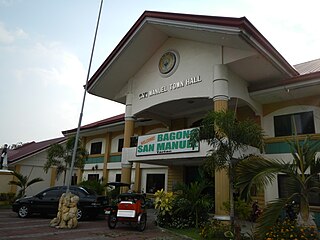
San Manuel, officially the Municipality of San Manuel, is a municipality in the province of Tarlac, Philippines. According to the 2020 census, it has a population of 28,387 people.

<span class="mw-page-title-main">Muñoz, Nueva Ecija</span> Component city in Nueva Ecija, Philippines

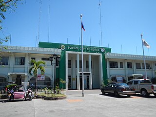
Muñoz, officially the Science City of Muñoz, is a 4th class component city in the province of Nueva Ecija, Philippines. According to the 2020 census, it has a population of 84,308 people.

<span class="mw-page-title-main">General Mamerto Natividad</span> Municipality in Nueva Ecija, Philippines

General Mamerto Natividad, officially the Municipality of General Mamerto Natividad, also known as Gen. M. Natividad, is a 4th class municipality in the province of Nueva Ecija, Philippines. According to the 2020 census, it has a population of 44,311 people.

<span class="mw-page-title-main">Licab</span> Municipality in Nueva Ecija, Philippines

Licab, officially the Municipality of Licab, is a 4th-class municipality in the province of Nueva Ecija, Philippines. According to the 2020 census, it has a population of 29,269 people.

<span class="mw-page-title-main">Llanera, Nueva Ecija</span> Municipality in Nueva Ecija, Philippines

Llanera, officially the Municipality of Llanera, is a 4th class municipality in the province of Nueva Ecija, Philippines. According to the 2020 census, it has a population of 42,281 people.

<span class="mw-page-title-main">Nampicuan</span> Municipality in Nueva Ecija, Philippines

Nampicuan, officially the Municipality of Nampicuan, is a 5th class municipality in the province of Nueva Ecija, Philippines. According to the 2020 census, it has a population of 14,471 people.

<span class="mw-page-title-main">Quezon, Nueva Ecija</span> Municipality in Nueva Ecija, Philippines

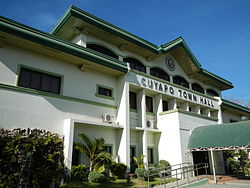
Quezon, officially the Municipality of Quezon, is a 4th class municipality in the province of Nueva Ecija, Philippines that was named from the 2nd president of the Philippines, Manuel L. Quezon. According to the 2020 census, it has a population of 41,845 people.

References

  1. Municipality of Cuyapo | (DILG)
  2. "2015 Census of Population, Report No. 3 – Population, Land Area, and Population Density" (PDF). Philippine Statistics Authority. Quezon City, Philippines. August 2016. ISSN   0117-1453. Archived (PDF) from the original on May 25, 2021. Retrieved July 16, 2021.
  3. 1 2 Census of Population (2020). "Region III (Central Luzon)". Total Population by Province, City, Municipality and Barangay. Philippine Statistics Authority . Retrieved 8 July 2021.
  4. "PSA Releases the 2018 Municipal and City Level Poverty Estimates". Philippine Statistics Authority. 15 December 2021. Retrieved 22 January 2022.
  5. McLennan, Marshall S. (1980). The Central Luzon Plain: Land and Society on the Inland Frontier. Alemar-Phoenix Publishing House. p. 166.
  6. Merrill, Elmer Drew (1903). A Dictionary of the Plant Names of the Philippine Islands. Manila: Bureau of Public Print. p. 8.
  7. "Cuyapo: Average Temperatures and Rainfall". Meteoblue. Retrieved 4 May 2020.
  8. Census of Population (2015). "Region III (Central Luzon)". Total Population by Province, City, Municipality and Barangay. Philippine Statistics Authority . Retrieved 20 June 2016.
  9. Census of Population and Housing (2010). "Region III (Central Luzon)" (PDF). Total Population by Province, City, Municipality and Barangay. National Statistics Office . Retrieved 29 June 2016.
  10. Censuses of Population (1903–2007). "Region III (Central Luzon)". Table 1. Population Enumerated in Various Censuses by Province/Highly Urbanized City: 1903 to 2007. National Statistics Office.{{cite encyclopedia}}: CS1 maint: numeric names: authors list (link)
  11. "Province of Nueva Ecija". Municipality Population Data. Local Water Utilities Administration Research Division. Retrieved 17 December 2016.
  12. "Poverty incidence (PI):". Philippine Statistics Authority. Retrieved December 28, 2020.
  13. "Estimation of Local Poverty in the Philippines" (PDF). Philippine Statistics Authority. 29 November 2005.
  14. "2003 City and Municipal Level Poverty Estimates" (PDF). Philippine Statistics Authority. 23 March 2009.
  15. "City and Municipal Level Poverty Estimates; 2006 and 2009" (PDF). Philippine Statistics Authority. 3 August 2012.
  16. "2012 Municipal and City Level Poverty Estimates" (PDF). Philippine Statistics Authority. 31 May 2016.
  17. "Municipal and City Level Small Area Poverty Estimates; 2009, 2012 and 2015". Philippine Statistics Authority. 10 July 2019.
  18. "PSA Releases the 2018 Municipal and City Level Poverty Estimates". Philippine Statistics Authority. 15 December 2021. Retrieved 22 January 2022.