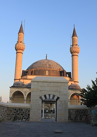
Konya Province, in southwest Central Anatolia, is the largest province of Turkey. The provincial capital is the city of Konya. Its traffic code is 42.

Doğanhisar is a town and district of Konya Province in the Central Anatolia region of Turkey. According to 2000 census, population of the district is 36,162 of which 9,756 live in the town of Doğanhisar.

Emirgazi is a town and district of Konya Province in the Central Anatolia region of Turkey. According to 2000 census, population of the district is 14,698, of which 5,562 live in the town of Emirgazi.

Hadim is a town and district of Konya Province in the Akdeniz region of Turkey. According to 2000 census, population of the district is 59,941 of which 16,620 live in the town of Hadim.

Ilgın is a town and district of Konya Province in the Central Anatolia region of Turkey. According to 2000 census, population of the district is 75,681 of which 26,698 live in the town of Hadim.

Kadınhanı is a town and district of Konya Province in the Central Anatolia region of Turkey. The name of the town refers to a certain female commissioner of an inn in the town. According to 2000 census, population of the district is 41,844 of which 14,816 live in the town of Kadınhanı.

Karapınar, formerly known as Barta is a town and district of Konya Province in the Central Anatolia region of Turkey. According to 2000 census, population of the district is 55,734 of which 35,285 live in the town of Karapınar. Volcanic Karapınar Field is located nearby.

Karatay is a town and district of Konya Province in the Central Anatolia region of Turkey. Karatay is one of the central districts of Konya along with the districts of Meram and Selçuklu. According to 2000 census, population of the district is 214,589 of which 183,677 live in the urban center of Karatay.

Meram is a town and district of Konya Province in the Central Anatolia region of Turkey. Meram is one of the central districts of Konya, along with the districts of Karatay and Selçuklu. According to 2000 census, the population of the district is 267,878, of which 231,386 live in the urban center of Meram.

Sarayönü is a town and district of the Konya Province in the Central Anatolia region of Turkey. According to the 2000 census, the population of the district was 36,525, of which 10,386 lived in the town of Sarayönü.

Selçuklu is a town and district of the Konya Province in the Central Anatolia region of Turkey. Selçuklu is one of the central districts of Konya, along with the districts of Karatay and Meram. According to the 2000 census, the population of the district was 348,329, of which 327,627 lived in the urban center of Selçuklu.

Tuzlukçu is a town and district of Konya Province in the Central Anatolia region of Turkey. According to 2000 census, population of the district is 9,783 of which 5,845 live in the town of Tuzlukçu.

Yalıhüyük is a town and district of Konya Province in the Central Anatolia region of Turkey. According to 2000 census, population of the district was 5,575 of whom 5,330 live in the town of Yalıhüyük. Gölcük Plateau is located in the district.

Yunak is a town and district of Konya Province in the Central Anatolia region of Turkey. According to the 2000 census, the population of the district is 41,506, of which 12,734 live in the town of Yunak.

Güneysınır is a town and district of Konya Province in the Central Anatolia region of Turkey. Karasınır and Güneybağ form the major neighbourhoods of the district. According to 2000 census, population of the district is 24,301 of which 10,217 live in the town of Güneysınır.

Hüyük, also Höyük, is a town and district of Konya Province in the Central Anatolia region of Turkey. According to 2000 census, population of the district is 52,110 of which 8,472 live in the town of Hüyük.

Kulu is a town and district of Konya Province in the Central Anatolia region of Turkey. According to the 2011 census, the population of the district is 55,573 and 22,844 of that number live in the town of Kulu. Kulu is situated approximately 110 km from Ankara and 150 km from the city of Konya. With a substantial Swedish-Turkish community, not few of whom are from this region, Kulu hosts around 100,000 visitors from Europe in the summer. Swedish Prime Minister Fredrik Reinfeldt visited the city once.

Seydişehir is a town and district of Konya Province in the Mediterranean region of Turkey. According to a 2000 census, the population of the district is 85,456 of which 48,372 live in the town of Seydişehir.

Halkapınar is a town and district of Konya Province in the Central Anatolia region of Turkey. According to 2000 census, population of the district is 6,255 of which 2,021 live in the town of Halkapınar.
Derebucak Çamlık Caves National Park are a group of several caves located in Konya Province, central Turkey. They are registered together a natural monument of the country.


